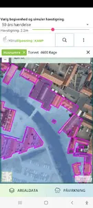
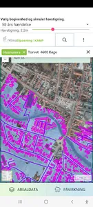
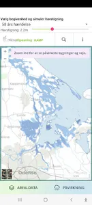
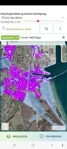
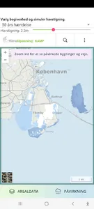
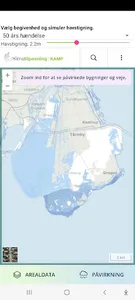
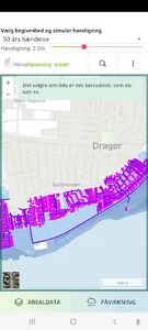
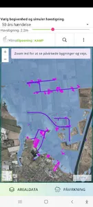
See exactly how the sea affects houses and land areas throughout Denmark.
Use possibly the map BEFORE you buy a house in a low-lying area.
The global sea level has risen about 6 cm in the last 19 years. A fifth comes from the Greenland ice sheet. This is shown by the latest satellite measurements.
You can:
- Search for addresses throughout Denmark
- Show how the water will distribute and where there will be floods
- Show graphically what happens at specific events such as year, 20/50/100 year events.
- Simulate sea level rise from 0 to 6m throughout the country.
- You can zoom out and see entire parts of the country, or zoom in at street level.
- Search for addresses or cities
- See your area's impact via satellite images.
Sea level rise is a fast and fun entry to Climate Adaptation "KAMP".
Show More