About Cinar Survey
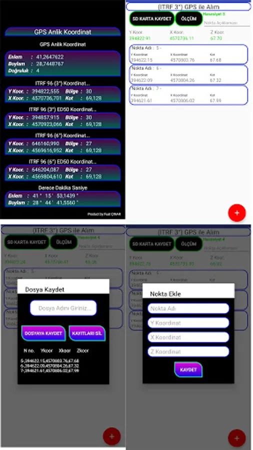
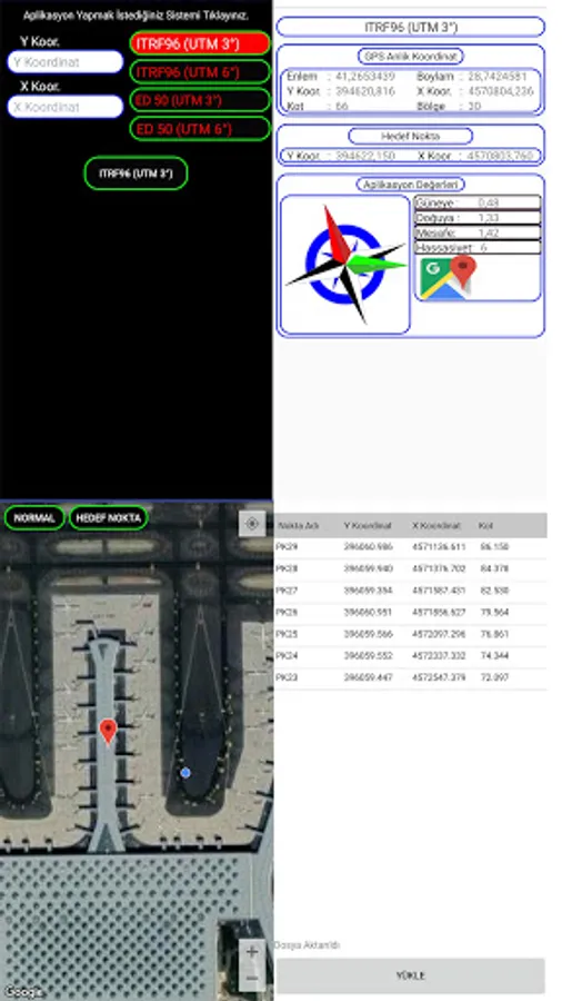
ITRF (3 °) Degree Gps Application,
ITRF (6 °) Degree Gps Application,
ED50 (3 °) Degree Gps Application,
ED50 (6 °) Degree Gps Application,
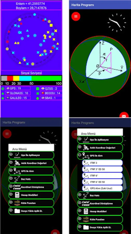
ITRF (3 °) Degree Gps Acquisition
ITRF (6 °) Degree Gps Acquisition
ED50 (3 °) Degree Gps Acquisition
ED50 (6 °) Degree Gps Acquisition
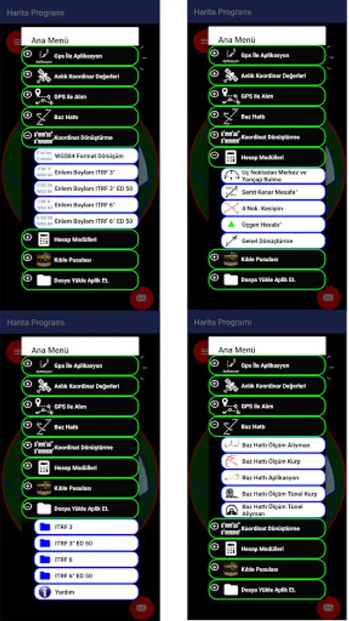
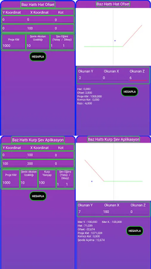
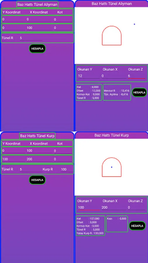
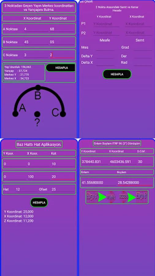
Base line Application,
Base line calculation,
Base line aliyman account,
Geographical coordinates from decimal to decimal-second and from dec-min-seconds to decimal translation,
Coordinate Transformations,
ITRF (3 °) - ITRF (3 °) to WGS84 from WGS84,
ITRF (6 °) - ITRF (6 °) to WGS84 from WGS84,
From WGS84 to ED50 (3 °) - ED50 (3 °) to WGS84,
From WGS84 to ED50 (6 °) - ED50 (6 °) to WGS84,
Find the intersection coordinates of two known lines (4 points),
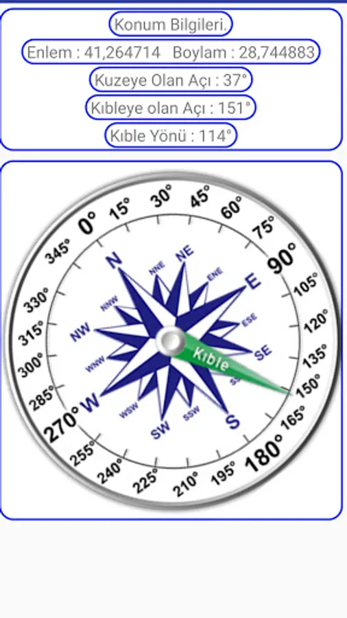
Finding the Direction of Qiblah,
Calculate distances between known two coordinates and angles (grad, degrees, radians),
Calculate the edge angles of a triangle with three sides entered,
Calculate a known three-point broadcast radius and center coordinates,
ITRF (6 °) Degree Gps Application,
ED50 (3 °) Degree Gps Application,
ED50 (6 °) Degree Gps Application,
ITRF (3 °) Degree Gps Acquisition
ITRF (6 °) Degree Gps Acquisition
ED50 (3 °) Degree Gps Acquisition
ED50 (6 °) Degree Gps Acquisition
Base line Application,
Base line calculation,
Base line aliyman account,
Geographical coordinates from decimal to decimal-second and from dec-min-seconds to decimal translation,
Coordinate Transformations,
ITRF (3 °) - ITRF (3 °) to WGS84 from WGS84,
ITRF (6 °) - ITRF (6 °) to WGS84 from WGS84,
From WGS84 to ED50 (3 °) - ED50 (3 °) to WGS84,
From WGS84 to ED50 (6 °) - ED50 (6 °) to WGS84,
Find the intersection coordinates of two known lines (4 points),
Finding the Direction of Qiblah,
Calculate distances between known two coordinates and angles (grad, degrees, radians),
Calculate the edge angles of a triangle with three sides entered,
Calculate a known three-point broadcast radius and center coordinates,