About QuakeInfo
Institute of Seismological Research established in the year 2003 under the Government of Gujarat. The motto of ISR is Effective Seismological Monitoring through e-Governance to Save Lives and Damage due to Earthquakes. Earthquake monitoring in Gujarat is carried out by a dense network of 60 broadband seismographs that are connected through VSAT (online) which can detect earthquakes down to magnitude 2 occurring anywhere in the state or magnitude 4.5 anywhere in the world. Through online functionality and auto location the earthquake parameters are disseminated within minutes to state authorities, disaster management team through both email and SMS. The quick availability of earthquake information as well as potential damage map and shake map increase the ability and efficiency of decision makers and significantly reduces the time delay in start of the relief work. The reliable and immediate reports are also provided to the media to allay the anxiety/fear among the people.
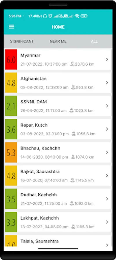
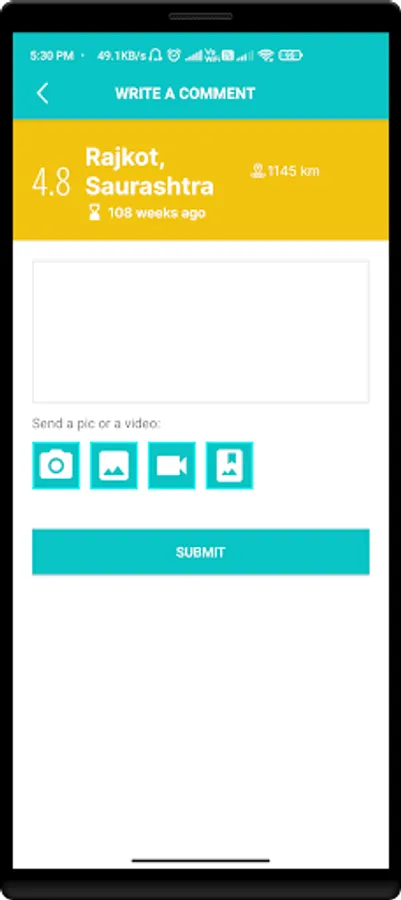
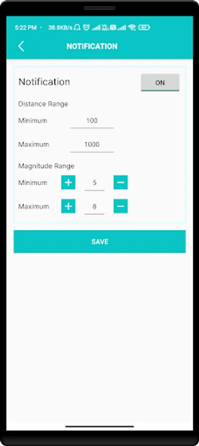
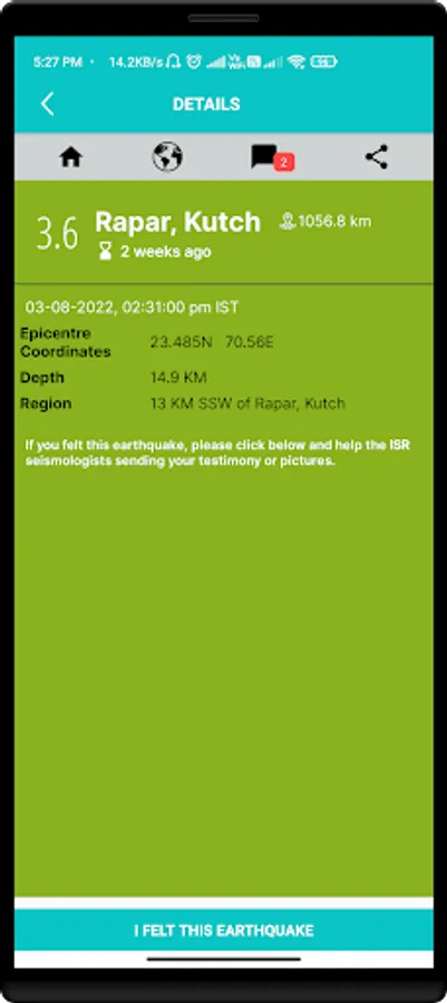
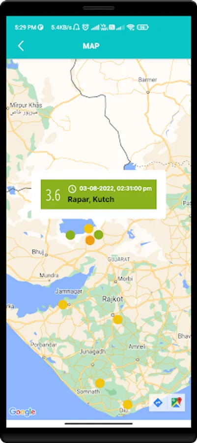
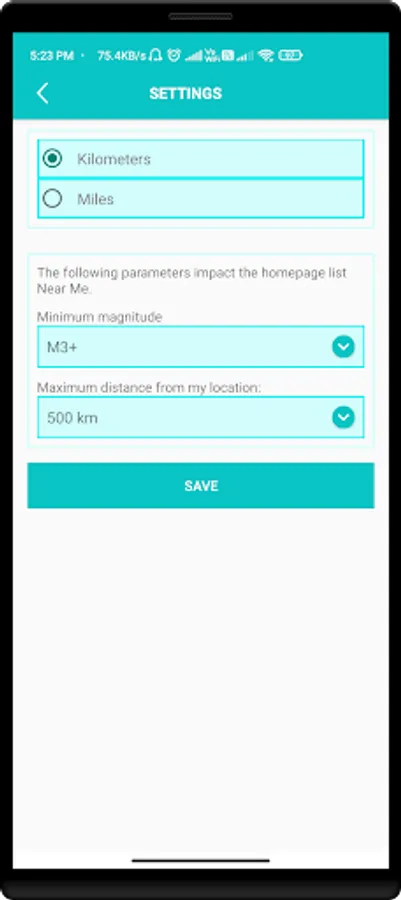
To increase the visibility and provide quick information to the general public, ISR has initiated for the development of a Mobile Application name “QuakeInfo” that can be easily downloaded and installed in any android/IOS mobile. The basic aspect of this App is to provide Earthquake location its magnitude in both tabulated as well as graphically on a Map. The App provides options for the user to choose the earthquake location notification based on user specified options such as Location, Magnitude and Time, etc. Further, it provides an option for the users to connect to us by an option “I Felt This Earthquake”, where the user can send pictures and videos.
To increase the visibility and provide quick information to the general public, ISR has initiated for the development of a Mobile Application name “QuakeInfo” that can be easily downloaded and installed in any android/IOS mobile. The basic aspect of this App is to provide Earthquake location its magnitude in both tabulated as well as graphically on a Map. The App provides options for the user to choose the earthquake location notification based on user specified options such as Location, Magnitude and Time, etc. Further, it provides an option for the users to connect to us by an option “I Felt This Earthquake”, where the user can send pictures and videos.
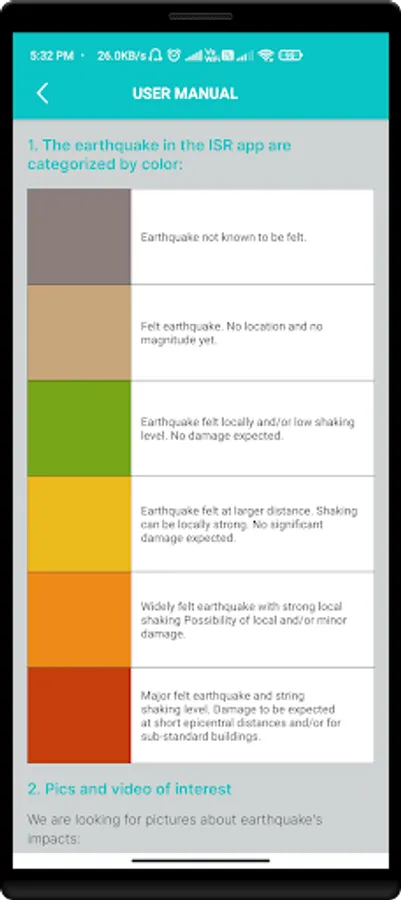
QuakeInfo Screenshots


Tap to Rate: