About AgroWeather
AgroWeather AGV is your agricultural weather tool for making better decisions in the field. View real-time forecasts and data from weather stations, organize them by farm/field, and visualize everything on an interactive map.
The application also includes a main module for generating, opening, sharing, and deleting reports in Excel format, with data obtained from inspections and evaluations. Therefore, it requires access to all device files to ensure proper operation.
Main features:
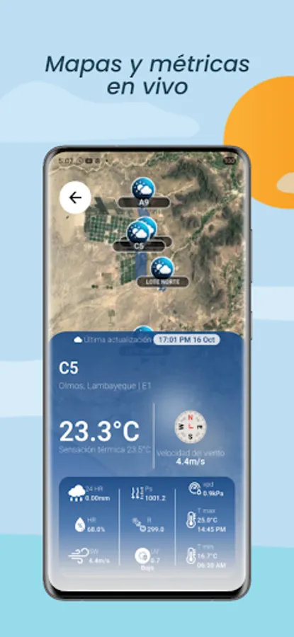
- Station map: quickly identify each station with its latest update.
- Real-time weather: temperature and wind chill, wind speed, relative humidity, pressure, radiation, UV index, VPD, 24-hour precipitation, and hourly maximum/minimum temperatures.
- Hourly and daily forecasts: switch views with a tap to plan irrigation and other tasks.
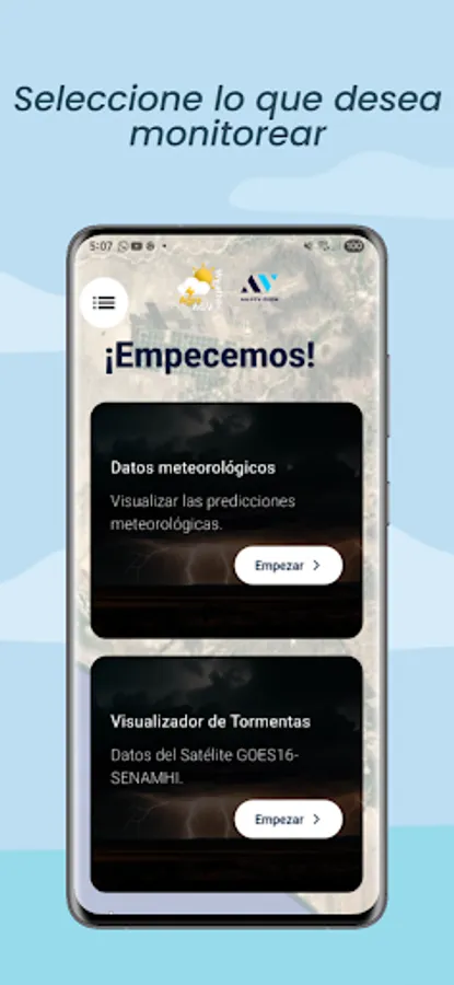
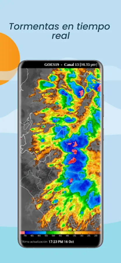
- Storm viewer: GOES-16 satellite imagery (SENAMHI) to track cloud cover and convective activity.
- Farm management: choose which stations to monitor in each production unit.
The application also includes a main module for generating, opening, sharing, and deleting reports in Excel format, with data obtained from inspections and evaluations. Therefore, it requires access to all device files to ensure proper operation.
Main features:
- Station map: quickly identify each station with its latest update.
- Real-time weather: temperature and wind chill, wind speed, relative humidity, pressure, radiation, UV index, VPD, 24-hour precipitation, and hourly maximum/minimum temperatures.
- Hourly and daily forecasts: switch views with a tap to plan irrigation and other tasks.
- Storm viewer: GOES-16 satellite imagery (SENAMHI) to track cloud cover and convective activity.
- Farm management: choose which stations to monitor in each production unit.