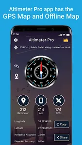
Introducing the Altimeter elevation tracker app: Your Ultimate Altitude Companion for Adventure and Exploration!
Are you an outdoor enthusiast seeking to conquer new heights? Presenting the Altimeter elevation and compass app, your reliable altimeter companion that will elevate your adventures to new levels. With its precise altitude tracking capabilities. Altimeter altitude tracker is designed to enhance your outdoor experience. GPS Altimeter is a smart tracking that measures altitude with precise gps coordinates. It requires access to the device's location to collect raw height from the GPS signal, to determine altitude above the sea level.
GPS Barometer Altimeter: is a Swiss grid device used to measure altitude. My Elevation App has an innovative barometer altimeter, combining the power of atmospheric pressure measurements with altitude tracking. Barometer altimeter is used to determine air pressure above sea level. By using the barometric pressure sensor in your device, this advanced feature enhances the accuracy of altitude readings, ensuring precise elevation data in various weather conditions.
Altimeter & Compass: Navigate like a pro with the built-in compass Altimeter Elevation & Compass App combines altimeter and compass functionalities, providing you with both altitude and direction in one convenient tool. Seamlessly switch between altitude and azimuth readings to navigate with ease.
My Elevation: Elevation finder provides accurate altitude readings, for precise current elevation. Whether you're climbing a mountain, skiing down a slope, or simply curious about your surroundings, the Altimeter elevation & compass will keep you informed about your current elevation.
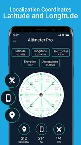
Coordinates Finder - Latitude longitude: Get precise coordinates for your location. The app uses GPS technology to provide accurate latitude and longitude readings, to pinpoint your exact position on the map.
📝User Guide📝
📌Installation:
Download the Altimeter pro app
Launch the app and grant the necessary permissions for location access.
📌Home Screen:
The home screen displays your current altitude, coordinates, and a compass for easy navigation.
📌Altitude Measurement:
Altimeter compass provides accurate altitude measurements and displays your current elevation.
📌Compass Navigation:
Access the compass screen to view your current direction.
The compass is integrated with the altimeter, allowing you to navigate and track your altitude simultaneously.
📌GPS Coordinates: Altimeter Altitude App has an accurate coordinate system which provides precise latitude and longitude coordinates for your location. Make sure your device's GPS is enabled for accurate positioning/ GPS coordinates.
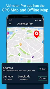
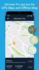
📌Offline Usage: With the Altimeter Elevation offline, you can track your current elevation in remote areas or without an internet connection. Ensure you have already downloaded the required maps for offline use.
💎Features💎
📍Accurate Altitude Measurement: My elevation provides precise altitude readings, ensuring you have accurate elevation data.
📍Elevation Tracking: Monitor your elevation changes over time with the app's tracking feature.
📍Altimeter Compass: The built-in compass helps you navigate with ease, combining altitude and directional information in one tool.
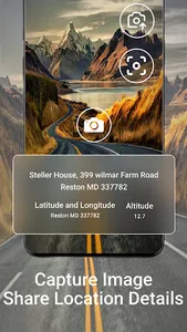
📍GPS Coordinates: Obtain precise latitude and longitude coordinates for your location, making it easy to navigate to specific points of interest.
📍Barometric Pressure Sensor: The app utilises a barometer and pressure sensor to provide accurate altitude readings, enhancing the reliability of the elevation data.
📍User-Friendly Interface: Altimeter: elevation finder has user-friendly interface, making it easy to access altitude and navigation information.
📍Offline Functionality: Enjoy the convenience of using the app even in remote areas without an internet connection.
📍Altimeter pro elevation finder finds your height above sea level, with the elevation map to determine your exact location.
Show More

