Earth Explorer 3D Map
Tech Maven Geospatial
1,000+
downloads
Free
+ in-app
AppRecs review analysis
AppRecs rating . Trustworthiness 82 out of 100. Review manipulation risk 24 out of 100. Based on a review sample analyzed.
★
AppRecs Rating
Ratings breakdown
5 star
25%
4 star
25%
3 star
0%
2 star
0%
1 star
50%
What to know
✓
Low review manipulation risk
24% review manipulation risk
✓
Credible reviews
82% trustworthiness score from analyzed reviews
⚠
Mixed user feedback
Average 2.8★ rating suggests room for improvement
About Earth Explorer 3D Map
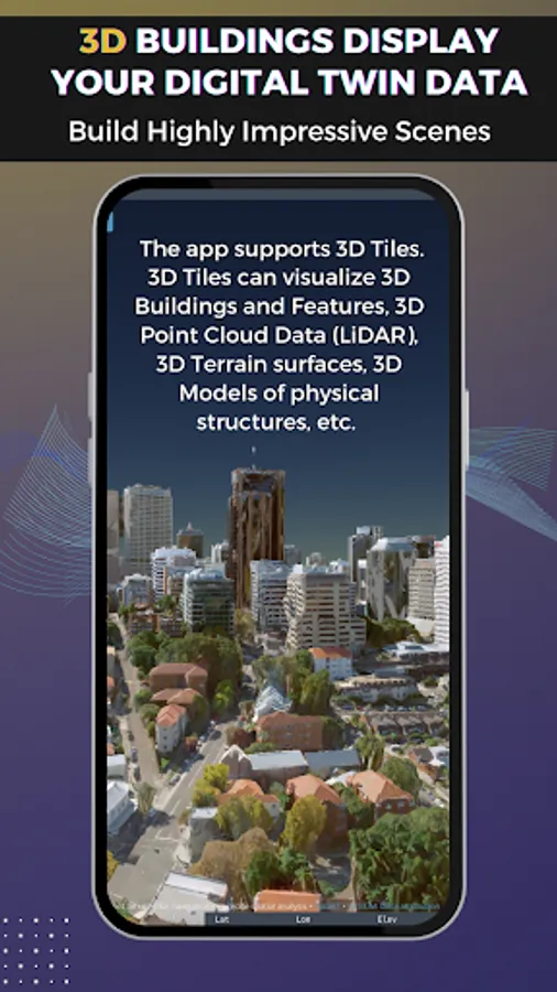
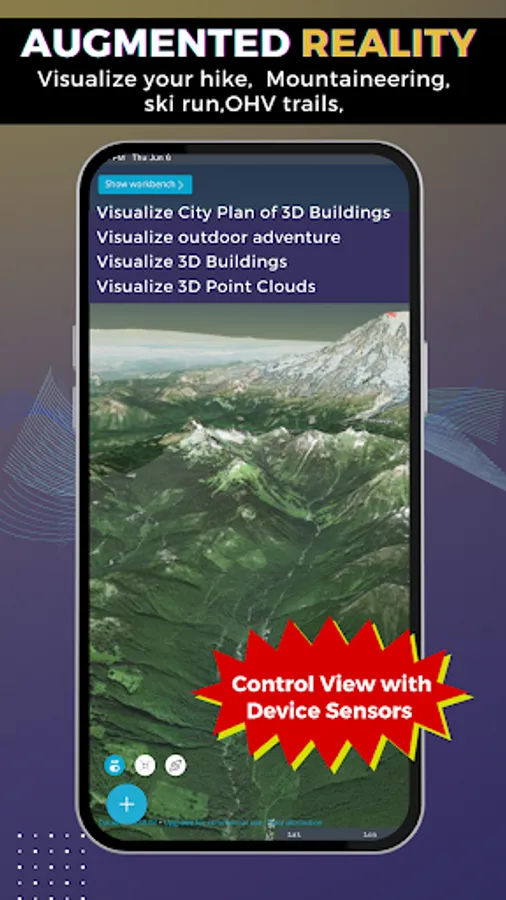
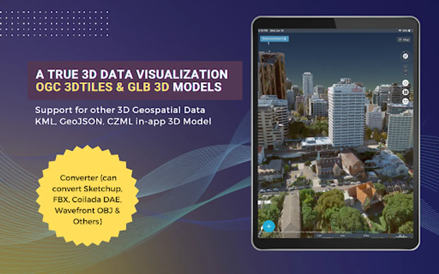
Earth Explorer is a 3D Globe with Augmented Reality (Control View with your device’s sensors GPS/GNSS, Accelerometer, Gyroscope, Compass, other)
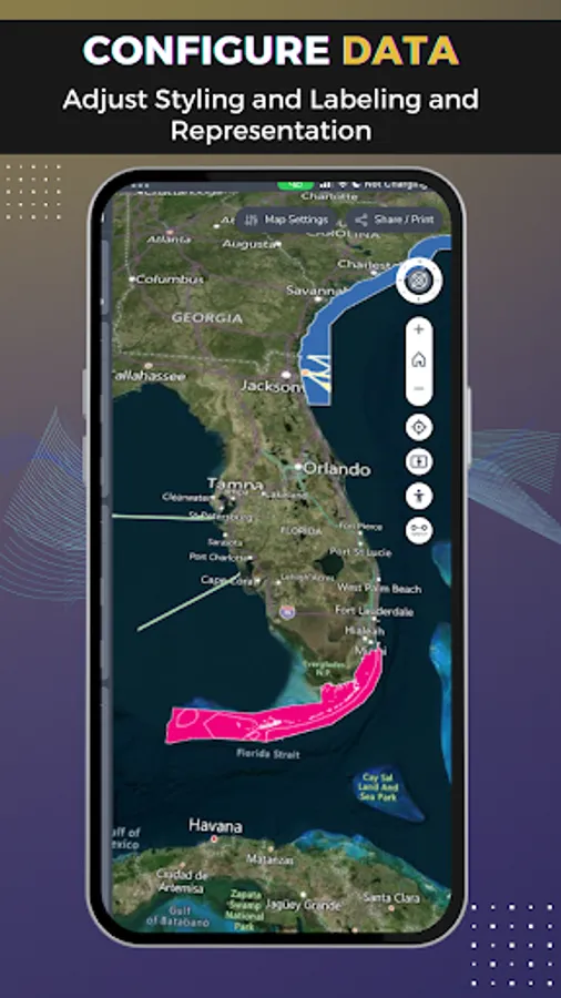
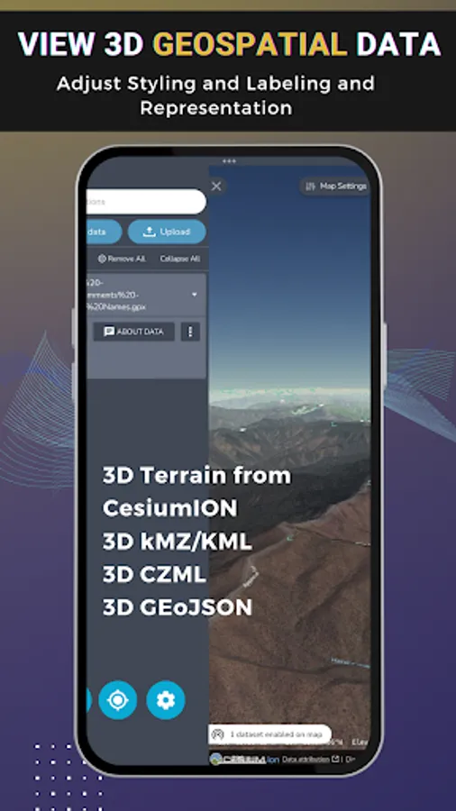
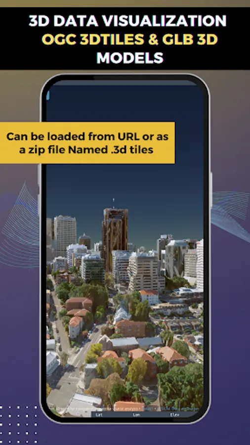
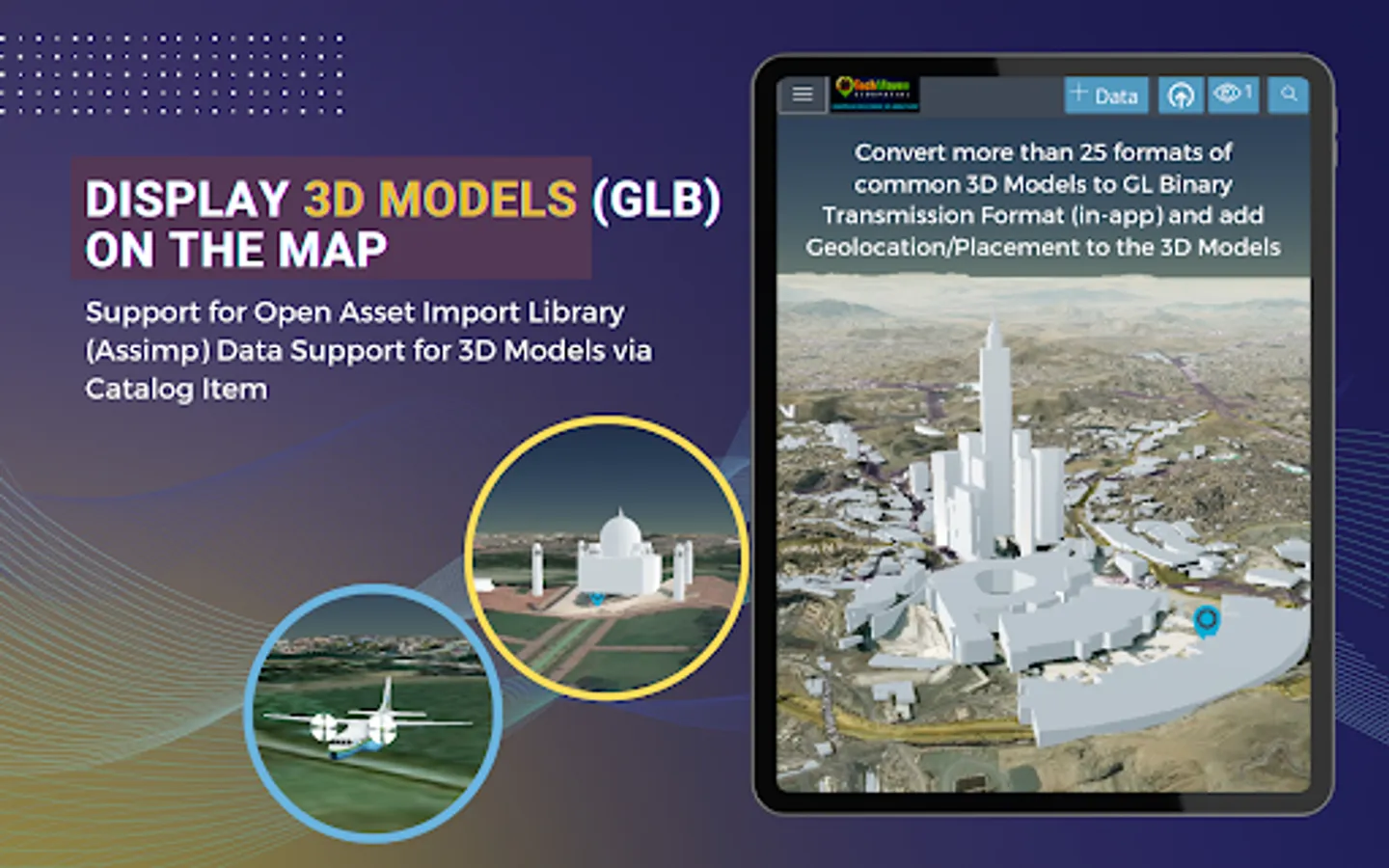
Users can load local vector data to the map
Supported formats are:
GeoJSON
KML/KMZ
GPX
CZML
CSV - Comma Separated Value Text file - with Latitude and Longitude or with known column/field names like state, zipcode,country and other regional mapping fields
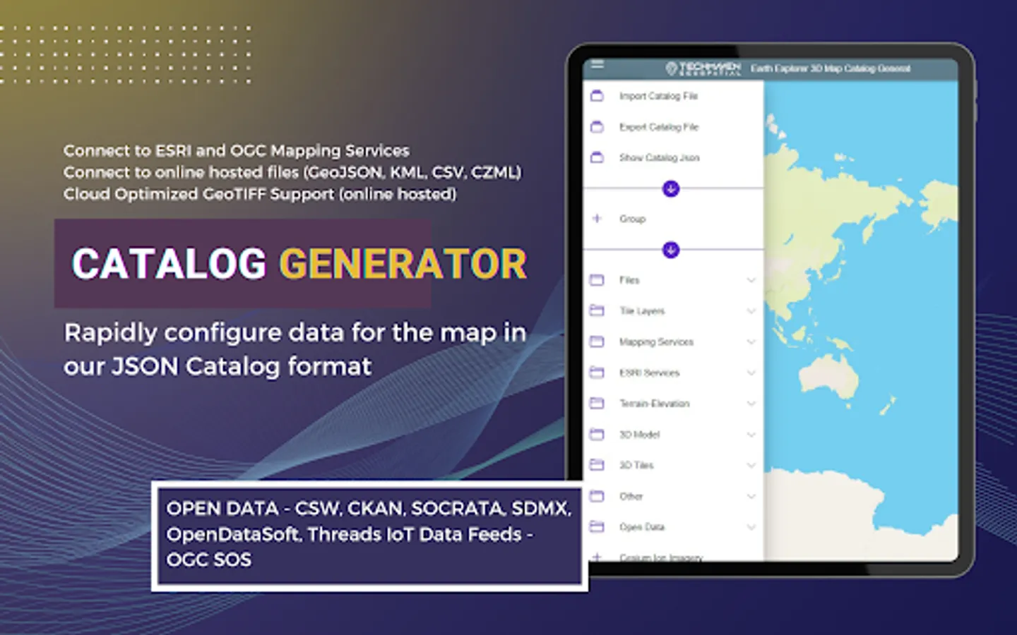
JSON Catalog files - data layers defined in a JSON file.
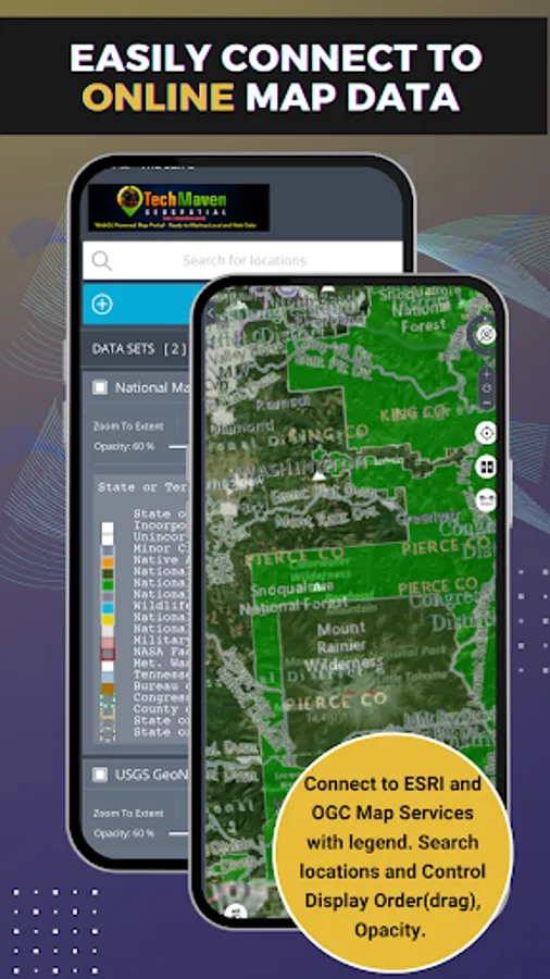
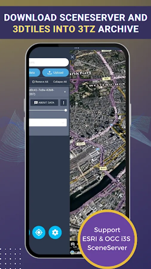
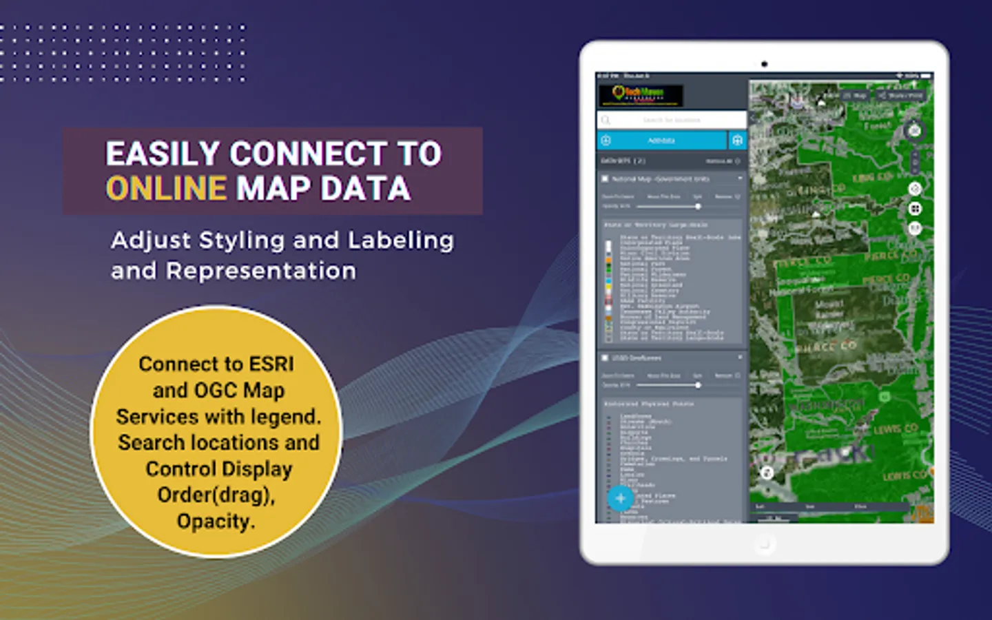
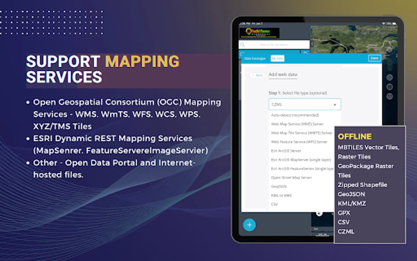
Users can load online mapping services:
ESRI Dynamic REST Mapping Services (MapServer, FeatureServer,ImageServer)
OGC Mapping Services (WMS, WFS, WCS, WMTS)
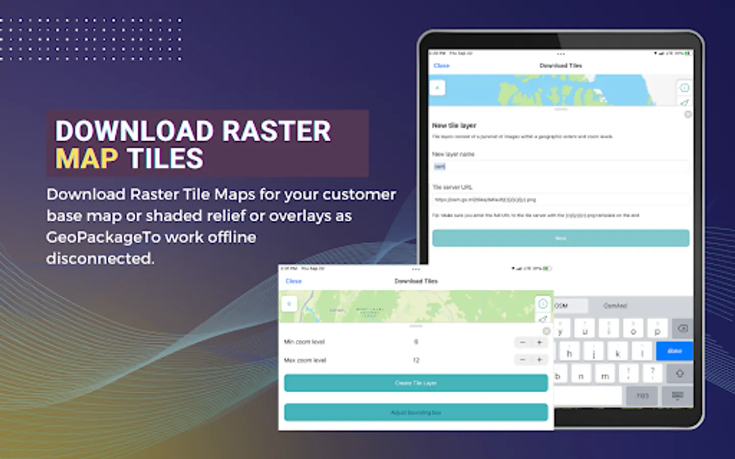
Raster Tile Servers - XYZ URL
Vector Tile Server - XYZ URL
If users have Vector Data in other formats, they can upload to our server and have it converted and sent back to app/map as GeoJSON.
App Features:
Measure Linear and Area
Search and Geocode
Raster Tile Basemap Picker - uses BING Maps, Open Street Map, CartoDB Basemaps, Stamen Basemaps, ESRI Basemaps
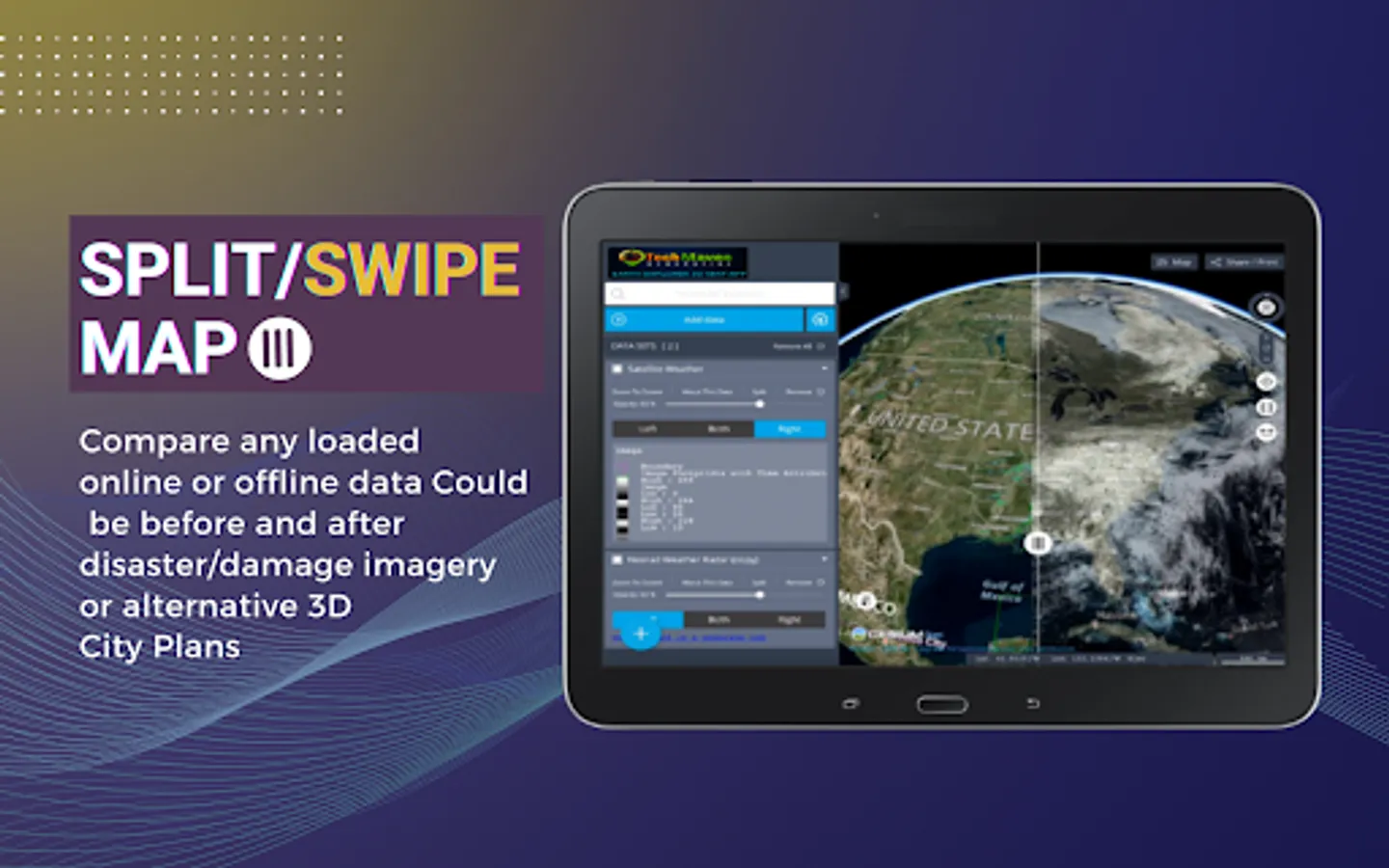
Split/Map Swipe to compare layers
Switch map between 3D Terrain, 2D or 3D Smooth
Geolocation show your location on the map
Tilt Map
Rotate Map
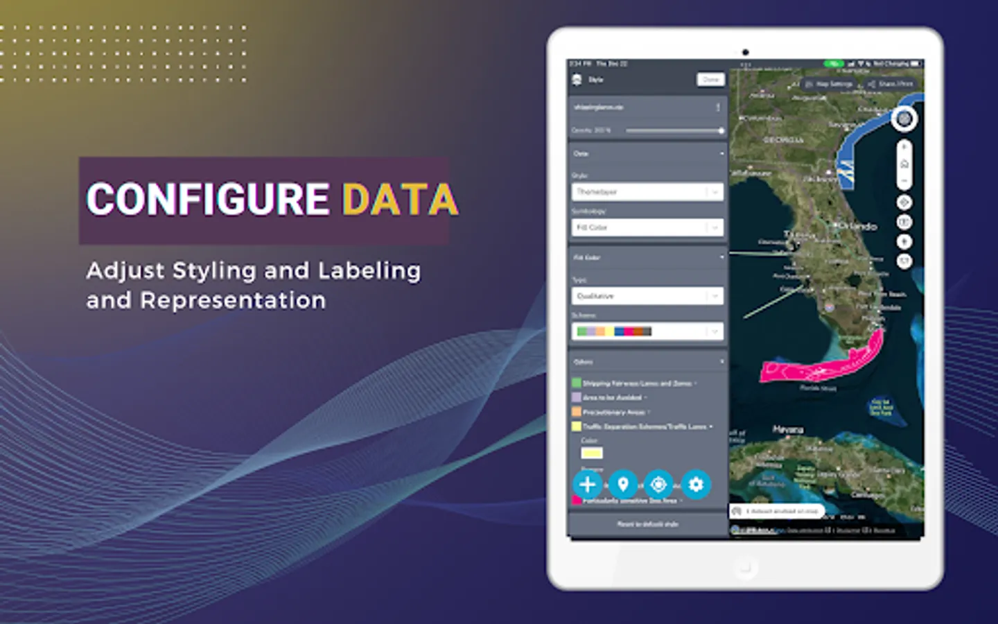
Table of Contents and Map Legend and ability to re-order data layers by dragging
Displays Coordinates in Lat Long or UTM
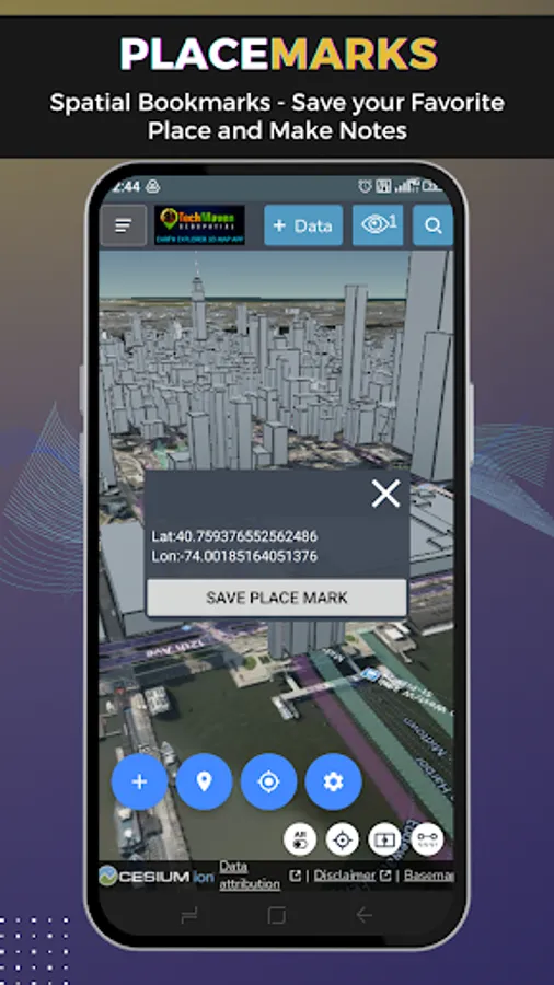
Drop Markers
Copy Lat Long
Ability to download tables from data loaded
Zoom to Extent of Data
Charting
Timeslider on Spatialtemporal datasets
Export/Print PNG/PDF of Map
Share Link and Embed code
View Metadata (data about data)
Re-Order Table of Contents Items
Search CKAN/CSW/SOCRATA OpenData Sites if Catalog file imported
Users can load local vector data to the map
Supported formats are:
GeoJSON
KML/KMZ
GPX
CZML
CSV - Comma Separated Value Text file - with Latitude and Longitude or with known column/field names like state, zipcode,country and other regional mapping fields
JSON Catalog files - data layers defined in a JSON file.
Users can load online mapping services:
ESRI Dynamic REST Mapping Services (MapServer, FeatureServer,ImageServer)
OGC Mapping Services (WMS, WFS, WCS, WMTS)
Raster Tile Servers - XYZ URL
Vector Tile Server - XYZ URL
If users have Vector Data in other formats, they can upload to our server and have it converted and sent back to app/map as GeoJSON.
App Features:
Measure Linear and Area
Search and Geocode
Raster Tile Basemap Picker - uses BING Maps, Open Street Map, CartoDB Basemaps, Stamen Basemaps, ESRI Basemaps
Split/Map Swipe to compare layers
Switch map between 3D Terrain, 2D or 3D Smooth
Geolocation show your location on the map
Tilt Map
Rotate Map
Table of Contents and Map Legend and ability to re-order data layers by dragging
Displays Coordinates in Lat Long or UTM
Drop Markers
Copy Lat Long
Ability to download tables from data loaded
Zoom to Extent of Data
Charting
Timeslider on Spatialtemporal datasets
Export/Print PNG/PDF of Map
Share Link and Embed code
View Metadata (data about data)
Re-Order Table of Contents Items
Search CKAN/CSW/SOCRATA OpenData Sites if Catalog file imported
Earth Explorer 3D Map Screenshots
Tap to Rate:
Reviews for Earth Explorer 3D Map
MyXo 1402
3/29/2025
App is not working, subscribed to it already, but then it does nothing
Brian Wasem
2/27/2025
Couldn't get app to load on Samsung s23 ultra. Never even got to trial app. Spent hrs trying to get it to work!!