Find all the advice from RoadTrippin.fr to prepare your trip to the USA, all the guides to visit the most beautiful American parks and the most beautiful cities in the United States, as well as numerous tools (weather, local time, notebook, expense tracking, conversions, translator...) very useful for organizing and carrying out your road trip!
VISIT GUIDES
More than 200 visit guides, detailing the activities not to be missed in the many magnificent American parks and the largest cities: access conditions, prices, walks and hikes to do, viewpoints not to be missed, excursions, weather, accommodation...
You will know everything about the different state and national parks (Grand Canyon, Monument Valley, Yellowstone, Yosemite, Zion, Death Valley...), Route 66, as well as the most beautiful American cities (Los Angeles, San Francisco, Las Vegas, New York...).
TIP SHEETS
30 advice sheets to help you prepare for your stay on American soil: formalities, ESTA, travel insurance, plane tickets, car and motorhome rental, driving, accommodation, budget, etc. .
CONVERTERS
A currency converter (EUR/CAD / USD) and a unit converter (distance, volumes, weight, temperature, fuel consumption...).
TIP CALCULATOR
A tip calculator to easily determine the tip you want to leave.
NOTEBOOK
A notebook to allow you to easily and quickly save any useful information gathered during your road trip.
LOGBOOK
A diary, in which you can record your purchases and daily expenses: fuel, restaurants, shopping..., as well as the follow-up of the hikes taken and the journeys made by car.
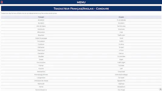
FR/ENG TRANSLATOR
A French/English translation module of the most useful terms when traveling in the USA.
All of this is available anytime, anywhere, even if you don't have an internet connection!
In addition, if you have an Internet connection (Wi-Fi or mobile network) during your trip to the USA, you will then be able to benefit from additional features:
INTERACTIVE MAP
An interactive map allowing you to display in real time your position and the viewpoints and points of interest located around you (1500 saved POIs), and to follow the routes of the surrounding hikes (750 referenced hikes).
WEATHER
The local weather, to know the 3-day weather forecast in your area.
LOCAL TIME
No more apothecary calculations with offsets/time zones and summer and winter times! With local time, you will have the correct time at a glance according to your position.
Note that you must authorize the application to access your position so that it can geolocate you.
VISIT GUIDES
More than 200 visit guides, detailing the activities not to be missed in the many magnificent American parks and the largest cities: access conditions, prices, walks and hikes to do, viewpoints not to be missed, excursions, weather, accommodation...
You will know everything about the different state and national parks (Grand Canyon, Monument Valley, Yellowstone, Yosemite, Zion, Death Valley...), Route 66, as well as the most beautiful American cities (Los Angeles, San Francisco, Las Vegas, New York...).
TIP SHEETS
30 advice sheets to help you prepare for your stay on American soil: formalities, ESTA, travel insurance, plane tickets, car and motorhome rental, driving, accommodation, budget, etc. .
CONVERTERS
A currency converter (EUR/CAD / USD) and a unit converter (distance, volumes, weight, temperature, fuel consumption...).
TIP CALCULATOR
A tip calculator to easily determine the tip you want to leave.
NOTEBOOK
A notebook to allow you to easily and quickly save any useful information gathered during your road trip.
LOGBOOK
A diary, in which you can record your purchases and daily expenses: fuel, restaurants, shopping..., as well as the follow-up of the hikes taken and the journeys made by car.
FR/ENG TRANSLATOR
A French/English translation module of the most useful terms when traveling in the USA.
All of this is available anytime, anywhere, even if you don't have an internet connection!
In addition, if you have an Internet connection (Wi-Fi or mobile network) during your trip to the USA, you will then be able to benefit from additional features:
INTERACTIVE MAP
An interactive map allowing you to display in real time your position and the viewpoints and points of interest located around you (1500 saved POIs), and to follow the routes of the surrounding hikes (750 referenced hikes).
WEATHER
The local weather, to know the 3-day weather forecast in your area.
LOCAL TIME
No more apothecary calculations with offsets/time zones and summer and winter times! With local time, you will have the correct time at a glance according to your position.
Note that you must authorize the application to access your position so that it can geolocate you.
Show More