Horizon Explorer AR
Arrow Software Development
4.0 ★
276 ratings
50,000+
downloads
Free
In this augmented reality app, you can point your device at landmarks to identify their names, distances, altitudes, and surrounding features. Includes map overlays, Wikipedia information, and live airplane data.
AppRecs review analysis
AppRecs rating 4.0. Trustworthiness 0 out of 100. Review manipulation risk 0 out of 100. Based on a review sample analyzed.
★★★★☆
4.0
AppRecs Rating
Ratings breakdown
5 star
58%
4 star
14%
3 star
10%
2 star
7%
1 star
12%
What to know
✓
Good user ratings
72% positive sampled reviews
✓
Authentic reviews
Natural distribution, no red flags
About Horizon Explorer AR
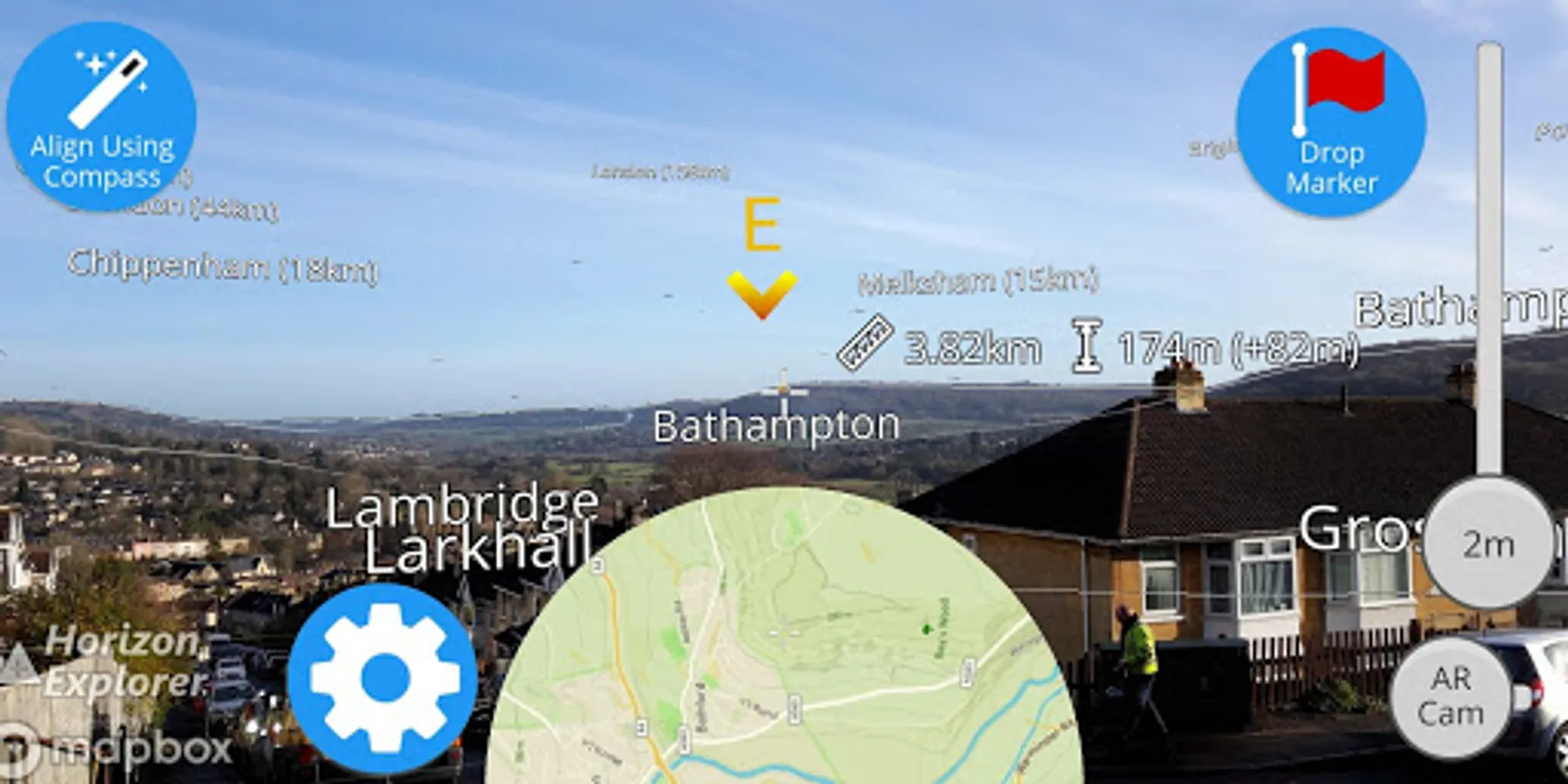
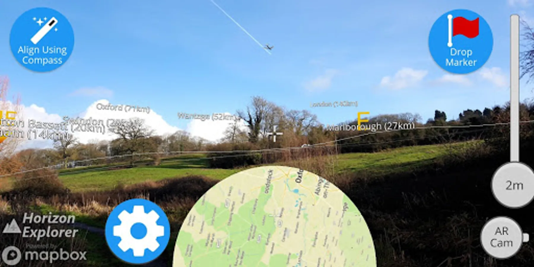
Point your camera at a landmark you can see on the horizon (eg. Mountain peak, Road, Lake, Building, Airplane) and see:
- Name of the landmark
- Distance from you
- Altitude (& relative to you)
- Map of surrounding area
- Nearby towns and cities
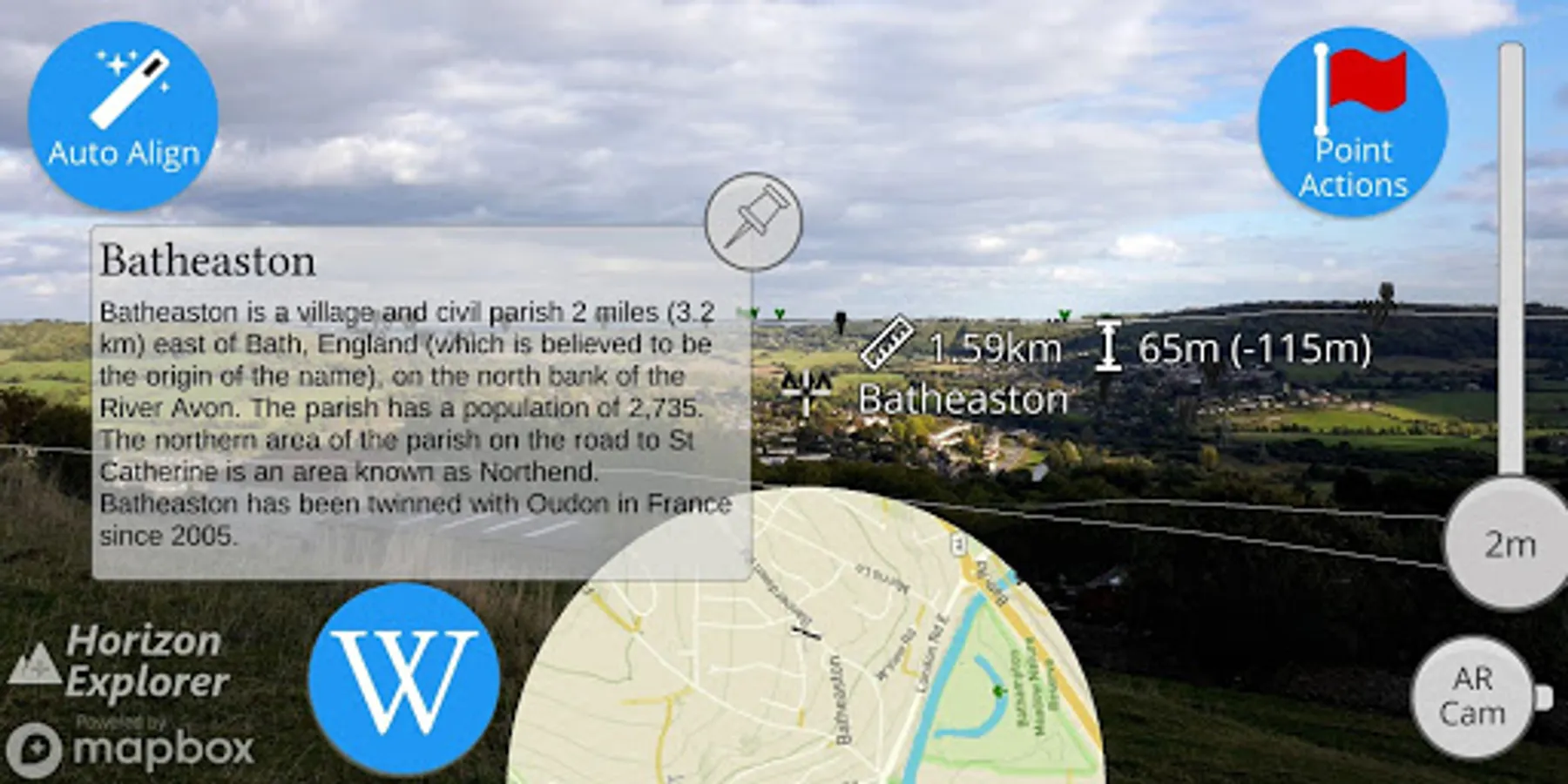
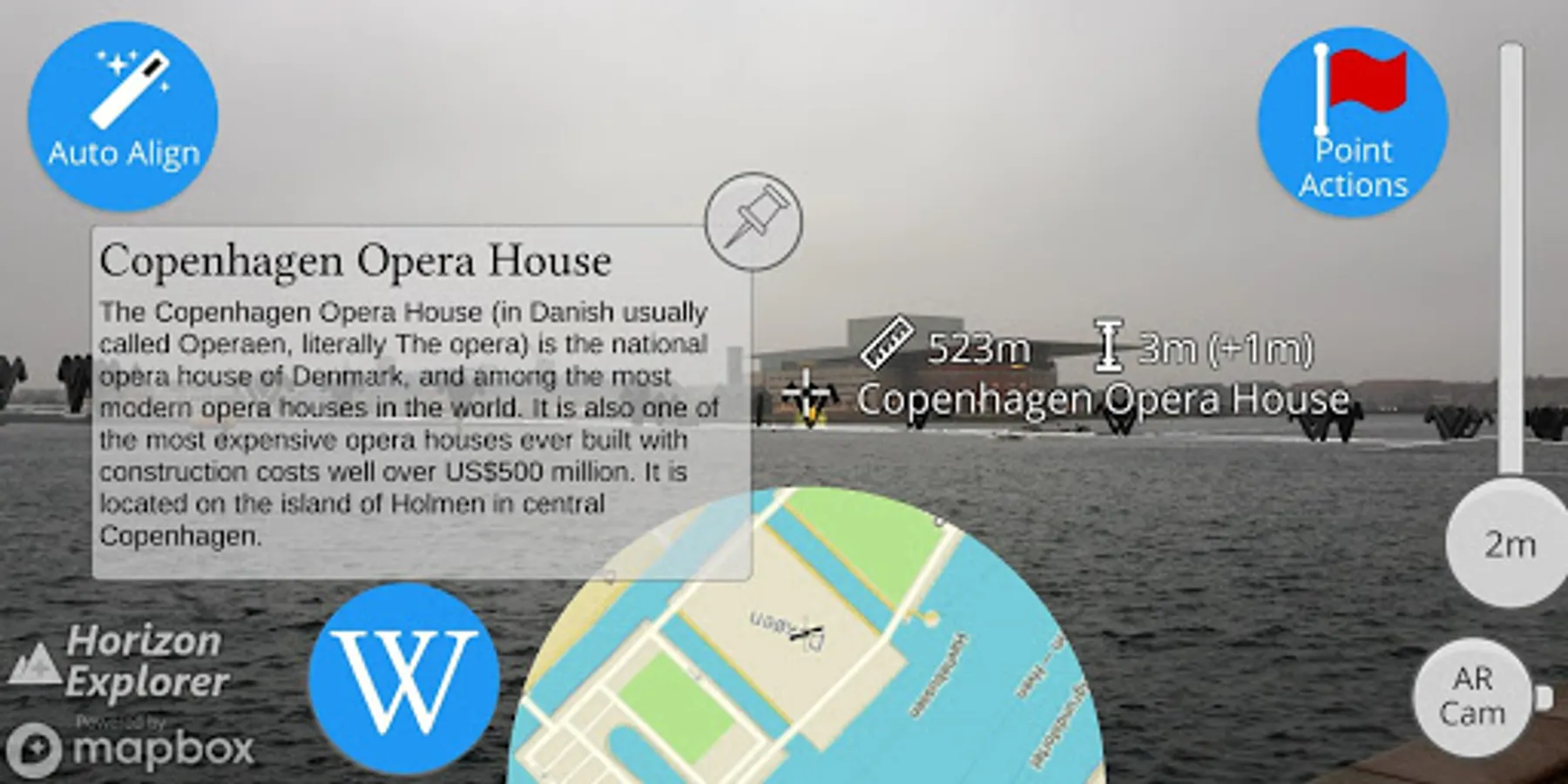
- Wikipedia info for any landmark with a Wikipedia page
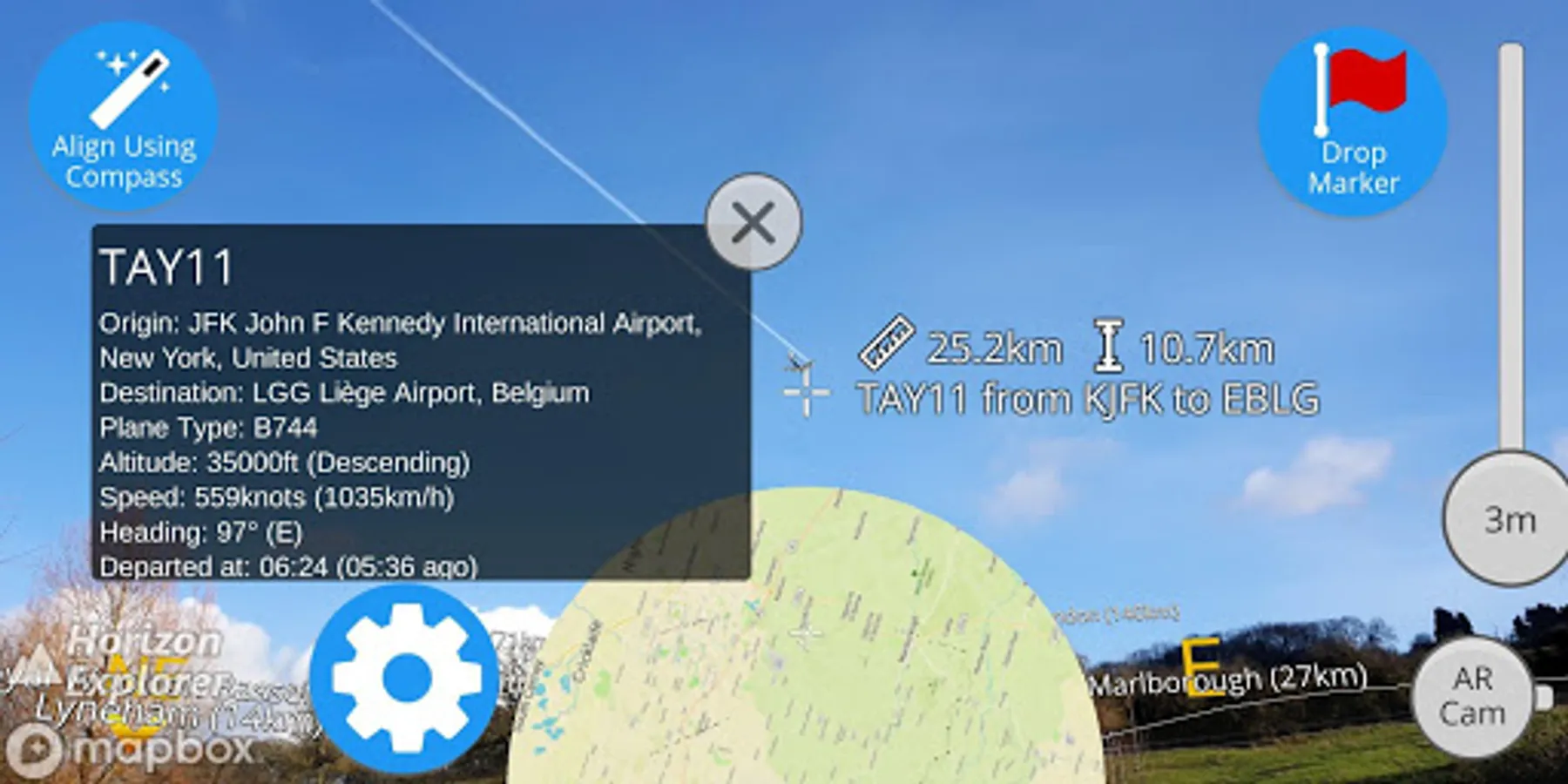
- Altitude, destination, flight number, airspeed of any commercial airline plane
- Directions to landmark (opens in google maps)
- Street view for where you're pointing (opens in google maps)
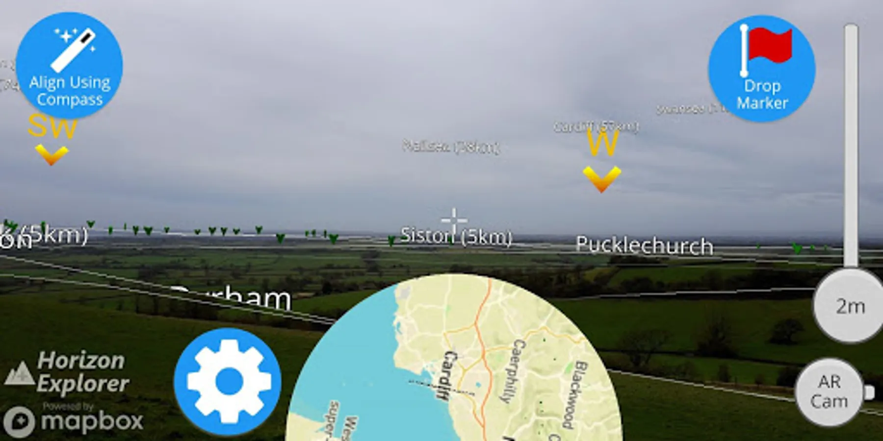
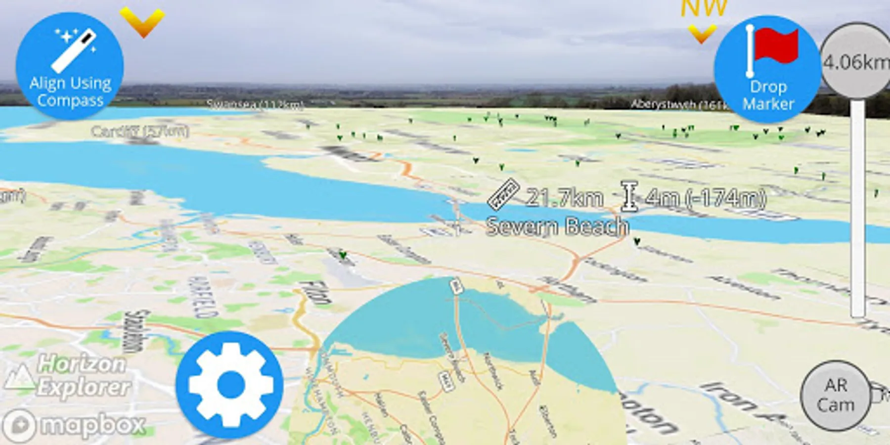
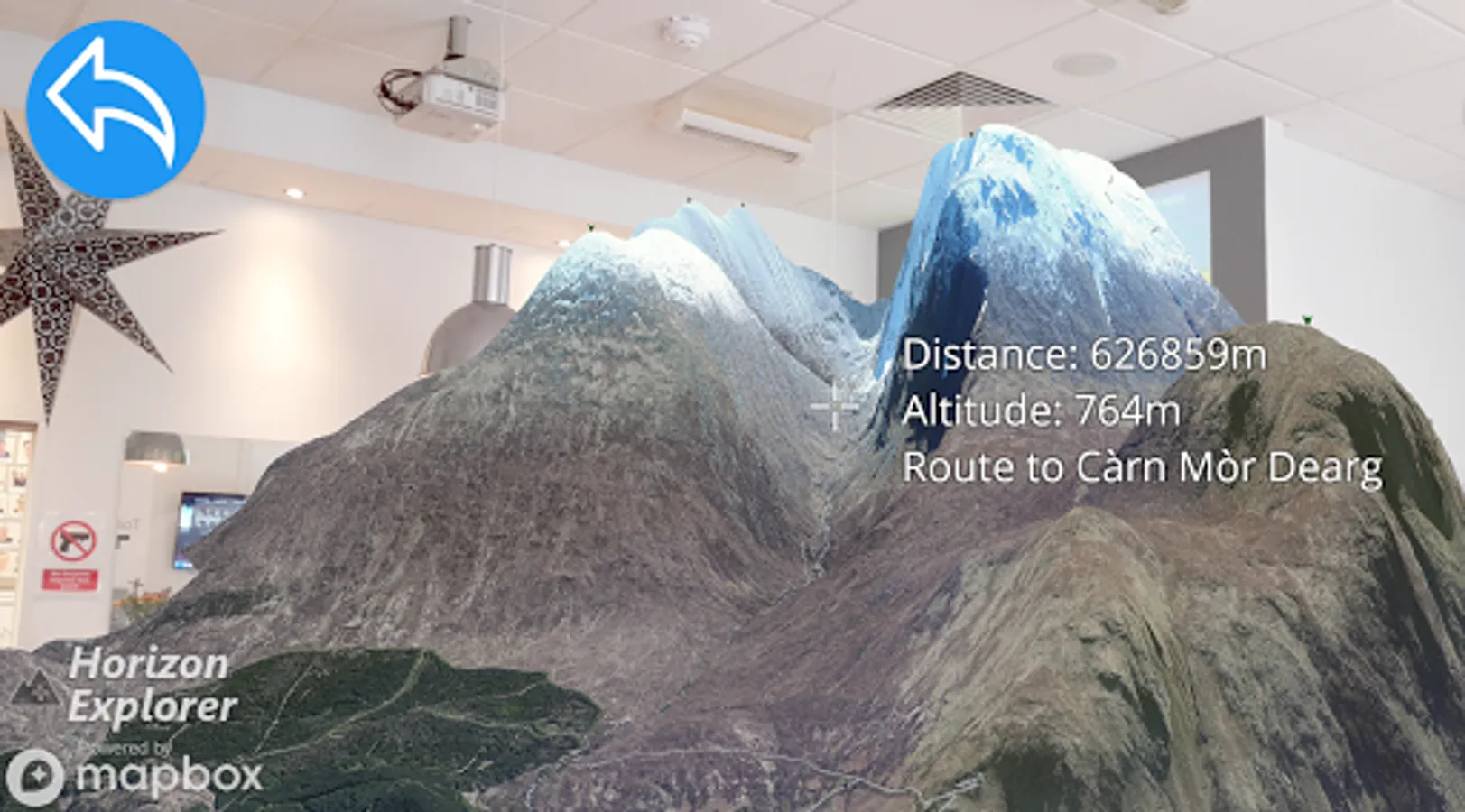
Or use 3D Map mode:
- See terrain and hills laid out in front of you
- Move phone to fly around the map
- Roadmap / satellite / hybrid
- Search & display 3D-maps for anywhere worldwide
- Distance, altitude and landmark names
- Markers on hill & mountain peaks
- Infinite scroll
Horizon Explorer works worldwide, but works best on top of a hill with an unobstructed view of your surroundings. You can drag the horizon line with your finger to line up with the camera if the automatic tracking is not working very well. Or try waving your phone around in the air in a figure 8, then press "align using compass" to calibrate the compass.
Live airplanes: Enable planes from the settings menu, then point at a plane to see the flight number, origin, destination, altitude and current airspeed of any commercial airline plane you can see.
If you are in a tall building, or otherwise not standing on the ground, enable "Tall Building mode" and optionally set your altitude using the slider.
Horizon Explorer will show mountain & hill peak names, lakes or forests, the names & designations of roads, and many buildings.
Wikipedia Information will be displayed for anything that has a Wikipedia article with a location set on the article.
- Name of the landmark
- Distance from you
- Altitude (& relative to you)
- Map of surrounding area
- Nearby towns and cities
- Wikipedia info for any landmark with a Wikipedia page
- Altitude, destination, flight number, airspeed of any commercial airline plane
- Directions to landmark (opens in google maps)
- Street view for where you're pointing (opens in google maps)
Or use 3D Map mode:
- See terrain and hills laid out in front of you
- Move phone to fly around the map
- Roadmap / satellite / hybrid
- Search & display 3D-maps for anywhere worldwide
- Distance, altitude and landmark names
- Markers on hill & mountain peaks
- Infinite scroll
Horizon Explorer works worldwide, but works best on top of a hill with an unobstructed view of your surroundings. You can drag the horizon line with your finger to line up with the camera if the automatic tracking is not working very well. Or try waving your phone around in the air in a figure 8, then press "align using compass" to calibrate the compass.
Live airplanes: Enable planes from the settings menu, then point at a plane to see the flight number, origin, destination, altitude and current airspeed of any commercial airline plane you can see.
If you are in a tall building, or otherwise not standing on the ground, enable "Tall Building mode" and optionally set your altitude using the slider.
Horizon Explorer will show mountain & hill peak names, lakes or forests, the names & designations of roads, and many buildings.
Wikipedia Information will be displayed for anything that has a Wikipedia article with a location set on the article.