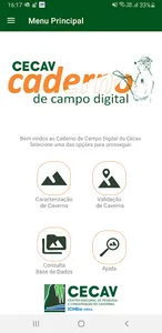
The Digital Field Notebook is a cave characterization and validation application that has an internal database, making it possible to use it even without access to the internet. The tool, available in the Android version, seeks to facilitate field activities in Brazilian caving.
With the application, you will be able to import data directly from the spreadsheet of the National Register of Speleological Information (Canie) for offline manipulation in the field. It is also possible to export the registered information using the application to process it on a computer.
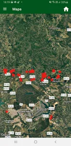
Being connected to the internet, the App brings the functionality of connection with Google Maps, allowing the visualization of its database with high definition satellite images.
RESOURCES:
Characterization of Underground Natural Cavity contemplating:
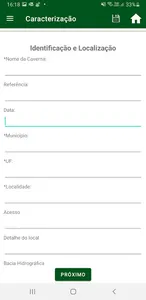
- Identification and Location
- Cave reference in other registers
- Date
- Municipality / UF
- Location
- Description of Entries
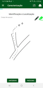
- Access
- Location Detail
- Hydrographic basin
- Dominant lithology
- Geological unit
- External difficulties
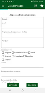
- Social and Environmental Aspects
- Use of the cave
- Protected areas
- Community involved
- Land use and occupation
- External infrastructure
- Input Characteristics
- Position
- Hydrography
- Strand Position
- Dolina
- Lapping
- Vegetation
- Internal Features
- Type of development
- Conservation state
- Internal difficulties
- Internal infrastructure
- Planialtimetry
- Standard Galleries
- Volume
- River and lake
- Water
- Soils
- Granulometry
- Suggested rock
- Lithology:
- Mineralogy and Texture
- Structure
- Fractures
- Section
- Slaughtered Blocks
- Atmosphere conditions
- Archeology
- Paleontology
- Speleothems
- Bats
- Guano
- Terrestrial invertebrates
- Aquatic invertebrates
Import of data from the National Register of Speleological Information - CANIE;
Export of the application database in ods and xls formats;
Sending by e-mail from the database;
Display of data stored in the application overlaid with Google Maps satellite images.
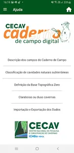
See Help in the application
With the application, you will be able to import data directly from the spreadsheet of the National Register of Speleological Information (Canie) for offline manipulation in the field. It is also possible to export the registered information using the application to process it on a computer.
Being connected to the internet, the App brings the functionality of connection with Google Maps, allowing the visualization of its database with high definition satellite images.
RESOURCES:
Characterization of Underground Natural Cavity contemplating:
- Identification and Location
- Cave reference in other registers
- Date
- Municipality / UF
- Location
- Description of Entries
- Access
- Location Detail
- Hydrographic basin
- Dominant lithology
- Geological unit
- External difficulties
- Social and Environmental Aspects
- Use of the cave
- Protected areas
- Community involved
- Land use and occupation
- External infrastructure
- Input Characteristics
- Position
- Hydrography
- Strand Position
- Dolina
- Lapping
- Vegetation
- Internal Features
- Type of development
- Conservation state
- Internal difficulties
- Internal infrastructure
- Planialtimetry
- Standard Galleries
- Volume
- River and lake
- Water
- Soils
- Granulometry
- Suggested rock
- Lithology:
- Mineralogy and Texture
- Structure
- Fractures
- Section
- Slaughtered Blocks
- Atmosphere conditions
- Archeology
- Paleontology
- Speleothems
- Bats
- Guano
- Terrestrial invertebrates
- Aquatic invertebrates
Import of data from the National Register of Speleological Information - CANIE;
Export of the application database in ods and xls formats;
Sending by e-mail from the database;
Display of data stored in the application overlaid with Google Maps satellite images.
See Help in the application
Show More