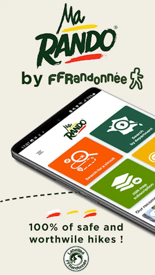
MaRando – FFRandonnée
FFRandonnée - Cirkwi
4.6 ★
1K ratings
500,000+
downloads
Free
+ in-app
In this hiking app, users can browse routes, filter options, and download trails for offline use. Includes route details, points of interest, GPS guidance, and trail filtering features.
AppRecs review analysis
AppRecs rating 4.6. Trustworthiness 0 out of 100. Review manipulation risk 0 out of 100. Based on a review sample analyzed.
★★★★☆
4.6
AppRecs Rating
Ratings breakdown
5 star
60%
4 star
40%
3 star
0%
2 star
0%
1 star
0%
What to know
✓
High user satisfaction
100% of sampled ratings are 4+ stars (4.6★ average)
✓
Authentic reviews
Natural distribution, no red flags
About MaRando – FFRandonnée
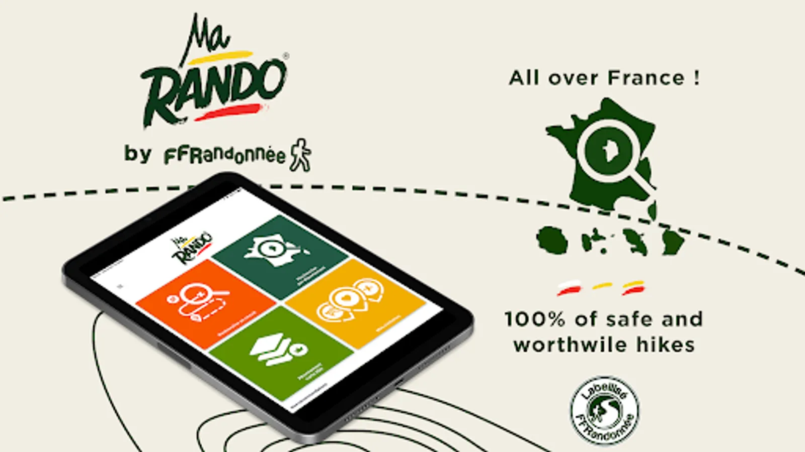
Designed to inspire and facilitate the practice of hiking for all nature sport fans, MaRando concentrates the work of its teams of passionate volunteer markers who help maintain more than 180 000 kilometers of trails since 1947.
THE FFRANDONNEE LABEL, A REAL ASSET !
A national label addressed to our association by a Federation recognized as being of public utility, guarantees every hiker the quality of the routes that are offered. It represents an undeniable asset in terms of sporting or heritage value, safety and comfort for the hiker, while taking care of our dear and beautiful planet. This label is awarded under very specific conditions :
- Quality marking in accordance with the official FFRandonnée marking and signposting charter
- Duration in maintaining the trails
- Safe from obstacles (under normal circumstances)
- The option of paved roads is minimal : only for rural PR® trails
- Heritage value of the circuit : natural landscape, architectural monuments, …
- Eco-friendly
A whole set of quality criteria which you will find in the hikes proposed within MaRando.
FEATURES THAT WILL CHANGE YOUR LIFE
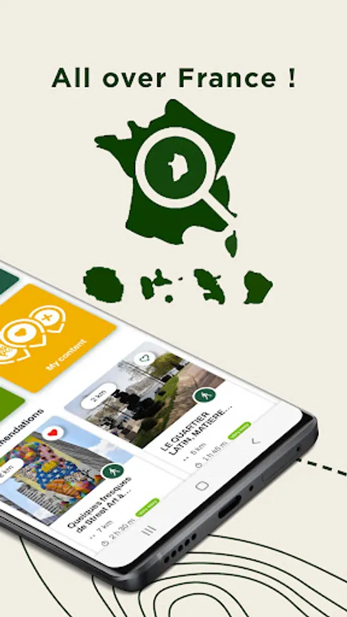
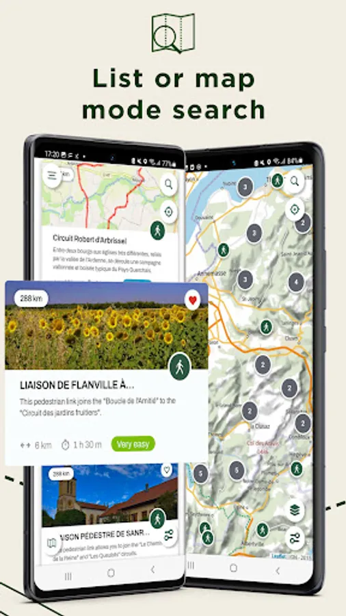
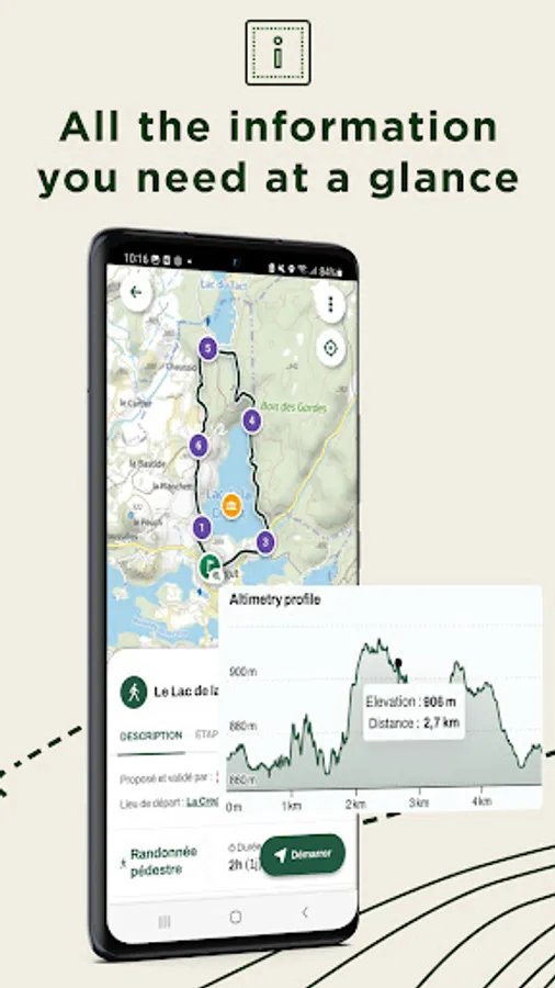
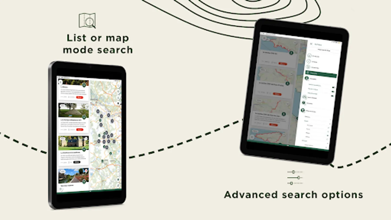
- Find a multitude of hiking ideas around you selected by lovers of their territory and experts of the FFRandonnée
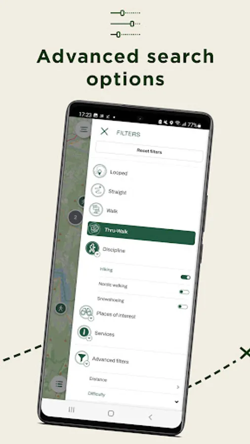
- Filter your search and access paths carefully chosen and decidaced to suit your own wishes
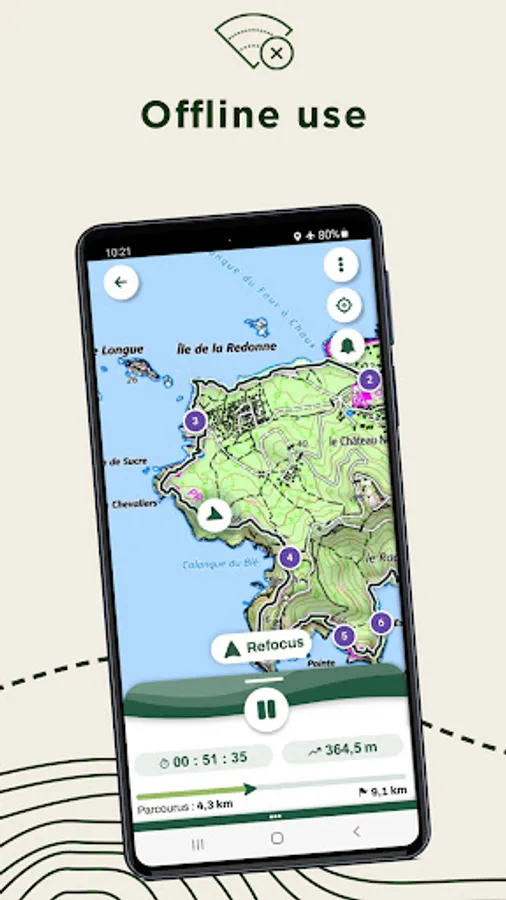
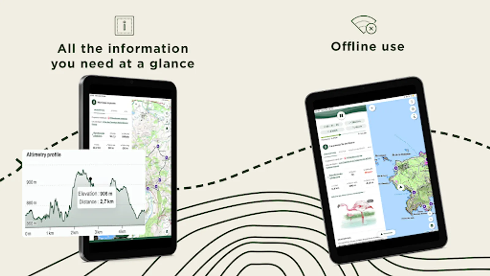
- Avoid connection difficulty during your trip : download your hike for free and take it along with you for offline consultation !
- Because hiking is good for health and mind, don’t miss any point of interest and bring onboard all of them located along your route
- Launch the GPS navigation and let yourself be guided in serenity : we will warn you whenever you stray too far from the path
- Otherwise, you can also download a PDF file of the path or its GPX layout
- For competitors, set your own goals and follow your performance with our statistics tool that will reveal the type of hiker you are !
- Bookmark all your favorite paths to make sure you won’t forget them !
BE AN ACTOR IN THE DEVELOPMENT OF HIKING
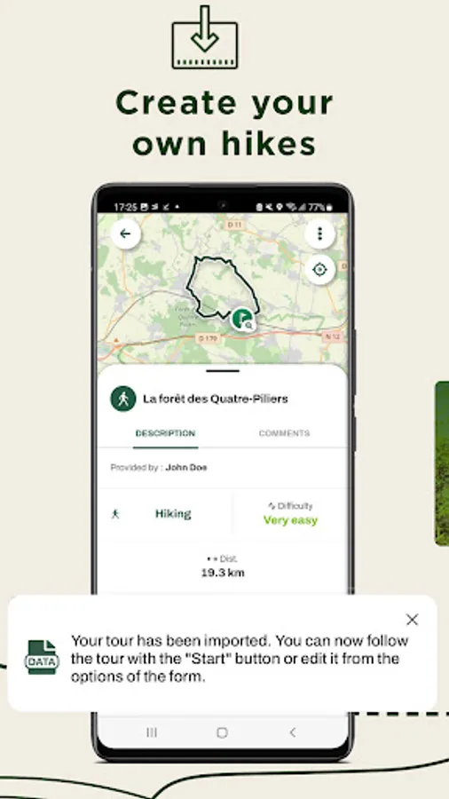
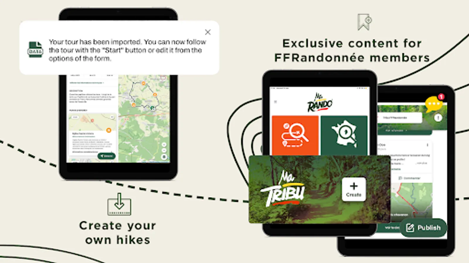
- Create your own hiking trail and associate points of interest with it, taking care to enrich it with illustrations
- If you happen to notice a marking error, a problem of access to the trail, a defective signpost, a problem impacting safety or anything else regarding the trail, please report directly in the app the encountered issue in the Suricate tab (https://sentinelles.sportsdenature.fr). Your report will be sent to a network of local authorities, sports federations, government services and natural area managers. In return, you will then be informed of the follow-up given to your report.
- Share your feedback on the journey you have just taken by writing a comment accessible to all the members of the MaRando community
- If a technical problem occurs or if you think your suggestion might improve the hiking experience or the application, do not hesitate to share your feedback and ideas at : support.marando@ffrandonnee.fr
MaRando is supported by the National Sports Agency (ANS).
MaRando – FFRandonnée Screenshots


Tap to Rate:
Reviews for MaRando – FFRandonnée
Christophe GAYOT
10/19/2025
testées sur deux parcours itinéraires sympa et le suivi en direct marche bien. descriptions précises. pas testé us de fonctionnalités RAS
Isobel Evans
6/14/2025
Where to begin? Very frustrating: in the search function, the filters don't work. Impossible to sort - by distance, by difficulty - nope, not available. This app needs A LOT of work to improve it.