In this mapping app, users can view, create, and edit spatial data offline with tools for measuring, marking, and attaching media. Includes features for managing maps, exporting data, and working with GPS tracks.
AppRecs review analysis
AppRecs rating 3.7. Trustworthiness 81 out of 100. Review manipulation risk 23 out of 100. Based on a review sample analyzed.
★★★☆☆
3.7
AppRecs Rating
Ratings breakdown
5 star
45%
4 star
15%
3 star
11%
2 star
11%
1 star
18%
What to know
✓
Low review manipulation risk
23% review manipulation risk
✓
Credible reviews
81% trustworthiness score from analyzed reviews
✓
Good user ratings
60% positive sampled reviews
About CarryMap
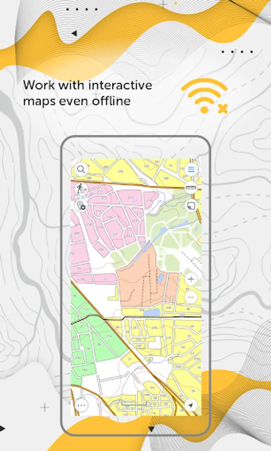
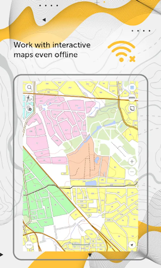
CarryMap is a free application for viewing and working with interactive maps offline, providing a wide range of tools.
It is designed to work with maps in a specific mobile format CMF2. To export your ArcGIS maps to this format, use CarryMap Builder, an extension to ArcGIS Desktop.
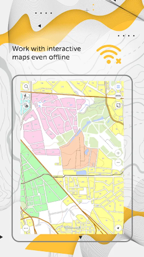
CarryMap app offers a comprehensive set of tools for collecting, processing and analyzing spatial geodata. It provides seamless field work without authorization, payments and in-app purchases.
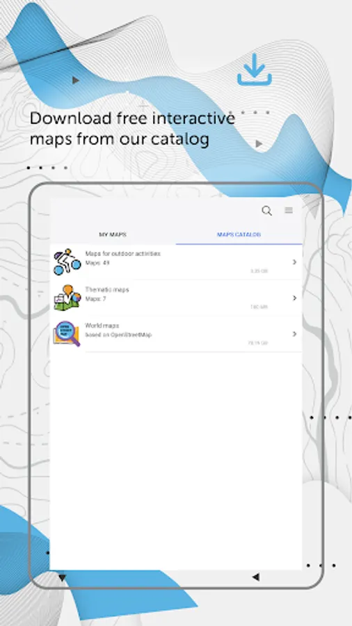
Maps management
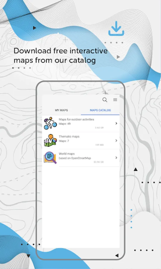
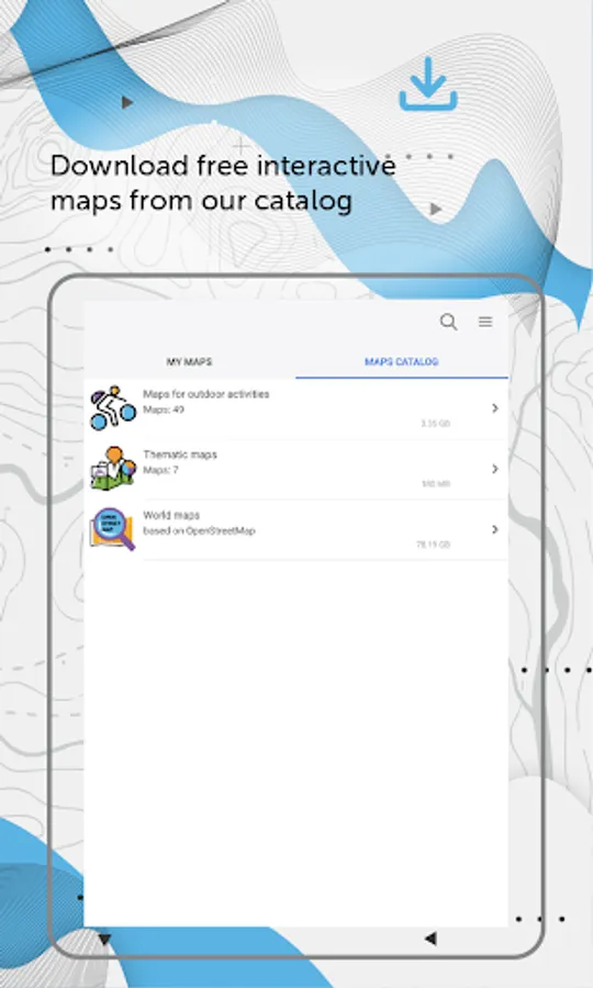
- Download maps of only needed areas and store them in a convenient catalog. The maps provided in the catalog were created based on OpenStreetMap data.
- Upload your own maps prepared in ArcGIS and work with them offline.
- Use reliable methods for your maps protection.
- Create fully functional projects for work with all the needed information.
- Save selected map areas as bookmarks.
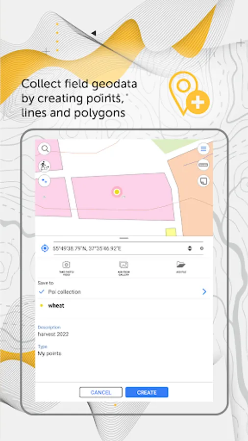
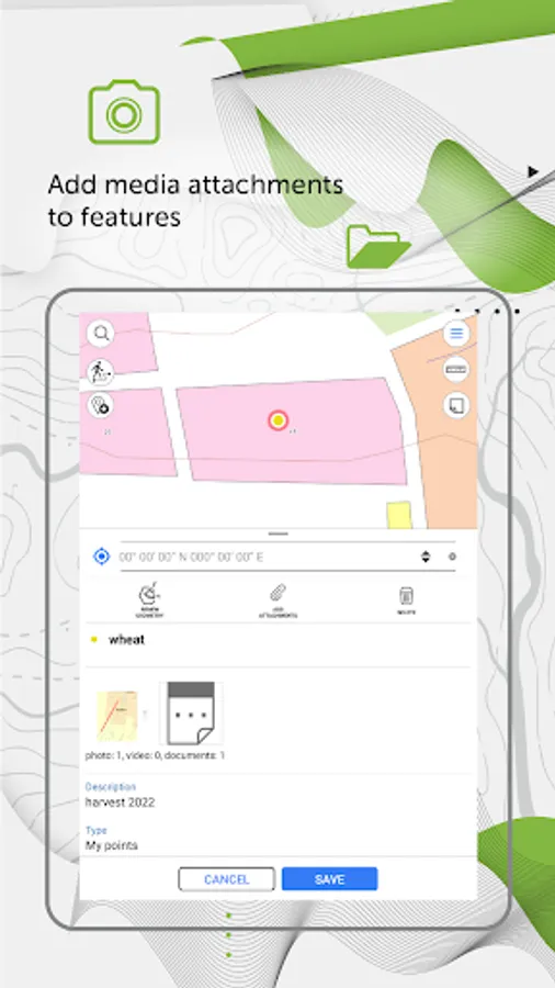
Working with objects
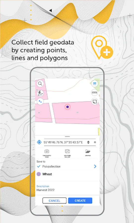
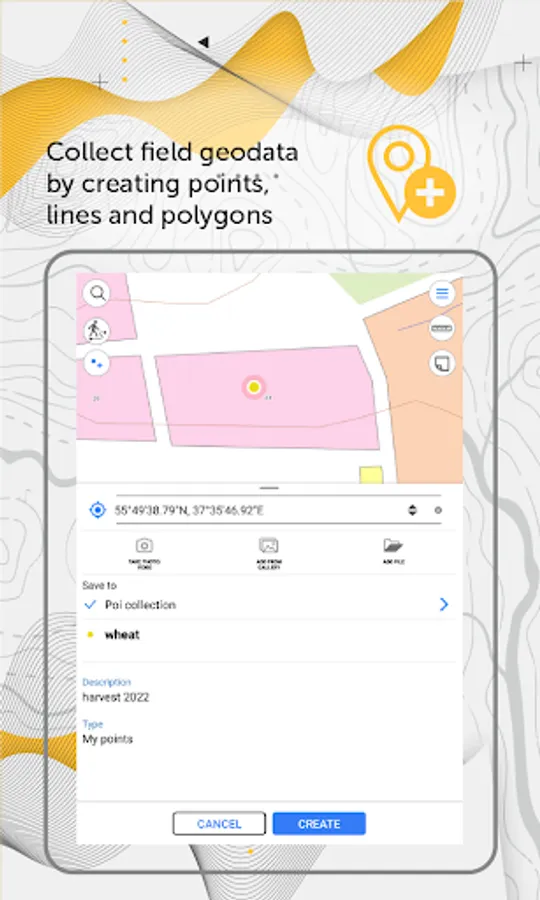
- Create and edit point, line, and polygon features on the map.
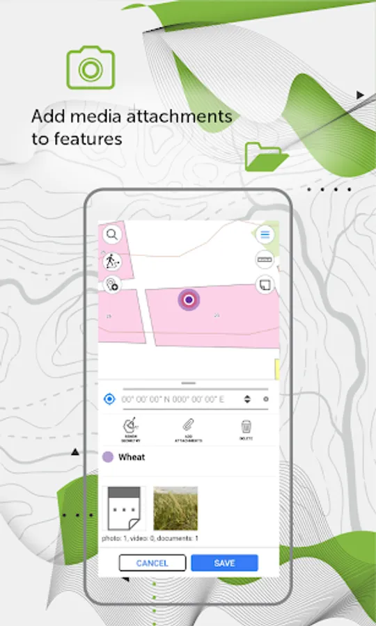
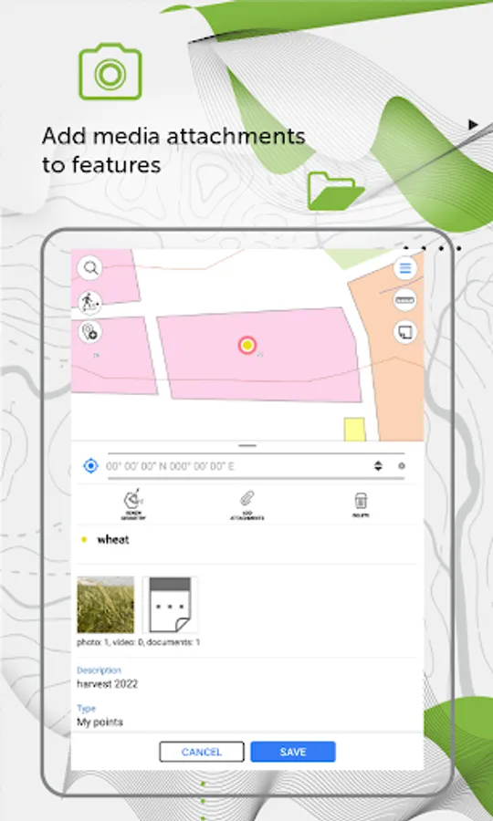
- Add media attachments (photo, video and documents) to features.
- Record voice comments when creating and describing features on the map.
- Create points on-the-fly using your device camera.
- Create points on the map with a single tap while moving, add description later if needed.
- Add graphic marks as text, arrows or free hand graphic.
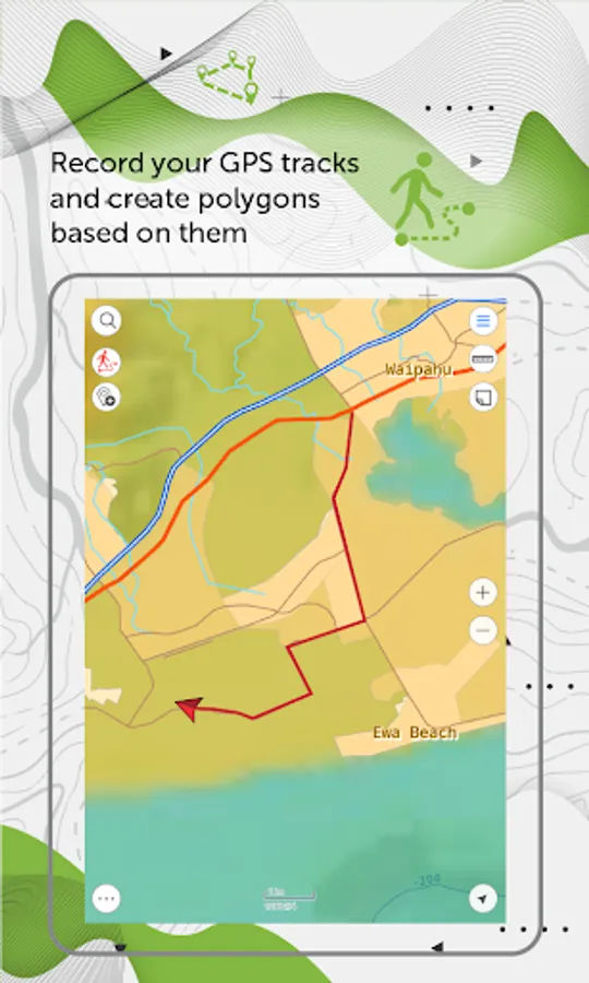
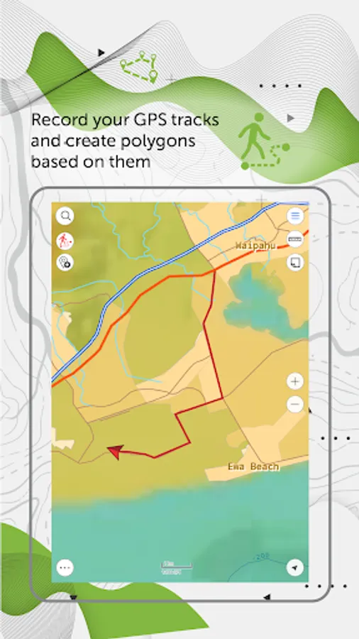
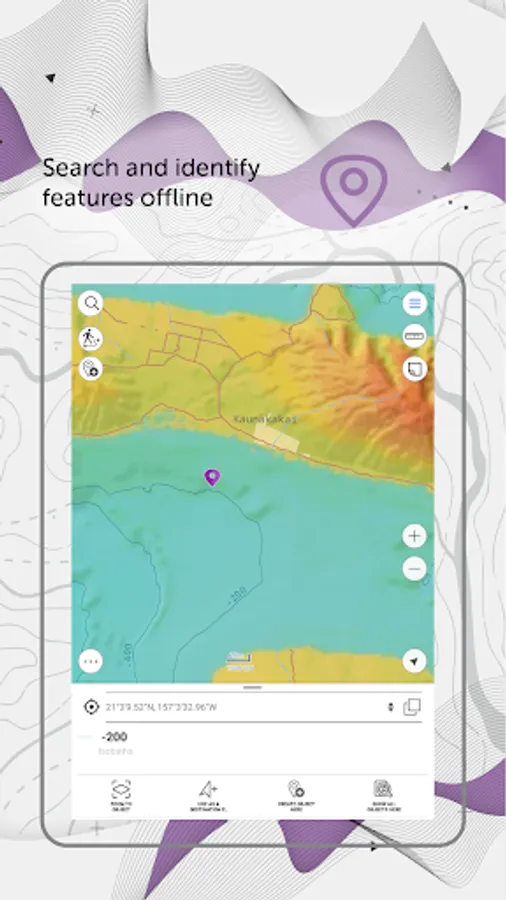
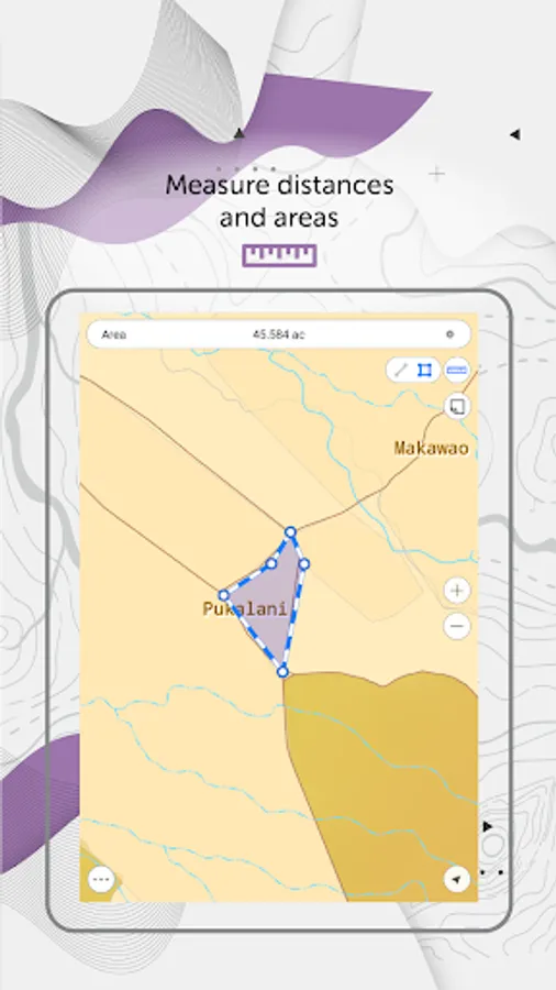
GPS tracks and navigation
- Use external Bad Elf GPS receiver to find your current location.
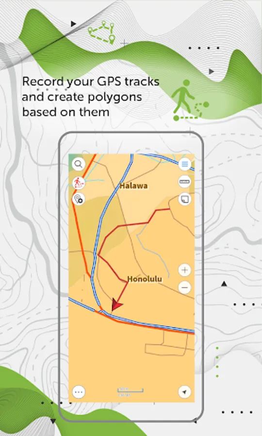
- Save tracks automatically without being distracted by editing them as you go.
- Use features on the map as landmarks or destination points on your route.
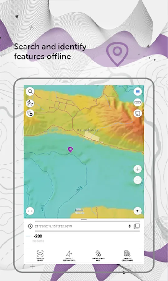
- Search and identify features offline.
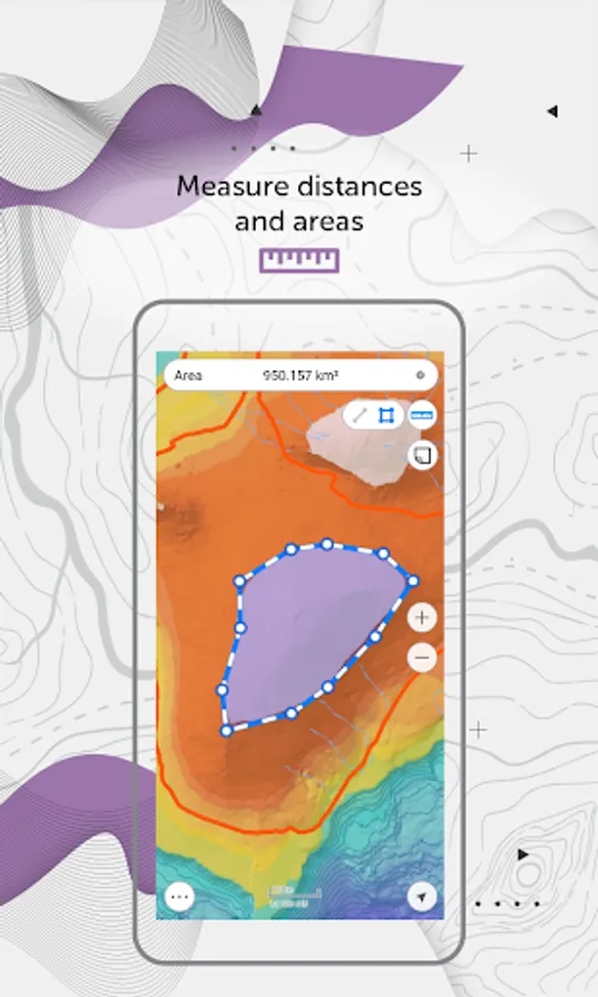
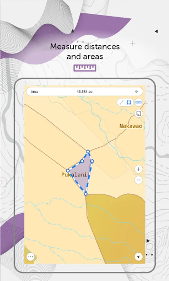
- Measure distances and areas.
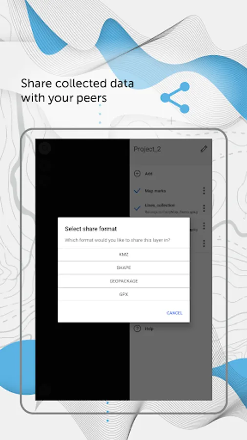
Data export
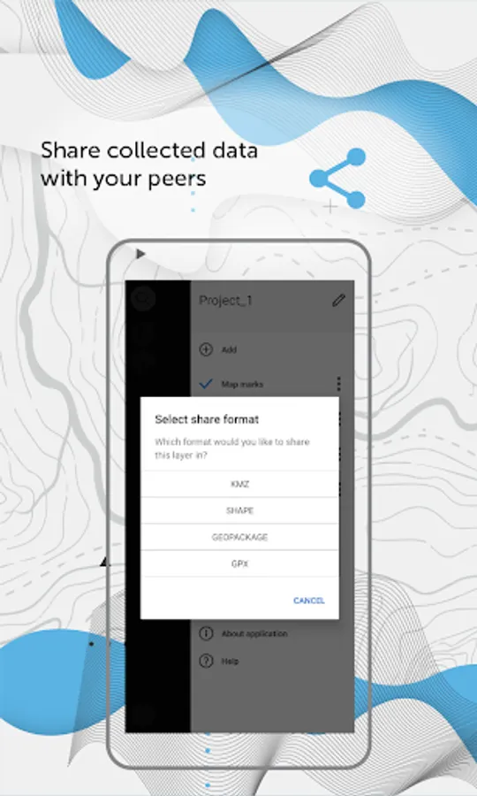
- Share coordinates of features on the map by sending a file or a link.
- Upload maps in MBTILES* formats.
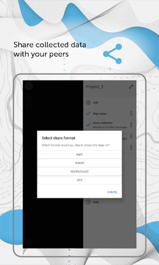
- Share collected data in GPKG (GeoPackage), GPX, KML/KMZ and SHP formats.
*Maps in MBTILES format with raster tile type only are supported.
The application is accessible to a wide range of users, regardless of GIS skills, and can be used in various fields, including electrical energy industry, agriculture, geology and geodesy, housing and utility, environmental protection, water and land resources management, ecology and incident management, urban management, etc.
Take the opportunity to create your own branded application for viewing and working with mobile maps based on CarryMap for your company. Read more: https://carrymap.com/en/features/branding/
Read more about all the capabilities of CarryMap Builder extension at https://builder.carrymap.com/en/
To learn more about CarryMap application, visit https://carrymap.com/en/overview/
Watch educational videos on our YouTube page:
https://www.youtube.com/c/CarryMap/videos
Your questions or comments are welcome at support@xtools.pro
It is designed to work with maps in a specific mobile format CMF2. To export your ArcGIS maps to this format, use CarryMap Builder, an extension to ArcGIS Desktop.
CarryMap app offers a comprehensive set of tools for collecting, processing and analyzing spatial geodata. It provides seamless field work without authorization, payments and in-app purchases.
Maps management
- Download maps of only needed areas and store them in a convenient catalog. The maps provided in the catalog were created based on OpenStreetMap data.
- Upload your own maps prepared in ArcGIS and work with them offline.
- Use reliable methods for your maps protection.
- Create fully functional projects for work with all the needed information.
- Save selected map areas as bookmarks.
Working with objects
- Create and edit point, line, and polygon features on the map.
- Add media attachments (photo, video and documents) to features.
- Record voice comments when creating and describing features on the map.
- Create points on-the-fly using your device camera.
- Create points on the map with a single tap while moving, add description later if needed.
- Add graphic marks as text, arrows or free hand graphic.
GPS tracks and navigation
- Use external Bad Elf GPS receiver to find your current location.
- Save tracks automatically without being distracted by editing them as you go.
- Use features on the map as landmarks or destination points on your route.
- Search and identify features offline.
- Measure distances and areas.
Data export
- Share coordinates of features on the map by sending a file or a link.
- Upload maps in MBTILES* formats.
- Share collected data in GPKG (GeoPackage), GPX, KML/KMZ and SHP formats.
*Maps in MBTILES format with raster tile type only are supported.
The application is accessible to a wide range of users, regardless of GIS skills, and can be used in various fields, including electrical energy industry, agriculture, geology and geodesy, housing and utility, environmental protection, water and land resources management, ecology and incident management, urban management, etc.
Take the opportunity to create your own branded application for viewing and working with mobile maps based on CarryMap for your company. Read more: https://carrymap.com/en/features/branding/
Read more about all the capabilities of CarryMap Builder extension at https://builder.carrymap.com/en/
To learn more about CarryMap application, visit https://carrymap.com/en/overview/
Watch educational videos on our YouTube page:
https://www.youtube.com/c/CarryMap/videos
Your questions or comments are welcome at support@xtools.pro