AppRecs review analysis
AppRecs rating 4.5. Trustworthiness 55 out of 100. Review manipulation risk 39 out of 100. Based on a review sample analyzed.
★★★★☆
4.5
AppRecs Rating
Ratings breakdown
5 star
100%
4 star
0%
3 star
0%
2 star
0%
1 star
0%
What to know
✓
High user satisfaction
100% of sampled ratings are 5 stars
About OCWGIS
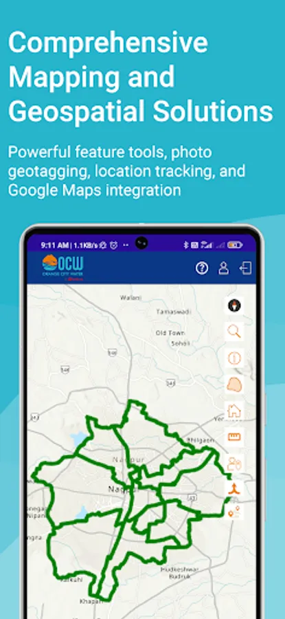
OCWGIS app is an official mobile utility app developed by OCW by Veolia for the Nagpur Municipal Corporation (NMC) Water Works Department. This app enables users to gather and analyze geographical data, access different base maps, navigate locations, measurement tools and perform various tasks related to GIS .
Key Features:
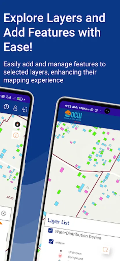
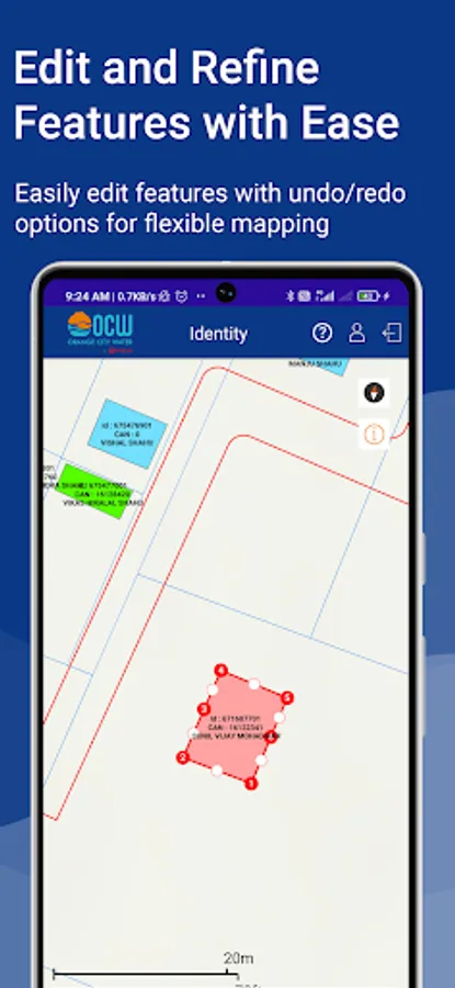
Editing Toolbar - This functionality helps the user to add new features, select features for split & merge using the editor's tool.
Save - Editing toolbar will be used to Save the features with activities.
Catching View Area - This functionality helps the user to view all features within a 300 m radius from its position.
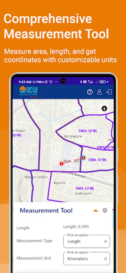
Measure Distance - Measure distance functionality in the mobile GIS application is used to measure distance. Users can measure the length of a line drawn over the map and calculate the segment length of a polygon drawn over the map.
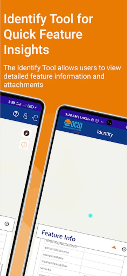
Identity - This function allows the user to view the relevant information of the features when the user clicks over it using this tool.
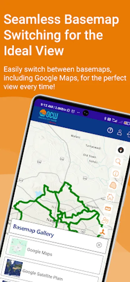
Basemap - This function allows the user to choose from the various maps given in the system.
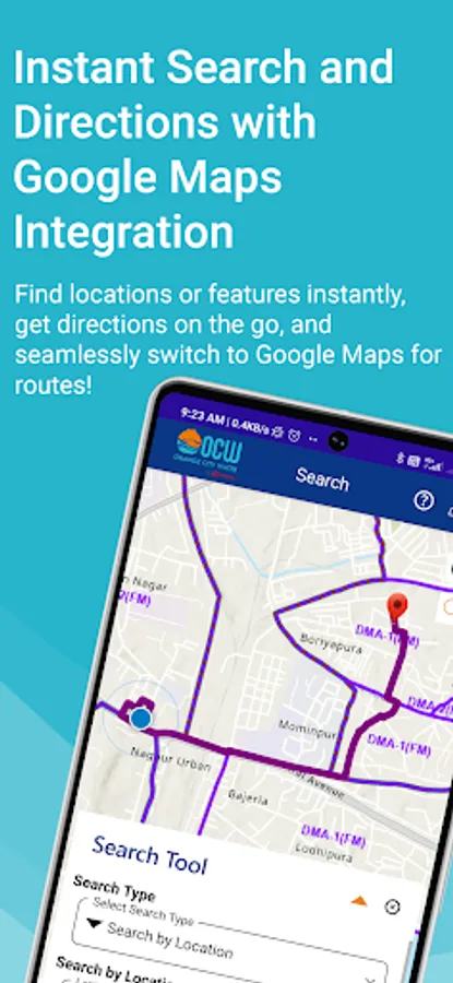
Route - This tool is used to get a route from the source to the destination.
Search Tool - Users will be able to search the features for selected layers. The app will pan to the location and user can select the features on the map to view those features.
Geotagged Photo - This function will geotag the captured image using the user's current location.
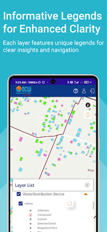
Symbology - This function allows the user to view Legend of the map.
North Arrow - This function allows the user to view the north arrow on the map.
Zoom in & Out - This functionality helps the user to zoom in and out on the map.
PAN - This functionality helps the user to navigate or pan on a map.
Refresh Map - This function allows the user to refresh the features within a 300 m buffer area.
App Requirements:
Android OS version 8.0 or above
Compatible with 4G/5G/Wi-Fi networks
For support, users can contact NMC via the toll-free number 1800-266-9899 or email Contact@ocwindia.com. This app prioritizes transparency, ease of use, and robust functionality for an improved water service management.
Key Features:
Editing Toolbar - This functionality helps the user to add new features, select features for split & merge using the editor's tool.
Save - Editing toolbar will be used to Save the features with activities.
Catching View Area - This functionality helps the user to view all features within a 300 m radius from its position.
Measure Distance - Measure distance functionality in the mobile GIS application is used to measure distance. Users can measure the length of a line drawn over the map and calculate the segment length of a polygon drawn over the map.
Identity - This function allows the user to view the relevant information of the features when the user clicks over it using this tool.
Basemap - This function allows the user to choose from the various maps given in the system.
Route - This tool is used to get a route from the source to the destination.
Search Tool - Users will be able to search the features for selected layers. The app will pan to the location and user can select the features on the map to view those features.
Geotagged Photo - This function will geotag the captured image using the user's current location.
Symbology - This function allows the user to view Legend of the map.
North Arrow - This function allows the user to view the north arrow on the map.
Zoom in & Out - This functionality helps the user to zoom in and out on the map.
PAN - This functionality helps the user to navigate or pan on a map.
Refresh Map - This function allows the user to refresh the features within a 300 m buffer area.
App Requirements:
Android OS version 8.0 or above
Compatible with 4G/5G/Wi-Fi networks
For support, users can contact NMC via the toll-free number 1800-266-9899 or email Contact@ocwindia.com. This app prioritizes transparency, ease of use, and robust functionality for an improved water service management.