Altimeter professional
FFZ srl
4.4 ★
59K ratings
1,000,000+
downloads
Free
+ in-app
AppRecs review analysis
AppRecs rating 4.0. Trustworthiness 73 out of 100. Review manipulation risk 27 out of 100. Based on a review sample analyzed.
★★★★☆
4.0
AppRecs Rating
Ratings breakdown
5 star
64%
4 star
24%
3 star
5%
2 star
2%
1 star
4%
What to know
✓
Low review manipulation risk
27% review manipulation risk
✓
Credible reviews
73% trustworthiness score from analyzed reviews
⚠
Ad complaints
Many low ratings mention excessive ads
About Altimeter professional
The professional altimeter with automatic altitude detection that works even without an internet connection!
With the professional altimeter application you will be able to know the real altitude of the place where you are. It automatically shows the altitude through a complex algorithm that uses three detection methods together:
- Via satellite triangulation (functioning even without internet connection)
- Through the altitude on the map by taking the altitude of the land from your position
- Through the pressure sensor (if present) calibrated with the nearest weather station
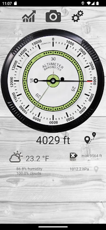
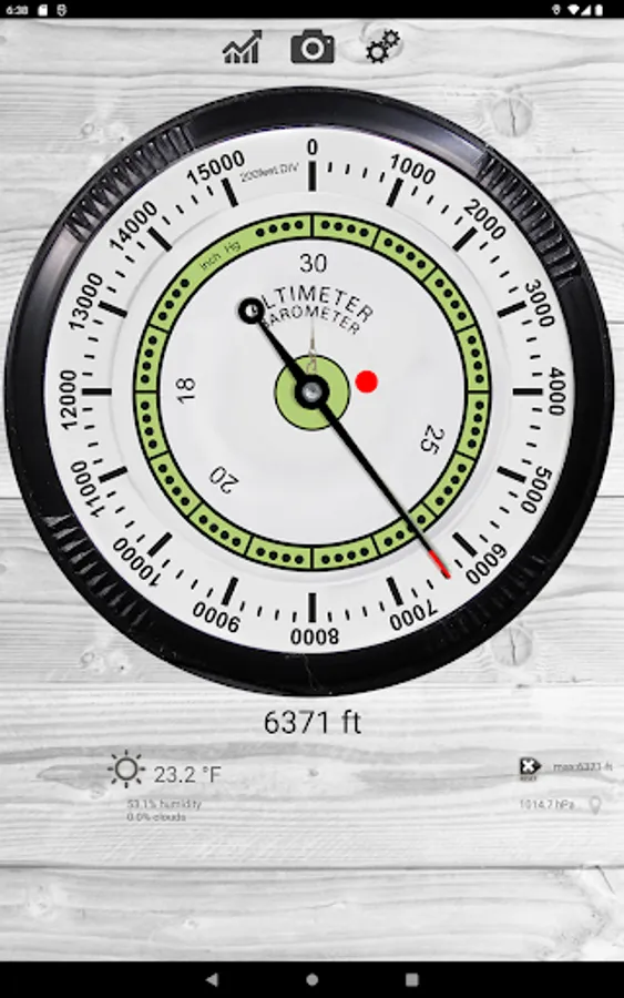
Very accurate graphics proposes an analog altimeter (in meters or feet) with digital measurement.
Here are some features:
- Automatic altitude measurement (possibility of manual setting even with one of the three measurement methods [Map Altitude, Flight Altitude, GPS Altitude])
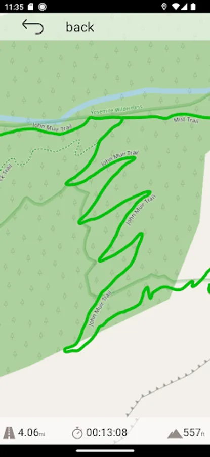
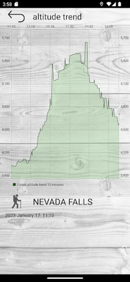
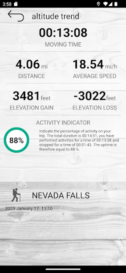
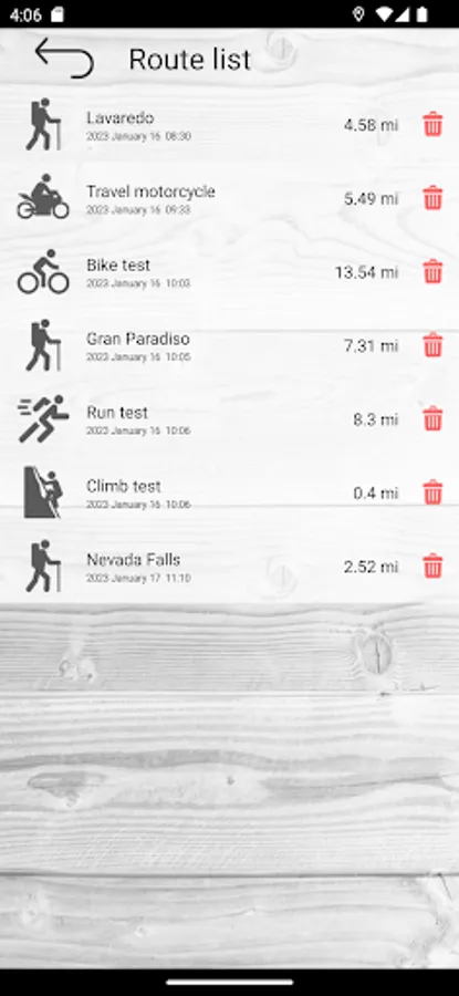
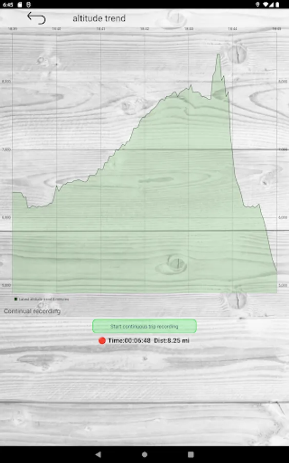
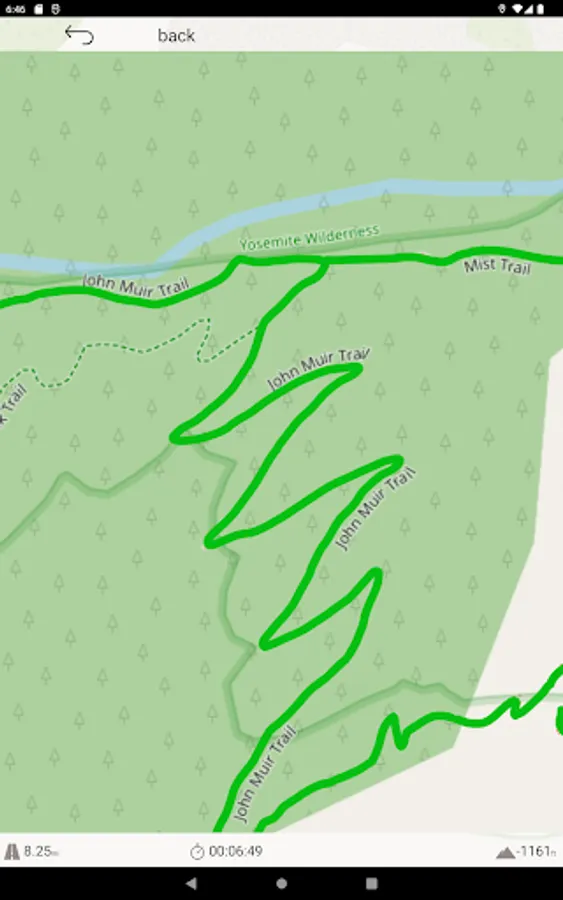
- History function with memorization of the route on the map and altitude difference graphs [also works when the app is closed] with indicators of speed, average speed, increase in altitude.
- Alert system to send your position in case of need by message or SMS
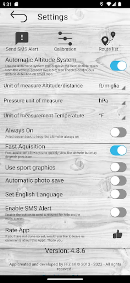
- Indication of weather forecast with trend, temperature and humidity measurement
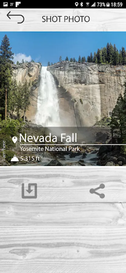
- Photos with superimposed data, location and altitude
- Custom widget to insert in Home
With the Premium additional function you can:
- Turn off advertising
- Remove watermark from photos
With the professional altimeter application you will be able to know the real altitude of the place where you are. It automatically shows the altitude through a complex algorithm that uses three detection methods together:
- Via satellite triangulation (functioning even without internet connection)
- Through the altitude on the map by taking the altitude of the land from your position
- Through the pressure sensor (if present) calibrated with the nearest weather station
Very accurate graphics proposes an analog altimeter (in meters or feet) with digital measurement.
Here are some features:
- Automatic altitude measurement (possibility of manual setting even with one of the three measurement methods [Map Altitude, Flight Altitude, GPS Altitude])
- History function with memorization of the route on the map and altitude difference graphs [also works when the app is closed] with indicators of speed, average speed, increase in altitude.
- Alert system to send your position in case of need by message or SMS
- Indication of weather forecast with trend, temperature and humidity measurement
- Photos with superimposed data, location and altitude
- Custom widget to insert in Home
With the Premium additional function you can:
- Turn off advertising
- Remove watermark from photos
Altimeter professional Screenshots


Tap to Rate:
Reviews for Altimeter professional
Peter Lucas
12/27/2025
Works very well. Even in a commercial airplane if you are near a window.
Kevin Edwards
12/4/2025
great!