About Mapfy
Mapfy is the ideal tool for rural producers, agronomists and agribusiness managers who need to visualize and manage geospatial information directly in the field.
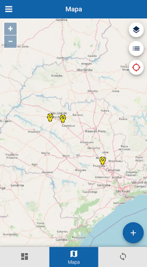
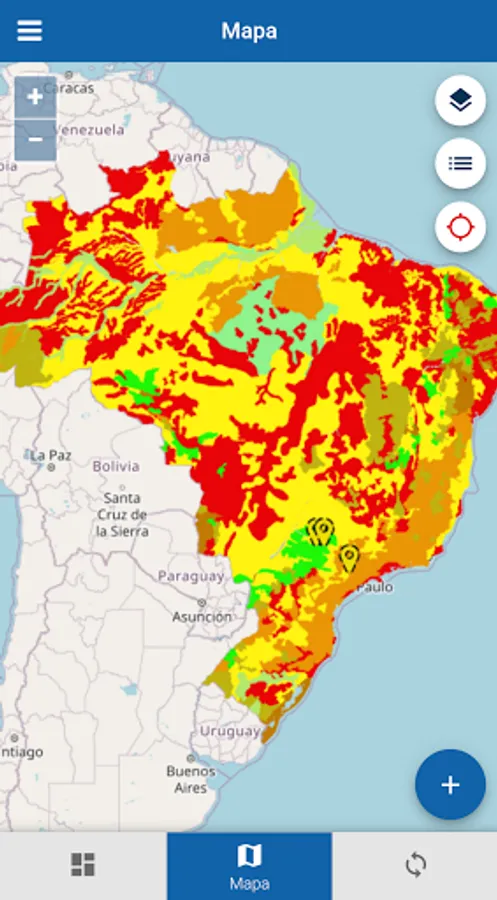
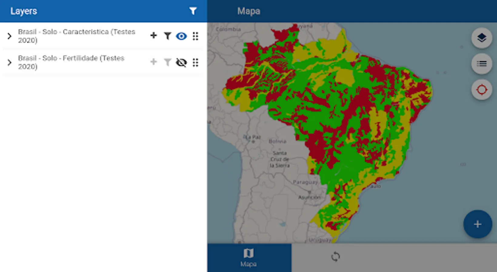
LAYER AND MAP VIEW
Import and upload SHP, KML, GeoJSON and RASTER files to the web portal and access them directly in the app, with personalized themes for better analysis.
GPS AND NAVIGATION
Track your location in real time and navigate between farms and fields with precision. Carry out records and occurrences based on your geographic information.
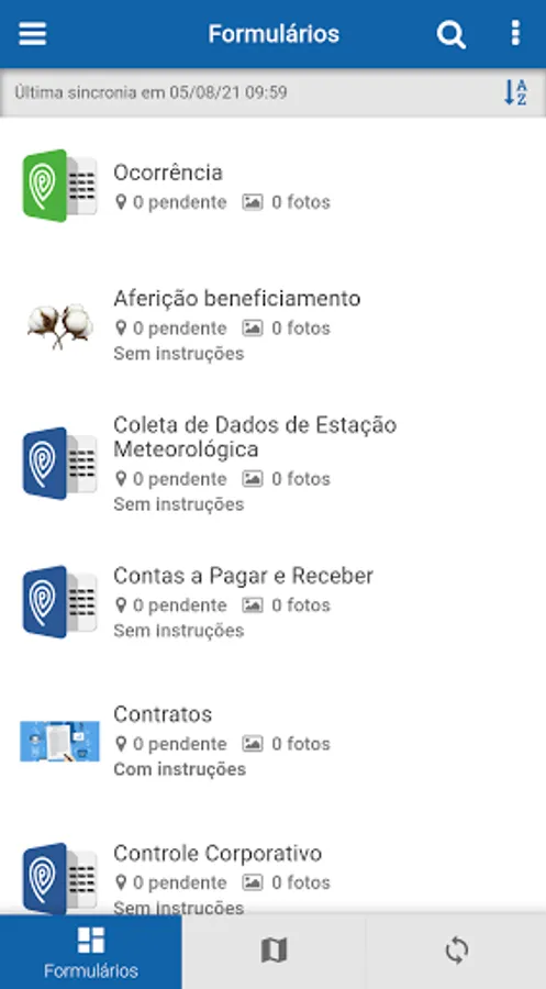
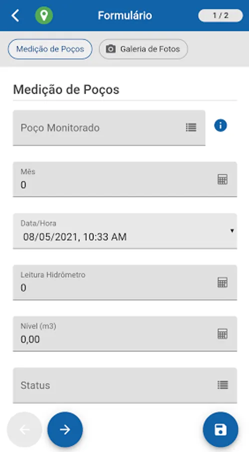
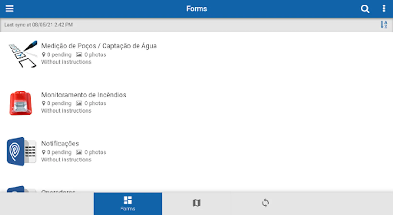
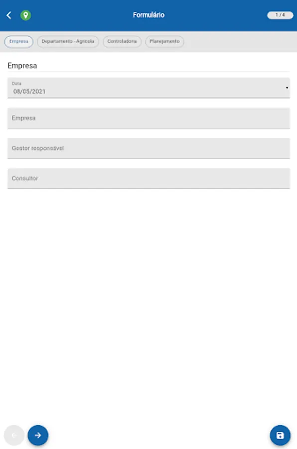
CUSTOM FORMS
Record field information through configurable forms on the web portal.
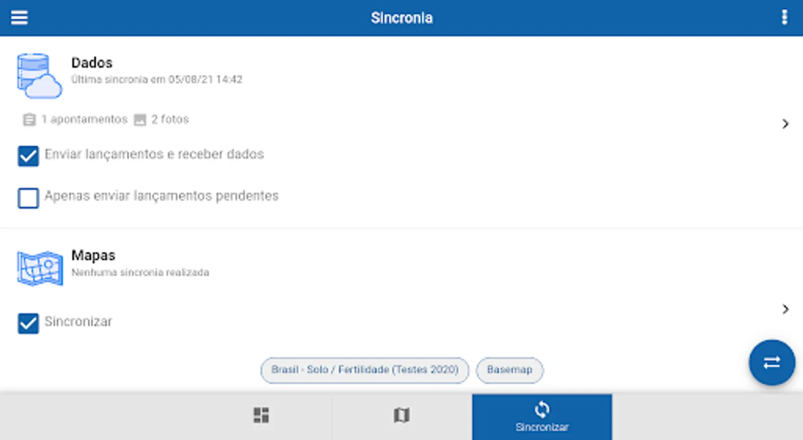
OFFLINE MODE AND SYNC
Use the app even without internet! The data is stored locally and can be synchronized with the web portal whenever the user desires.
Download Mapfy now and bring innovation to the field! Shall we do this?
For more information, visit:
https://gatec.com.br/mapfy-dados/
LAYER AND MAP VIEW
Import and upload SHP, KML, GeoJSON and RASTER files to the web portal and access them directly in the app, with personalized themes for better analysis.
GPS AND NAVIGATION
Track your location in real time and navigate between farms and fields with precision. Carry out records and occurrences based on your geographic information.
CUSTOM FORMS
Record field information through configurable forms on the web portal.
OFFLINE MODE AND SYNC
Use the app even without internet! The data is stored locally and can be synchronized with the web portal whenever the user desires.
Download Mapfy now and bring innovation to the field! Shall we do this?
For more information, visit:
https://gatec.com.br/mapfy-dados/
Mapfy Screenshots

Tap to Rate: