GPS Map Camera & Navigation
RACCOON TECH
4.2 ★
store rating
1,000,000+
downloads
Free
+ in-app
AppRecs review analysis
AppRecs rating 4.0. Trustworthiness 80 out of 100. Review manipulation risk 36 out of 100. Based on a review sample analyzed.
★★★☆☆
4.0
AppRecs Rating
Ratings breakdown
5 star
73%
4 star
8%
3 star
0%
2 star
0%
1 star
19%
What to know
✓
Credible reviews
80% trustworthiness score from analyzed reviews
✓
High user satisfaction
81% of sampled ratings are 4+ stars (4.2★ average)
✓
Authentic reviews
No red flags detected
About GPS Map Camera & Navigation
GPS Map Timestamp Camera, & GPS Navigation App
GPS Map Camera & Navigation app lets you capture geotagged photos with the GPS camera and timestamp camera, add map locations using the map camera, and follow routes with built-in GPS navigation tools. GPS Map Camera is designed for anyone who needs to add locations on photos, add timestamps, explore areas, or find directions.
Capture Photos with Location and Timestamp
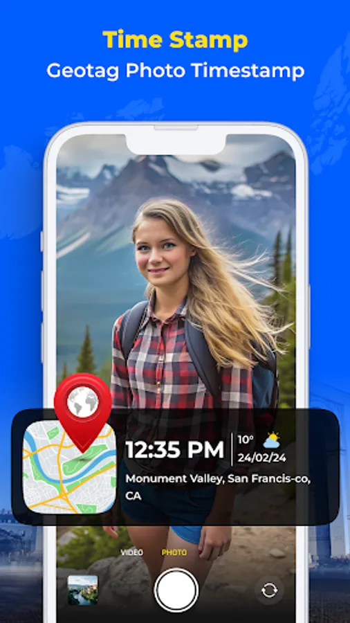
GPS Camera & Timestamp Camera: Take photos with GPS details like latitude, longitude, altitude, direction, and a visible timestamp. Perfect for travel, work, or daily use.
Map Camera: Add map locations on your photos to record where and when each moment happened.
Geotagged Photos and Selfies: Save memories with GPS tags and timestamps using the GPS map camera and timestamp camera.
Location Stamps: Add your current location and timestamp directly to images using the GPS map camera.
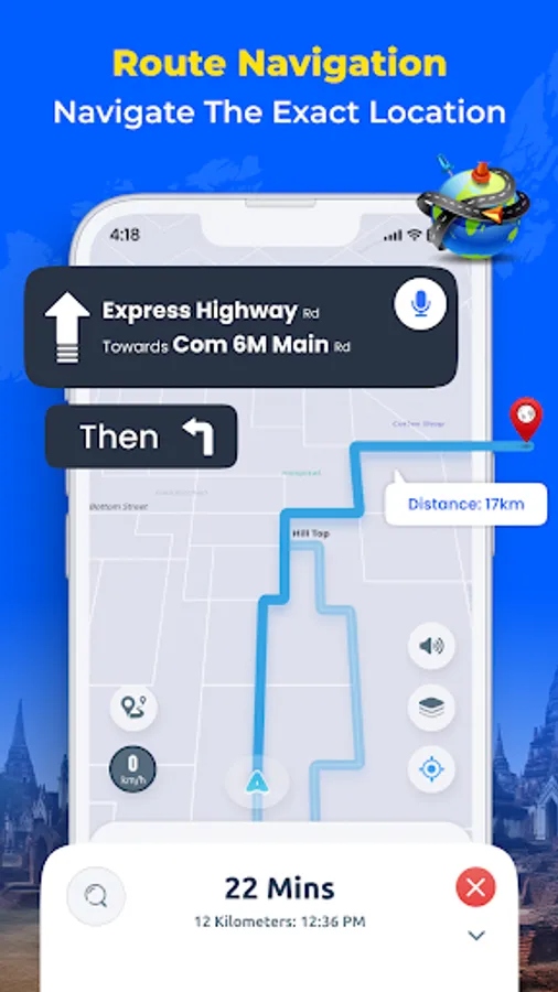
Use GPS Map & Navigation for Directions
GPS Navigation: Get step-by-step directions with live traffic updates.
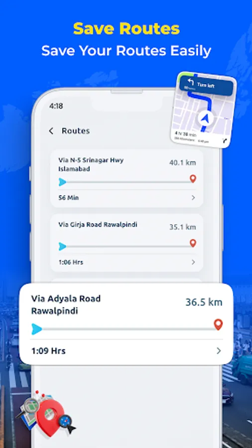
Route Planning: Find short with traffic updates for your trip.
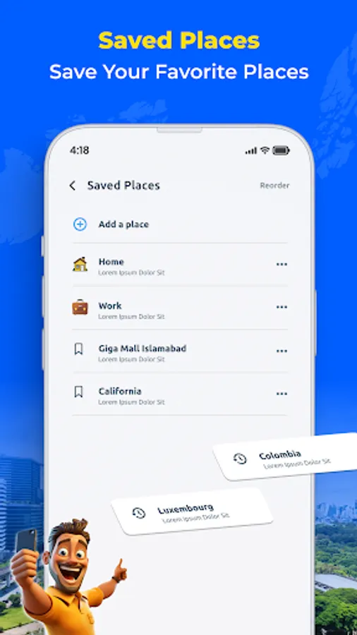
My Location: Share your current GPS location with contacts when needed.
Save Parking Location: Save your car’s location and use GPS map navigation to return later.
Extra Tools in the GPS Camera App
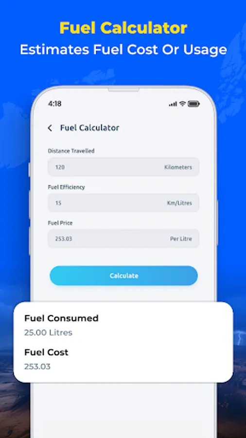
Fuel Calculator: Check fuel costs based on route distance and fuel price.
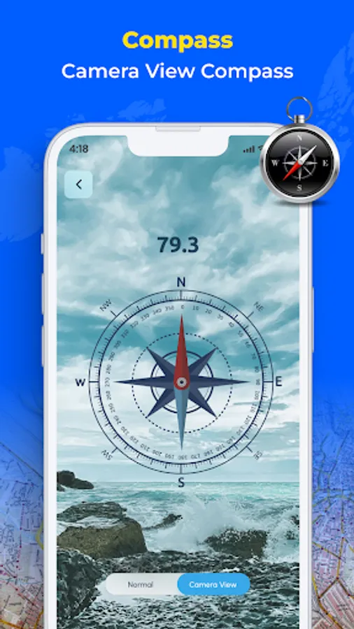
GPS Compass: Use a digital compass to check directions on the go.
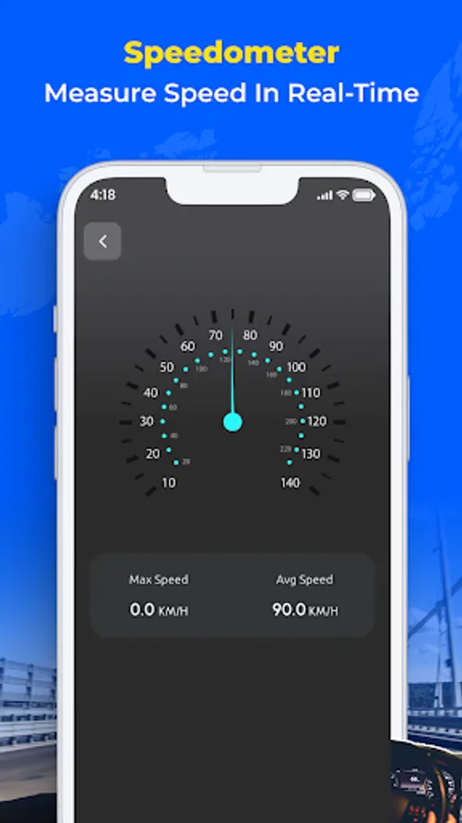
Speedometer: See your current speed while traveling.
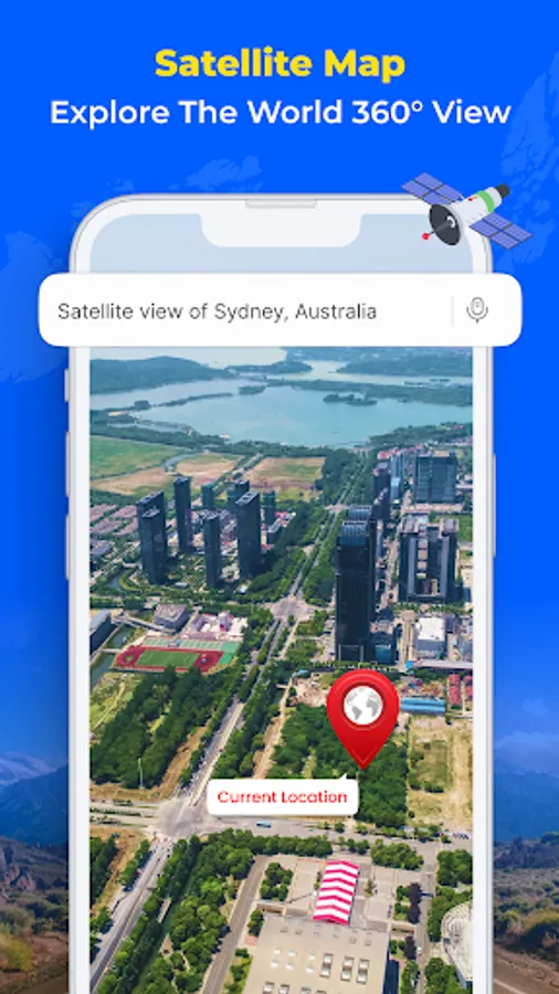
Nearby Places: Find restaurants, hospitals, hotels, ATMs, and more.
Location Finder: Locate stations, services, and other important places using the GPS map camera.
Who Can Use This App
Travelers and Bloggers: Use the map camera and timestamp camera to take geotagged and timestamped photos.
Real Estate Agents: Add location info and timestamps to property photos using the GPS camera.
Event Planners: Save photo records with the map camera and timestamp camera.
Hikers and Explorers: Navigate trails and capture images with location and timestamp data.
Daily Drivers: Plan routes, track speed, save parking spots, and document trips with timestamps using GPS map navigation.
Download GPS Map Camera & Navigation App Now
The app works as a GPS map timestamp camera and GPS navigation tool to help you capture photos with locations, times, and travel routes.
GPS Map Camera & Navigation app lets you capture geotagged photos with the GPS camera and timestamp camera, add map locations using the map camera, and follow routes with built-in GPS navigation tools. GPS Map Camera is designed for anyone who needs to add locations on photos, add timestamps, explore areas, or find directions.
Capture Photos with Location and Timestamp
GPS Camera & Timestamp Camera: Take photos with GPS details like latitude, longitude, altitude, direction, and a visible timestamp. Perfect for travel, work, or daily use.
Map Camera: Add map locations on your photos to record where and when each moment happened.
Geotagged Photos and Selfies: Save memories with GPS tags and timestamps using the GPS map camera and timestamp camera.
Location Stamps: Add your current location and timestamp directly to images using the GPS map camera.
Use GPS Map & Navigation for Directions
GPS Navigation: Get step-by-step directions with live traffic updates.
Route Planning: Find short with traffic updates for your trip.
My Location: Share your current GPS location with contacts when needed.
Save Parking Location: Save your car’s location and use GPS map navigation to return later.
Extra Tools in the GPS Camera App
Fuel Calculator: Check fuel costs based on route distance and fuel price.
GPS Compass: Use a digital compass to check directions on the go.
Speedometer: See your current speed while traveling.
Nearby Places: Find restaurants, hospitals, hotels, ATMs, and more.
Location Finder: Locate stations, services, and other important places using the GPS map camera.
Who Can Use This App
Travelers and Bloggers: Use the map camera and timestamp camera to take geotagged and timestamped photos.
Real Estate Agents: Add location info and timestamps to property photos using the GPS camera.
Event Planners: Save photo records with the map camera and timestamp camera.
Hikers and Explorers: Navigate trails and capture images with location and timestamp data.
Daily Drivers: Plan routes, track speed, save parking spots, and document trips with timestamps using GPS map navigation.
Download GPS Map Camera & Navigation App Now
The app works as a GPS map timestamp camera and GPS navigation tool to help you capture photos with locations, times, and travel routes.