Green Island's rich marine ecology, natural coastal landscape and the island's indigenous customs will attract tourists to visit: snorkeling, diving to explore the underwater ecology, sea view starry sky, tribal culture, tasting local delicious food, island travel! . Based on the rich and complete information of Taitung Sightseeing and Travel Network, this software aims to be easy to use and provide a free download for practical action guides in island travel.
Function brief
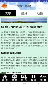
--Text explanation and operation
--Browsing function of photo album
--Add text description to photo
--Voice commentary
--Attraction list and real-world guidance function (Location VR)
--Spot name and distance sorting
--Users can mark key items
--Integrate Google Map to display location and navigation
--The map can be switched between standard and satellite mode
--720 live viewing, can be used with Cardboard VR navigation device (partial content)
--Practical digital audio guide function
--Relevant blogs, websites and video links that can be categorized and organized
--Overall setting of interface font size
--Font size adjustment when text browsing (corresponding to the overall font setting)
- According to the user's mobile phone language setting, the appropriate interface language is given
--Add function keys for frequently used destination URLs
Permission description
--Background location permission: This application will access the current location, only to prompt nearby locations for navigation, display the relative location of the current location and attractions on the map, provide navigation, and support real-world azimuth and distance guidance, This is done even if the app is closed or not in use. The results of this location access will not be transmitted and used for other functions.
--Photo permission: This app will download photos and data for offline use, reduce cloud traffic, and make navigation smoother by reading data from mobile phones.
--Camera permission: This app provides AR positioning function to guide various attractions through the lens.
Function brief
--Text explanation and operation
--Browsing function of photo album
--Add text description to photo
--Voice commentary
--Attraction list and real-world guidance function (Location VR)
--Spot name and distance sorting
--Users can mark key items
--Integrate Google Map to display location and navigation
--The map can be switched between standard and satellite mode
--720 live viewing, can be used with Cardboard VR navigation device (partial content)
--Practical digital audio guide function
--Relevant blogs, websites and video links that can be categorized and organized
--Overall setting of interface font size
--Font size adjustment when text browsing (corresponding to the overall font setting)
- According to the user's mobile phone language setting, the appropriate interface language is given
--Add function keys for frequently used destination URLs
Permission description
--Background location permission: This application will access the current location, only to prompt nearby locations for navigation, display the relative location of the current location and attractions on the map, provide navigation, and support real-world azimuth and distance guidance, This is done even if the app is closed or not in use. The results of this location access will not be transmitted and used for other functions.
--Photo permission: This app will download photos and data for offline use, reduce cloud traffic, and make navigation smoother by reading data from mobile phones.
--Camera permission: This app provides AR positioning function to guide various attractions through the lens.
Show More