
SnoTel Mapper - Snow Data
Jason Flaherty
4.1 ★
104 ratings
10,000+
downloads
Free
+ in-app
In this snow data app, users can view real-time snow conditions, avalanche forecasts, and weather data through interactive maps and charts. Includes offline access, historical data comparisons, and customizable station favorites.
AppRecs review analysis
AppRecs rating 4.1. Trustworthiness 67 out of 100. Review manipulation risk 31 out of 100. Based on a review sample analyzed.
★★★★☆
4.1
AppRecs Rating
Ratings breakdown
5 star
55%
4 star
17%
3 star
18%
2 star
6%
1 star
4%
What to know
✓
High user satisfaction
72% of sampled ratings are 4+ stars (4.1★ average)
✓
Authentic reviews
Natural distribution, no red flags
About SnoTel Mapper - Snow Data
SnoTel Mapper puts real-time snow data from 900+ SNOTEL weather stations in your pocket. Track snow conditions, avalanche forecasts, and weather data for safer backcountry adventures. Perfect for backcountry skiers, snowboarders, snowshoers, winter hikers, and anyone who needs accurate snowpack information for winter recreation.
Free Features:
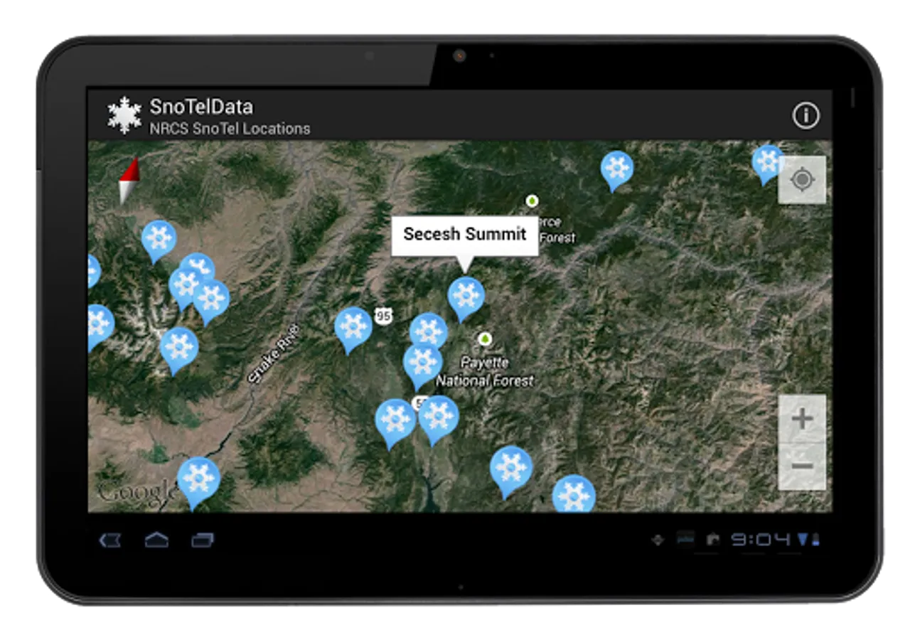
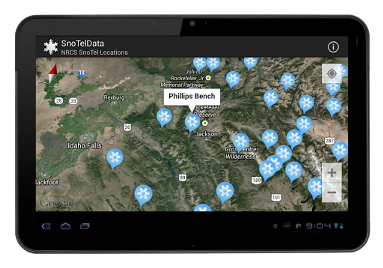
• Interactive maps with all SNOTEL stations across the United States
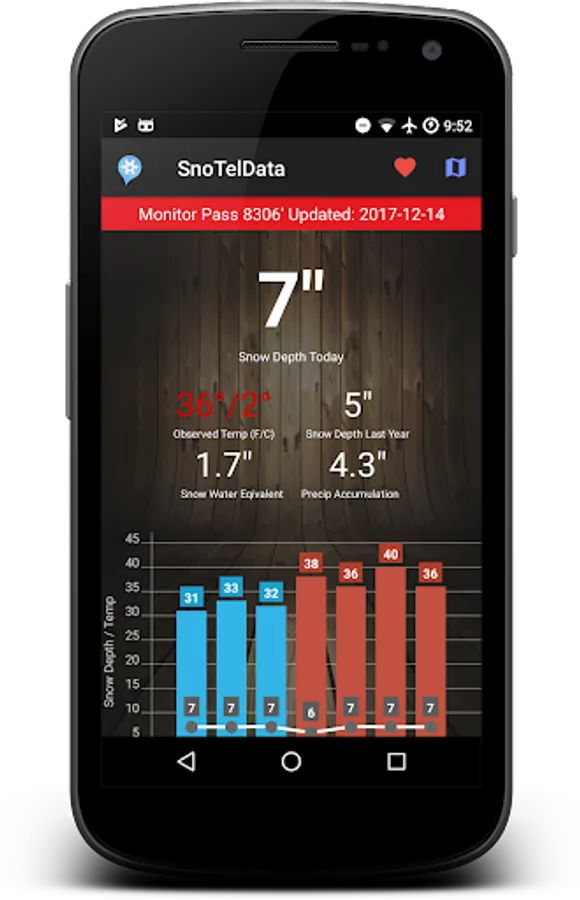
• Current and historical snow depth data with 20-year averages
• Temperature and precipitation tracking
• Avalanche forecast overlays with current danger ratings
• Unlimited favorite stations with smart offline caching
• Beautiful charts and graphs showing snow depth trends
• Light and dark themes for any viewing preference
• Offline access for backcountry use without cell service
• Historical data comparisons to last year and averages
Pro Features:
• Hourly data updates (vs. daily summaries) for precise tracking
• 3-day NOAA point forecasts for each station location
• Snowfall prediction gauges showing expected accumulation
• Top 3 site SNOTEL alerts for your most-used stations
• Multi-model weather predictions with precipitation and temperature
• Nearby webcam feeds to verify actual ground conditions
• Pin primary station to open automatically on launch
BEAUTIFUL & INTUITIVE
Modern design with smooth animations, customizable views, and dark mode support. Reorder your favorite stations, export favorites for backup, and pin your primary station for quick access. Smart clustering on maps makes it easy to navigate hundreds of stations.
PERFECT FOR
• Backcountry skiers and snowboarders planning safer trips with current conditions
• Winter campers monitoring weather patterns and snow accumulation
• Weather enthusiasts tracking snowpack development throughout the season
• Mountain guides and avalanche professionals accessing official NRCS data
KEY BENEFITS
• Complete Coverage: Access over 900 SNOTEL stations plus SNOW and SCAN monitoring sites
• Official Data: Direct access to USDA NRCS sources—the same data used by avalanche forecasters
• Lightning Fast: Smart caching ensures instant load times and reliable access in poor connectivity
• Privacy First: Zero personal data collection. Location used only for map centering, never stored
• Continuously Improving: Regular updates bring new features and performance improvements
• Community Input!
TRUSTED DATA SOURCES
Official data from USDA Natural Resources Conservation Service (NRCS) SNOTEL network, NOAA National Weather Service, and regional avalanche information centers via Avalanche.org. The same authoritative data sources used by avalanche forecasters, backcountry professionals, and water resource managers.
USE CASES
• Plan backcountry ski tours with current snow depth and avalanche danger ratings
• Check conditions before snowshoeing or winter hiking trips
• Monitor snowpack development for water resource tracking
• Compare current season to historical averages and last year's conditions
• Track temperature trends and precipitation patterns
Whether you're planning a backcountry mission, tracking water resources, monitoring winter weather patterns, or just love snow data, SnoTel Mapper is your essential companion for mountain conditions.
SAFETY NOTICE
This application displays data from USDA NRCS and other sources for informational purposes only. Data availability and accuracy may vary. Always consult official sources, check current avalanche forecasts from regional avalanche centers, and use proper judgment when making decisions about backcountry travel and winter recreation. The developers assume no responsibility for decisions made based on information provided by this application.
Pro features available via subscription. Terms apply.
Free Features:
• Interactive maps with all SNOTEL stations across the United States
• Current and historical snow depth data with 20-year averages
• Temperature and precipitation tracking
• Avalanche forecast overlays with current danger ratings
• Unlimited favorite stations with smart offline caching
• Beautiful charts and graphs showing snow depth trends
• Light and dark themes for any viewing preference
• Offline access for backcountry use without cell service
• Historical data comparisons to last year and averages
Pro Features:
• Hourly data updates (vs. daily summaries) for precise tracking
• 3-day NOAA point forecasts for each station location
• Snowfall prediction gauges showing expected accumulation
• Top 3 site SNOTEL alerts for your most-used stations
• Multi-model weather predictions with precipitation and temperature
• Nearby webcam feeds to verify actual ground conditions
• Pin primary station to open automatically on launch
BEAUTIFUL & INTUITIVE
Modern design with smooth animations, customizable views, and dark mode support. Reorder your favorite stations, export favorites for backup, and pin your primary station for quick access. Smart clustering on maps makes it easy to navigate hundreds of stations.
PERFECT FOR
• Backcountry skiers and snowboarders planning safer trips with current conditions
• Winter campers monitoring weather patterns and snow accumulation
• Weather enthusiasts tracking snowpack development throughout the season
• Mountain guides and avalanche professionals accessing official NRCS data
KEY BENEFITS
• Complete Coverage: Access over 900 SNOTEL stations plus SNOW and SCAN monitoring sites
• Official Data: Direct access to USDA NRCS sources—the same data used by avalanche forecasters
• Lightning Fast: Smart caching ensures instant load times and reliable access in poor connectivity
• Privacy First: Zero personal data collection. Location used only for map centering, never stored
• Continuously Improving: Regular updates bring new features and performance improvements
• Community Input!
TRUSTED DATA SOURCES
Official data from USDA Natural Resources Conservation Service (NRCS) SNOTEL network, NOAA National Weather Service, and regional avalanche information centers via Avalanche.org. The same authoritative data sources used by avalanche forecasters, backcountry professionals, and water resource managers.
USE CASES
• Plan backcountry ski tours with current snow depth and avalanche danger ratings
• Check conditions before snowshoeing or winter hiking trips
• Monitor snowpack development for water resource tracking
• Compare current season to historical averages and last year's conditions
• Track temperature trends and precipitation patterns
Whether you're planning a backcountry mission, tracking water resources, monitoring winter weather patterns, or just love snow data, SnoTel Mapper is your essential companion for mountain conditions.
SAFETY NOTICE
This application displays data from USDA NRCS and other sources for informational purposes only. Data availability and accuracy may vary. Always consult official sources, check current avalanche forecasts from regional avalanche centers, and use proper judgment when making decisions about backcountry travel and winter recreation. The developers assume no responsibility for decisions made based on information provided by this application.
Pro features available via subscription. Terms apply.
SnoTel Mapper - Snow Data Screenshots


Tap to Rate:
Reviews for SnoTel Mapper - Snow Data
Joey Hawkins
12/13/2025
doesn't cover all resorts and trails but puts suggestions for all far away from civilization
Tyrel Cropper
11/21/2025
loved the app but it has quit opening please fix it