In this app, you can connect to the AltimeterThree device via Bluetooth to record altitude and acceleration data during flights. Includes flight graph visualization, data sharing options, and optional GPS-based location tracking.
AppRecs review analysis
AppRecs rating 3.6. Trustworthiness 53 out of 100. Review manipulation risk 34 out of 100. Based on a review sample analyzed.
★★★☆☆
3.6
AppRecs Rating
Ratings breakdown
5 star
60%
4 star
11%
3 star
11%
2 star
3%
1 star
14%
What to know
✓
Good user ratings
71% positive sampled reviews
About AltimeterThree
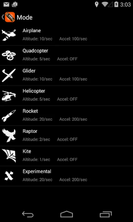
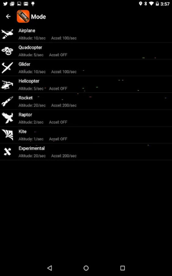
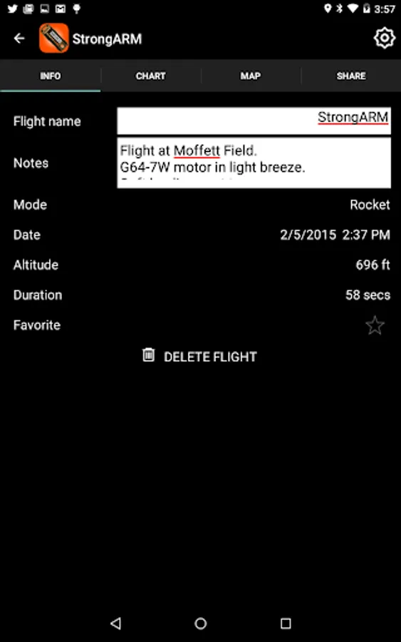
This is the companion app for Jolly Logic's AltimeterThree, a tiny recording altimeter for hobby model flyers. AltimeterThree can record the altitude and acceleration of quadcopters, planes, rockets, kites, hunting falcons, gliders, and helicopters. Essentially anything that flies.
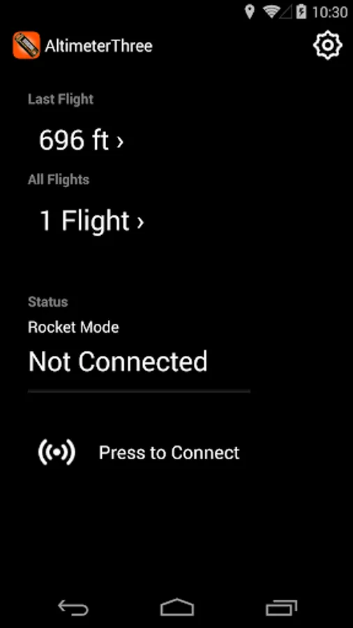
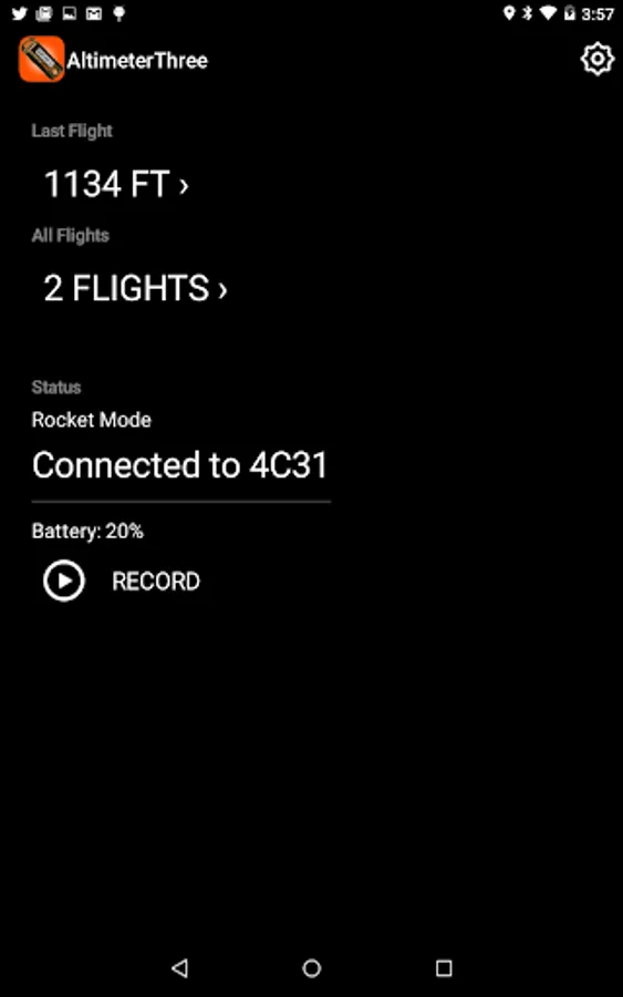
This app connects via Bluetooth to AltimeterThree to control it from up to 100 feet away. Press Record in the app, and the altimeter uses its highly-accurate sensors to begin recording the flight, even when it flies out of Bluetooth range.
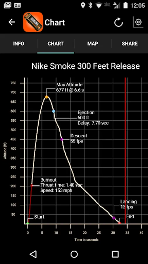
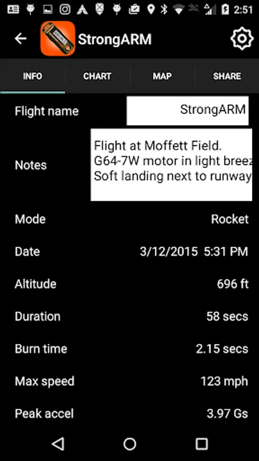
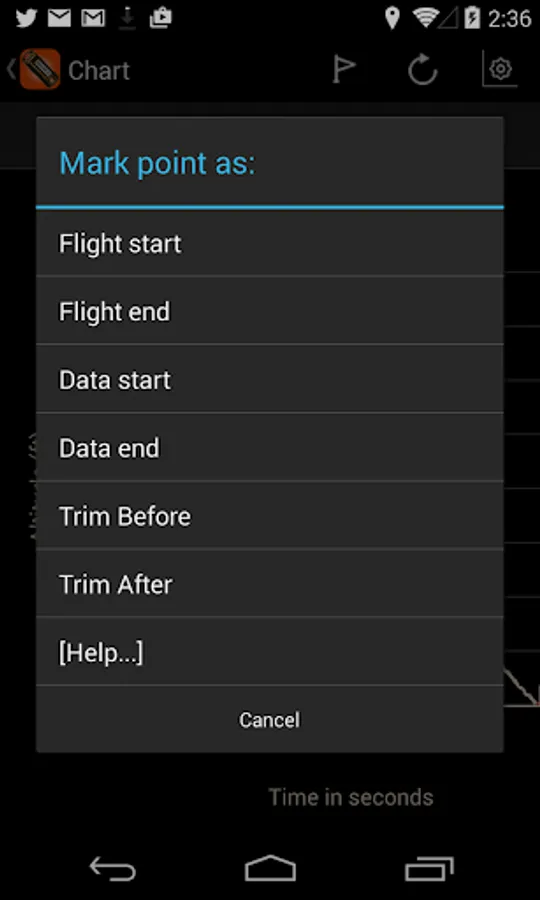
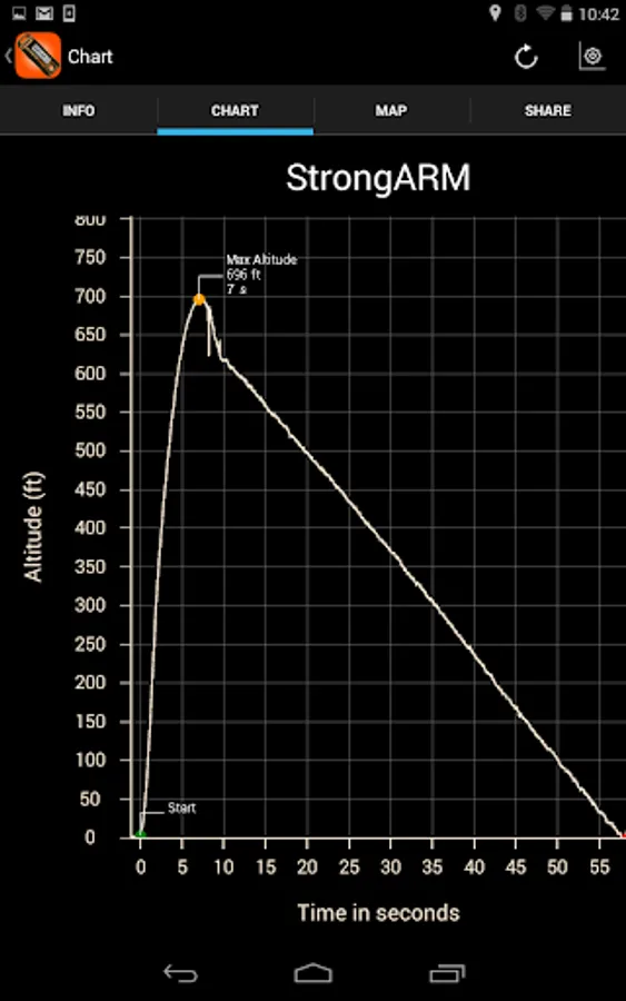
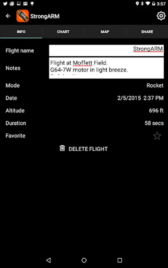
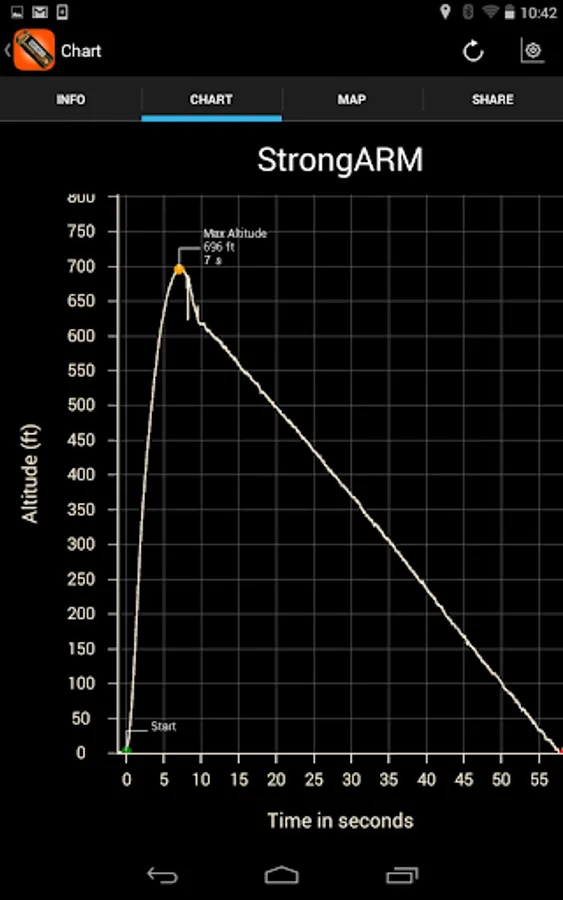
After flight, the app downloads and displays an interactive graph of altitude, allowing you to pinch and zoom to examine every detail of the flight. Version 3.2 adds a new Climb/Sink Rate chart, as well as full flight analysis for rocket flights (engine burn time, top speed, ejection delay, descent and landing rates).
Want to dig a little deeper into the science and math of your flight? The app can share your flight data in a standard spreadsheet file that is perfect for analysis on your computer back in your lab or classroom.
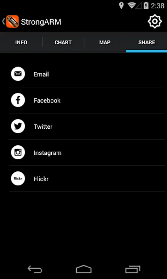
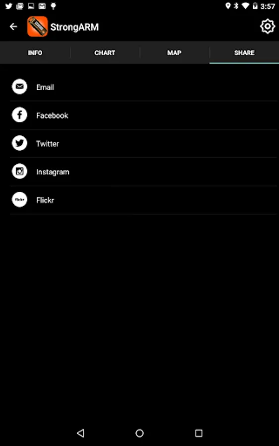
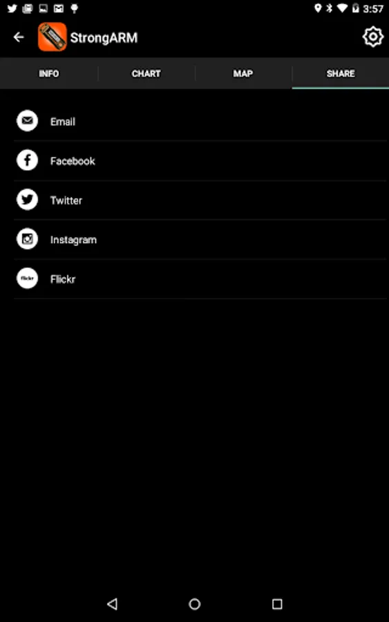
Great flights deserve sharing. This app lets you post your flight graphs and flight statistics with friends, colleagues and classmates via Facebook, Twitter, Instagram, Flickr, and email---all from your phone or tablet right after a flight.
This app is free and fully functional, but recording of flights requires the Jolly Logic AltimeterThree altimeter from Jolly Logic or one of its worldwide resellers.
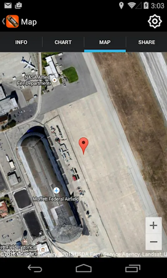
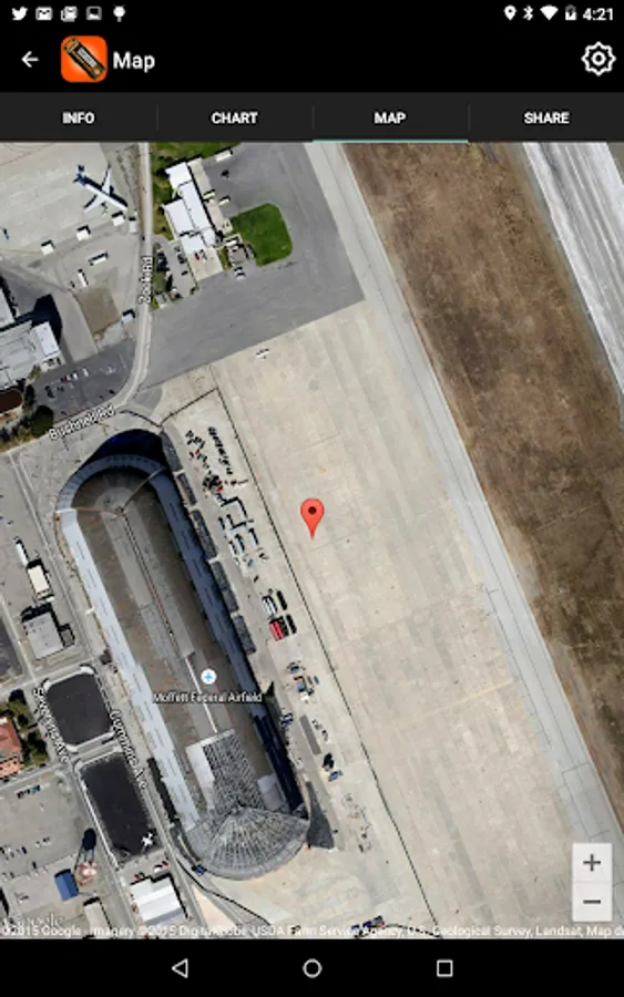
If GPS is enabled on your phone, AltimeterThree will save the location of each flight, and allow you to view it on Google Maps.
This app connects via Bluetooth to AltimeterThree to control it from up to 100 feet away. Press Record in the app, and the altimeter uses its highly-accurate sensors to begin recording the flight, even when it flies out of Bluetooth range.
After flight, the app downloads and displays an interactive graph of altitude, allowing you to pinch and zoom to examine every detail of the flight. Version 3.2 adds a new Climb/Sink Rate chart, as well as full flight analysis for rocket flights (engine burn time, top speed, ejection delay, descent and landing rates).
Want to dig a little deeper into the science and math of your flight? The app can share your flight data in a standard spreadsheet file that is perfect for analysis on your computer back in your lab or classroom.
Great flights deserve sharing. This app lets you post your flight graphs and flight statistics with friends, colleagues and classmates via Facebook, Twitter, Instagram, Flickr, and email---all from your phone or tablet right after a flight.
This app is free and fully functional, but recording of flights requires the Jolly Logic AltimeterThree altimeter from Jolly Logic or one of its worldwide resellers.
If GPS is enabled on your phone, AltimeterThree will save the location of each flight, and allow you to view it on Google Maps.