About Picmapper - GPS Photo Map
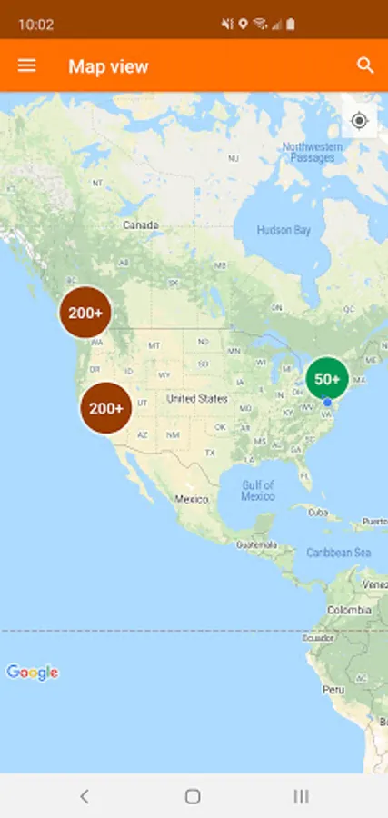
See the places you've gone with Picmapper! Every photo taken becomes a point on the map, so you can retrace the steps you took on that vacation, or zoom out and recall the places you've set foot in.
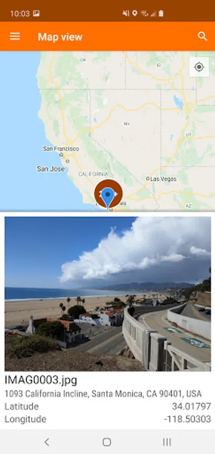
▸ Powered by Google Maps - choose your favorite type of map
▸ Addresses and coordinates for each photo
▸ Location grouping - tap on the circle to see all pictures taken in the area
▸ Search for cities and landmarks
~~~~~~~~~~~~~~~~~~~~
Technical note: Your photos must contain geographical metadata ("geotag" for short) to be plotted on the map. If some or all of your pictures are missing, make sure that you:
▸ Have GPS enabled
▸ Enable "location tags" or a similar option in your Camera app to tag future photos