Paddle Ways - Lets Go Paddling
onwater llc
4.0 ★
298 ratings
10,000+
downloads
Free
+ in-app
In this navigation and planning app, you can explore rivers, track routes, and access real-time weather data. Includes interactive maps, access points, weather updates, and user comments.
AppRecs review analysis
AppRecs rating 3.7. Trustworthiness 86 out of 100. Review manipulation risk 15 out of 100. Based on a review sample analyzed.
★★★☆☆
3.7
AppRecs Rating
Ratings breakdown
5 star
60%
4 star
14%
3 star
10%
2 star
5%
1 star
12%
What to know
✓
Low review manipulation risk
15% review manipulation risk
✓
Credible reviews
86% trustworthiness score from analyzed reviews
⚠
Pricing complaints
Many low ratings mention paywalls or pricing
About Paddle Ways - Lets Go Paddling
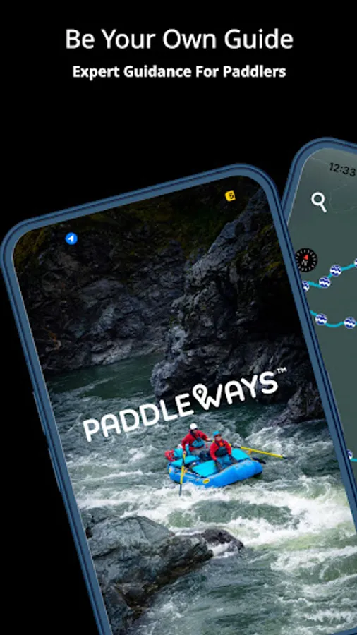
NOW with nationwide coverage of rivers and access points.
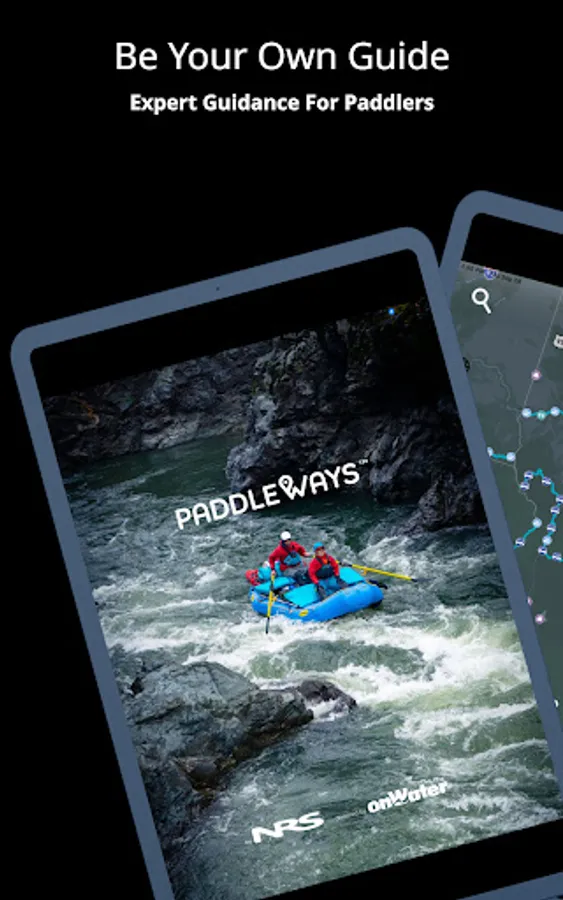
PaddleWays is your indispensable digital guidebook and GPS navigation tool for whitewater adventures. Whether you're kayaking, rafting, canoeing, or stand-up paddling, PaddleWays has you covered. Developed in collaboration with American White Water, this app delivers crucial information to ensure safe and informed decisions before you hit the water.
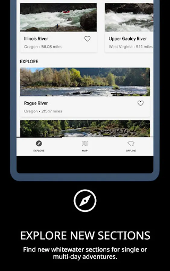
Discover Exciting Paddling Locations
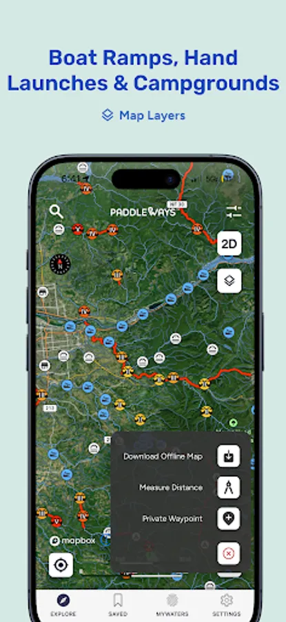
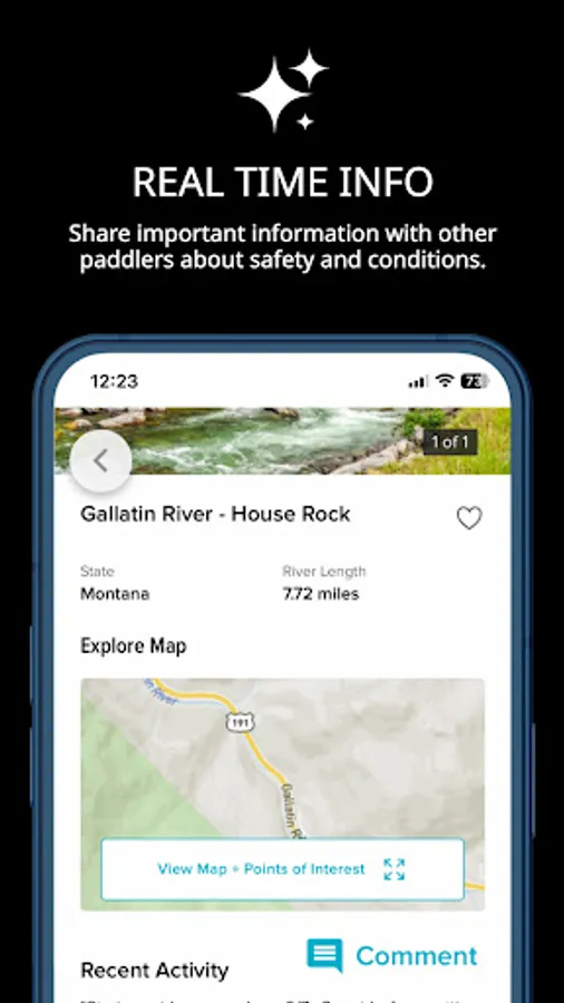
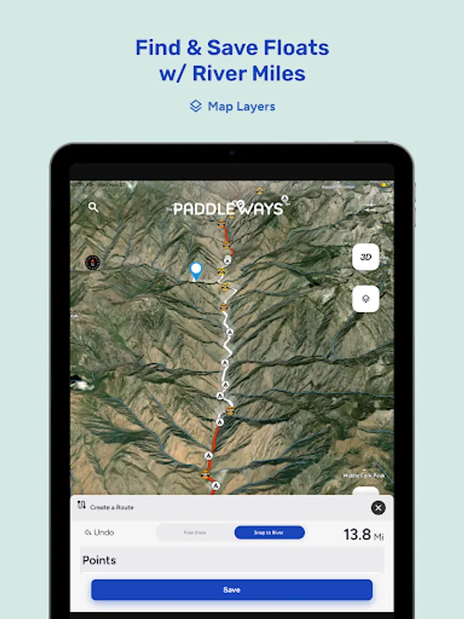
Explore new rivers and sections, near and far, through interactive maps. Dive into guidebook descriptions, match your skill level with provided difficulty ratings, and connect with related resources for comprehensive insights.
Effortless Planning
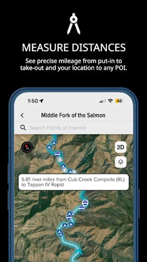
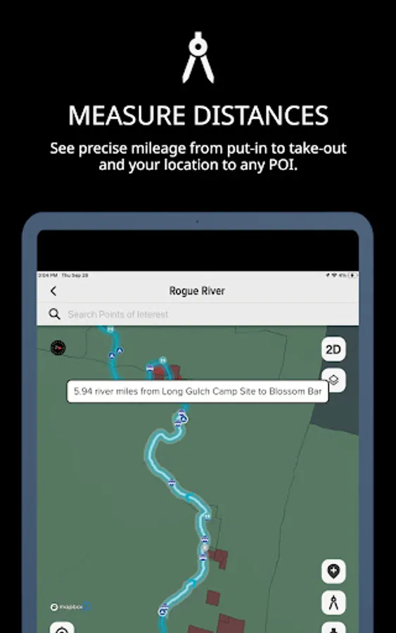
Plan your perfect outing with confidence using PaddleWays. Measure river miles, access thousands of points of interest like access points, boat ramps, campsites, and more. Bookmark your favorite rivers, check real-time weather, and river flow rates (CFS) by location to find the ideal time for your adventure.
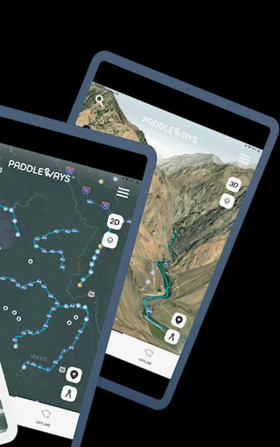
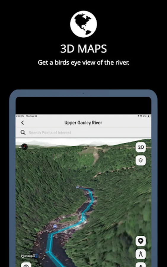
Seamless Navigation
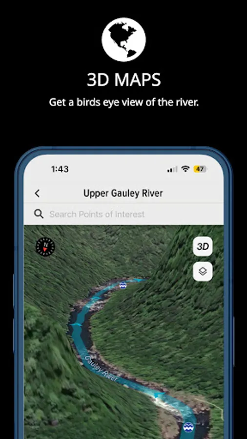
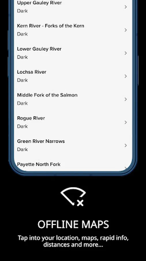
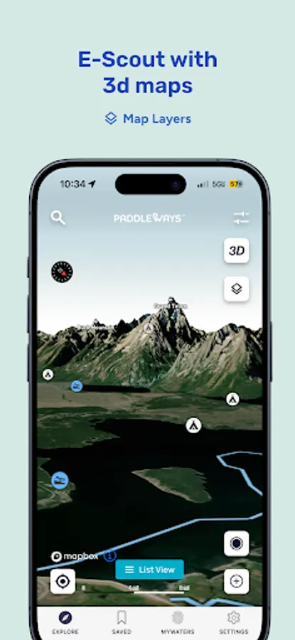
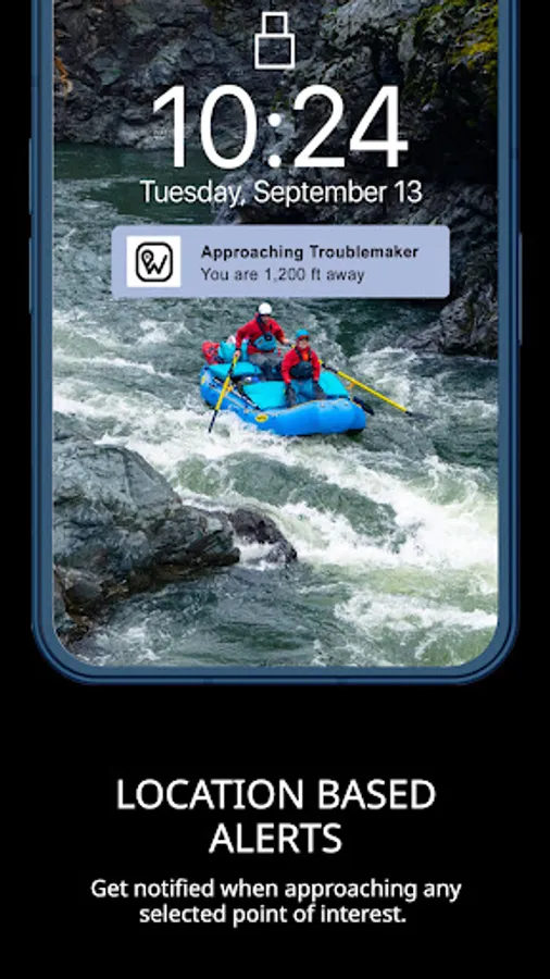
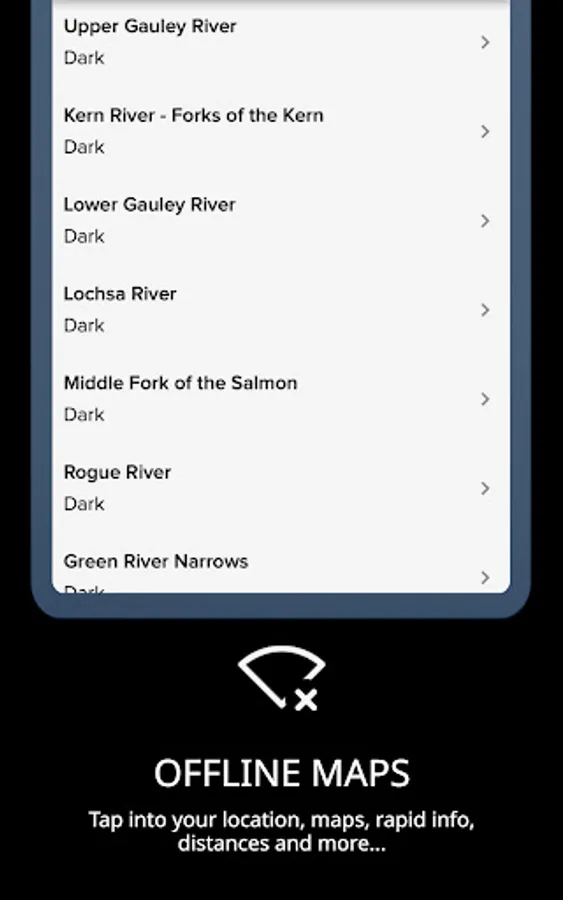
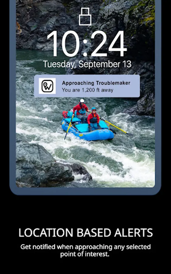
Navigate with ease using detailed interactive 2D and 3D maps, available online and offline. Choose from Satellite, Outdoor, and Street map modes, measure distances in river miles, and set location-based alerts for upcoming take-outs, camps, or rapids.
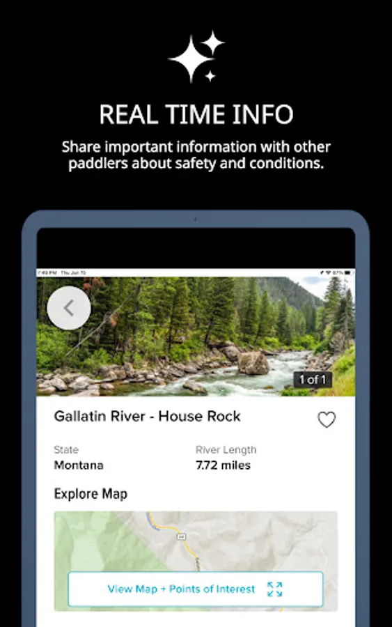
Connect with the Paddling Community
Stay in the loop with user comments on recent conditions, and reference notes, photos, and saved places from previous trips. PaddleWays is not just an app; it's an interactive atlas and community forum designed for paddlers, by paddlers.
Who is PaddleWays?
PaddleWays is powered by NRS, dedicated to making human-powered recreation more accessible, safe, sustainable, and enjoyable. With technology developed by onWater, PaddleWays donates 1% of sales to promote responsible use and resource conservation.
PaddleWays Plus
Unlock premium features with a PaddleWays Plus subscription, including offline maps, river guidebooks, real-time flow data, and public & private land data.
Discover the ultimate tool for your whitewater, kayaking, and rafting adventures. Download PaddleWays today and explore the waters like never before.
USGS, go, levels, flow, white water, whitewater, weather, kayaking, rafting, raft, boat, canoe
Paddle Ways - Lets Go Paddling Screenshots


Tap to Rate:
Reviews for Paddle Ways - Lets Go Paddling
Marcus Alden
12/4/2025
- Can't download app onto computer at home. - On phone, a "Rate this app" pop-up blocks screen and won't go away - Have to zoom in to see campsites but then loose all perspective of where you are on the river. - No rapid names or locations - No mile markers from starting point - When attempting to put app logo on homepage, won't allow Honestly, you're better off just using google maps at this point. Feel like I got ripped off for the "premium" version
Zhang Junyan
11/26/2025
The upgrade feature (pay) is not working. I tried android and iOS. Click upgrade button doesn't pop up anything. I want to pay for it, but you don't want me to do so.