Use this aviation app to access detailed information on over 5,500 US public airports and related weather data. Includes offline airport details, weather updates, NOTAMS, D-ATIS, and free aviation resource library.
AppRecs review analysis
AppRecs rating 4.5. Trustworthiness 53 out of 100. Review manipulation risk 32 out of 100. Based on a review sample analyzed.
★★★★☆
4.5
AppRecs Rating
Ratings breakdown
5 star
90%
4 star
2%
3 star
3%
2 star
5%
1 star
0%
What to know
✓
High user satisfaction
90% of sampled ratings are 5 stars
✓
Authentic reviews
No red flags detected
About FlightIntel
US AIRPORTS ONLY.
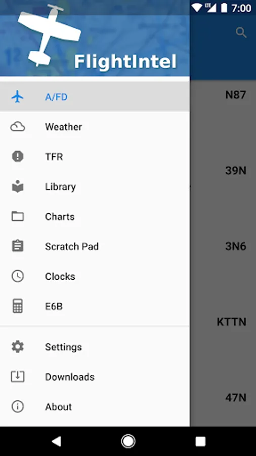
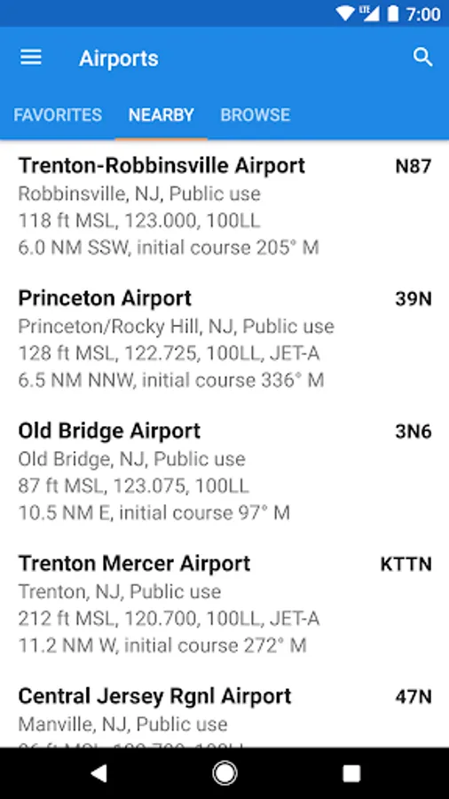
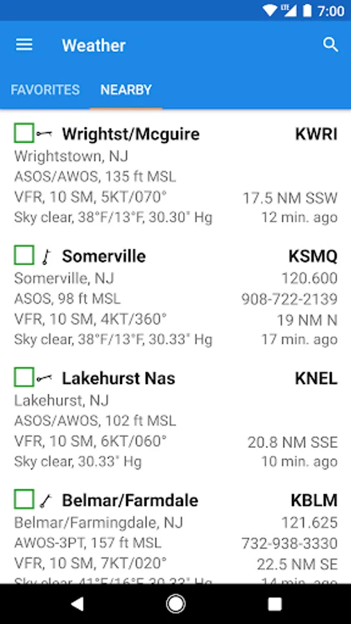
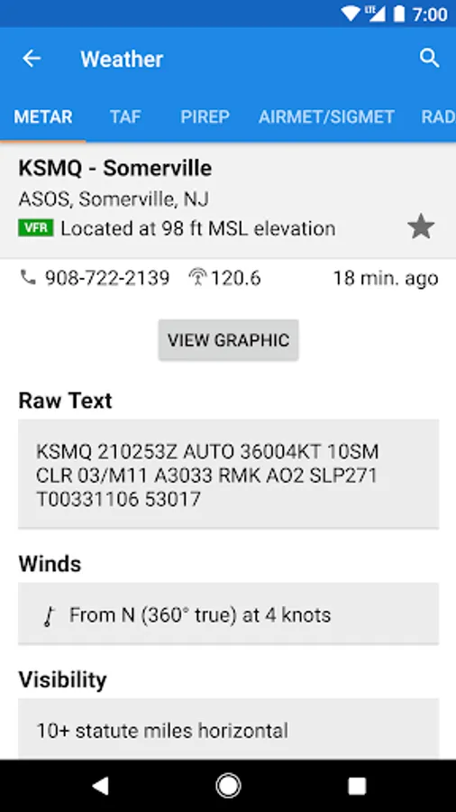
FlightIntel is designed to be a resource to a pilot during all phases of a flight. It provides detailed information about 5500+ US public airports. AF/D data is downloaded to your phone and is available for offline use.
FlightIntel is not affiliated with FAA, National Weather Service or any other government agency.
Data sources:
===========
FAA NASR:
https://www.faa.gov/air_traffic/flight_info/aeronav/aero_data/NASR_Subscription/
FAA AeroNav:
https://www.faa.gov/air_traffic/flight_info/aeronav/digital_products/
Aviation Weather Center:
https://aviationweather.gov/data/api/
FAA SWIM:
https://portal.swim.faa.gov/home
Features:
=========
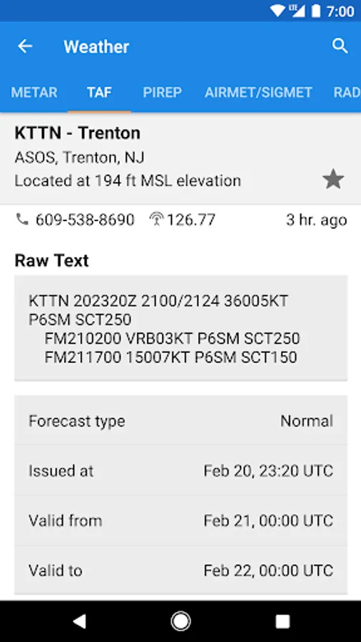
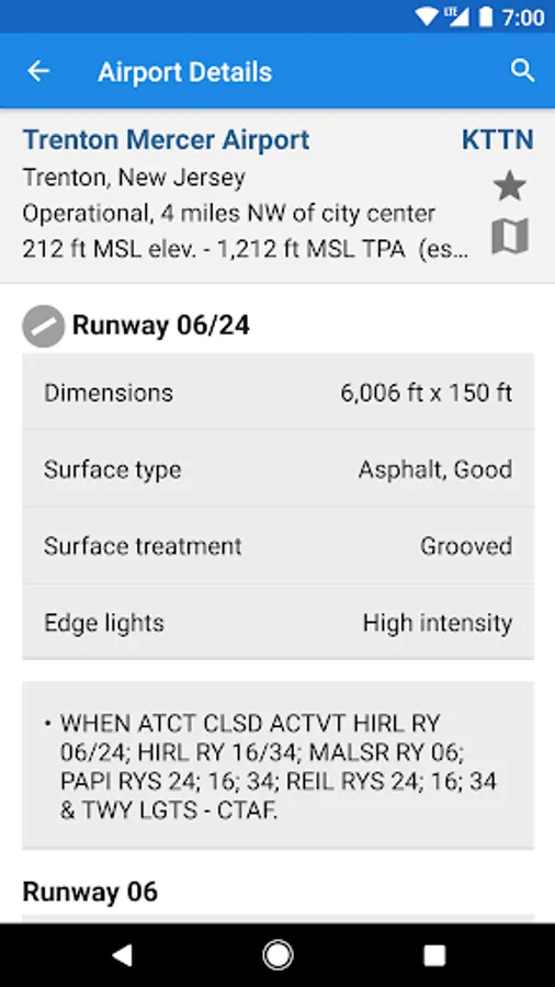
* Full info on 5,500+ US public use airports
* Detailed Wx for all your flight planning
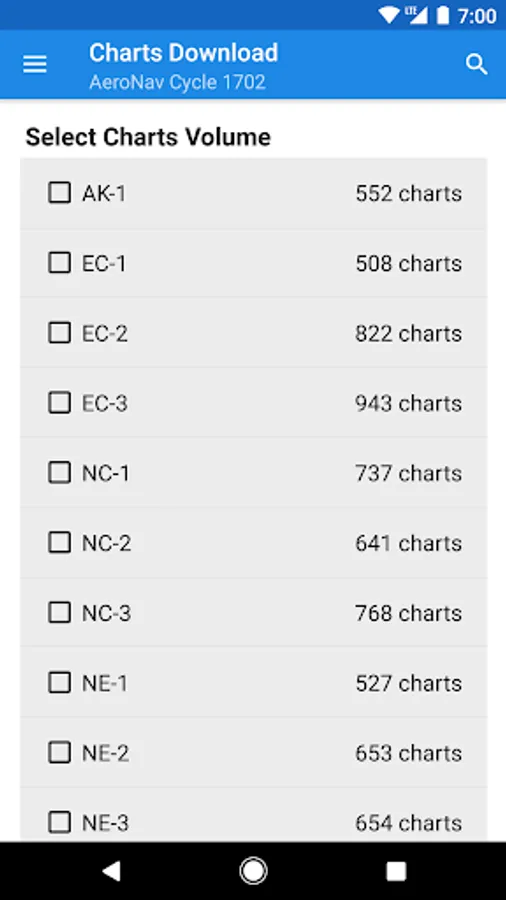
* Free access to d-TPP including airport diagrams, and d-CS
* Free data updates every 28 days
* TFRs, Notams and D-ATIS
* E6B
* Scratchpad
* Extensive library of aviation related books & periodicals PDFs
* No ads and no personal data collection
PERMISSIONS
===========
* Location - To determine current location to show nearby airports/wx stations. Location information stays on the device.
* Full Internet Access - To download data files, weather, NOTAMS, AeroNav PDFs etc.
* Modify/Delete SD Card Contents - To store data files, cache weather data and PDFs.
* View Network State - To check if connected to internet and to determine if connected to WIFI for downloads.
Beta Testing
==========
You can opt-in to test the beta versions when available here:
https://play.google.com/apps/testing/com.nadmm.airports
User Groups: https://groups.google.com/forum/?hl=en&fromgroups#!forum/flightintel-users
Issue Tracker: https://github.com/nhasan/FlightIntel/issues
Source: https://github.com/nhasan/FlightIntel
FlightIntel is designed to be a resource to a pilot during all phases of a flight. It provides detailed information about 5500+ US public airports. AF/D data is downloaded to your phone and is available for offline use.
FlightIntel is not affiliated with FAA, National Weather Service or any other government agency.
Data sources:
===========
FAA NASR:
https://www.faa.gov/air_traffic/flight_info/aeronav/aero_data/NASR_Subscription/
FAA AeroNav:
https://www.faa.gov/air_traffic/flight_info/aeronav/digital_products/
Aviation Weather Center:
https://aviationweather.gov/data/api/
FAA SWIM:
https://portal.swim.faa.gov/home
Features:
=========
* Full info on 5,500+ US public use airports
* Detailed Wx for all your flight planning
* Free access to d-TPP including airport diagrams, and d-CS
* Free data updates every 28 days
* TFRs, Notams and D-ATIS
* E6B
* Scratchpad
* Extensive library of aviation related books & periodicals PDFs
* No ads and no personal data collection
PERMISSIONS
===========
* Location - To determine current location to show nearby airports/wx stations. Location information stays on the device.
* Full Internet Access - To download data files, weather, NOTAMS, AeroNav PDFs etc.
* Modify/Delete SD Card Contents - To store data files, cache weather data and PDFs.
* View Network State - To check if connected to internet and to determine if connected to WIFI for downloads.
Beta Testing
==========
You can opt-in to test the beta versions when available here:
https://play.google.com/apps/testing/com.nadmm.airports
User Groups: https://groups.google.com/forum/?hl=en&fromgroups#!forum/flightintel-users
Issue Tracker: https://github.com/nhasan/FlightIntel/issues
Source: https://github.com/nhasan/FlightIntel
FlightIntel Screenshots

Tap to Rate:
Reviews for FlightIntel
Nima J
11/4/2025
since the recent update can't get the Notam. and the App crashes after two attempts. tried clearing the cache and reinstalling the app but the problem continues. please fix it.
Thomas Perry
7/26/2025
I Absolutely love this app!! I uae it all the time for flight planning as a private pilot. And even when I'm just curious about an airport. And he's still supporting it! I had an issue, emailed, he fixed it within an hour! Love it!