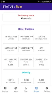
Land survey application aka controller for Pantai RTK receiver, High precision GNSS RTK. Planning for your survey site in office then go to the site a lot easy. After work, you are able to export reports for use in you favolite CAD.
Show More