TAS Fires
P4G Pty Ltd
500+
downloads
$0.99
AppRecs review analysis
AppRecs rating 2.1. Trustworthiness 71 out of 100. Review manipulation risk 25 out of 100. Based on a review sample analyzed.
★★☆☆☆
2.1
AppRecs Rating
Ratings breakdown
5 star
17%
4 star
11%
3 star
6%
2 star
17%
1 star
50%
What to know
✓
Low review manipulation risk
25% review manipulation risk
✓
Credible reviews
71% trustworthiness score from analyzed reviews
⚠
Mixed user feedback
Average 2.3★ rating suggests room for improvement
About TAS Fires
This is the original TAS Fires app and is designed to provide up to date information about bush fire data in Tasmania, Australia for Android phone and tablet users.
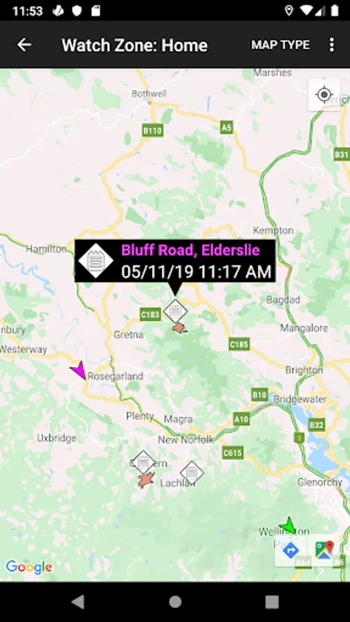
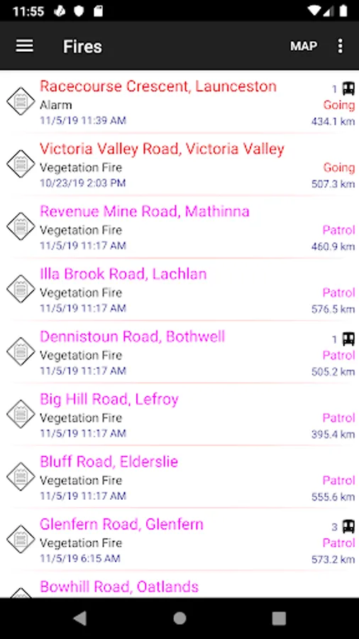
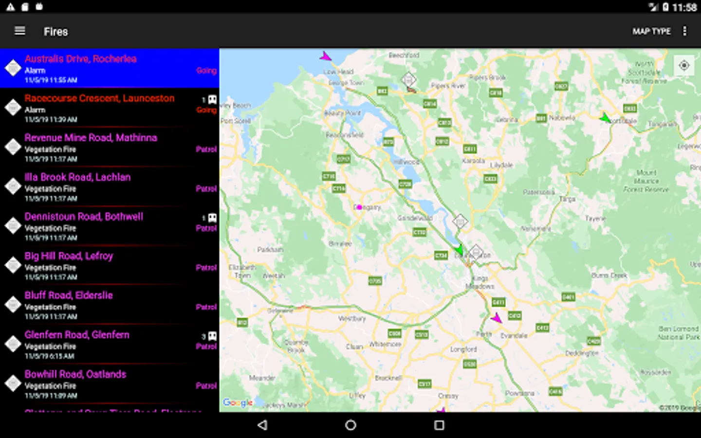
The information is provided to you in both a searchable/sortable list and on a map to help the user understand which fires are of importance to them. The information can also be shared via social media/email and text.
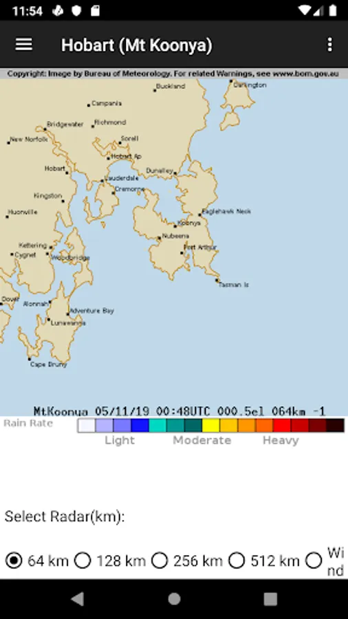
It utilises data from the Tasmanian Fire Service RSS feeds on fires (https://fire.tas.gov.au), wind data from the Bureau of Meteorology (http://www.bom.gov.au) with your current location provided by the iPhone GPS. This app does NOT represent any government organisation.
Using this information the application is able to provide a list of fires showing the nearest ones first, helping you to understand your current situation.
The information is reliant on both the accuracy of the iPhone GPS and the data recorded on the TFS's website.
This application does not cache any data, so Internet access (either Wireless. 3G or LTE) is required to access the data.
Be aware that while P4G has utilised "best efforts" to provide this information to you, it is not intended to replace other sources of information on the fire situation near you. Also remember that fire and weather can change quickly.
All data is provided Copyright from the Tasmanian Fire Service and the Bureau of Meteorology.
If you use watch zones then it is possible that the application will store your current location at that time. This information is not correlated with any other user data, and can be deleted at any time. Please check the privacy policy at https://www.p4g.biz/app-privacy-policy.
This application and P4G do NOT represent the Tasmanian Fire Service or any other government organisation.
Follow P4G on twitter at P4G_Apps
The information is provided to you in both a searchable/sortable list and on a map to help the user understand which fires are of importance to them. The information can also be shared via social media/email and text.
It utilises data from the Tasmanian Fire Service RSS feeds on fires (https://fire.tas.gov.au), wind data from the Bureau of Meteorology (http://www.bom.gov.au) with your current location provided by the iPhone GPS. This app does NOT represent any government organisation.
Using this information the application is able to provide a list of fires showing the nearest ones first, helping you to understand your current situation.
The information is reliant on both the accuracy of the iPhone GPS and the data recorded on the TFS's website.
This application does not cache any data, so Internet access (either Wireless. 3G or LTE) is required to access the data.
Be aware that while P4G has utilised "best efforts" to provide this information to you, it is not intended to replace other sources of information on the fire situation near you. Also remember that fire and weather can change quickly.
All data is provided Copyright from the Tasmanian Fire Service and the Bureau of Meteorology.
If you use watch zones then it is possible that the application will store your current location at that time. This information is not correlated with any other user data, and can be deleted at any time. Please check the privacy policy at https://www.p4g.biz/app-privacy-policy.
This application and P4G do NOT represent the Tasmanian Fire Service or any other government organisation.
Follow P4G on twitter at P4G_Apps