Live Satellite - 3D Earth Map
Echo AI Labs
4.3 ★
160 ratings
50,000+
downloads
Free
In this mapping app, you can explore the Earth with live satellite imagery, switch between 3D maps, and access HD street views. Includes real-time disaster alerts, satellite map layers, and immersive earth views.
AppRecs review analysis
AppRecs rating 4.3. Trustworthiness 80 out of 100. Review manipulation risk 31 out of 100. Based on a review sample analyzed.
★★★★☆
4.3
AppRecs Rating
Ratings breakdown
5 star
61%
4 star
27%
3 star
6%
2 star
0%
1 star
6%
What to know
✓
Credible reviews
80% trustworthiness score from analyzed reviews
✓
High user satisfaction
87% of sampled ratings are 4+ stars (4.3★ average)
✓
Authentic reviews
Natural distribution, no red flags
About Live Satellite - 3D Earth Map
🌍 See the World in a Whole New Way – Live Satellite Map & GPS Navigation
✨ Step into the future of exploration with Live Satellite Map & GPS Navigation, your all-in-one tool to explore the planet. From breathtaking live earth view and crystal-clear HD street view, to immersive 3D earth map, full 360 view, and instant satellite map updates, this app transforms your phone into a real-time live satellite explorer.
🚀 Travel anywhere, anytime. With satellite map accuracy, stay safe through real-time disaster alerts, switch between live earth view, explore cities with HD street view, and unlock stunning locations with immersive 3D earth map powered by live satellite data.
✅ Key Features:
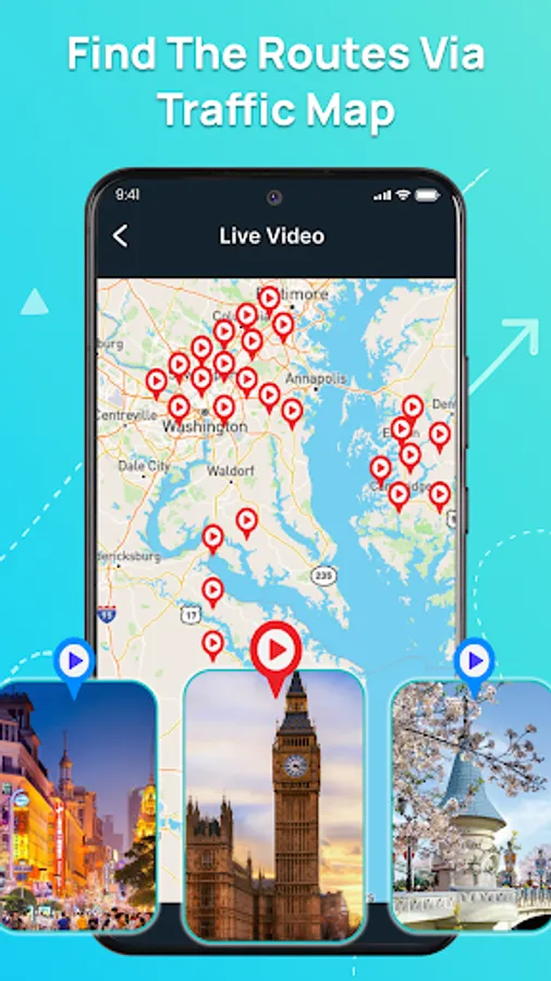
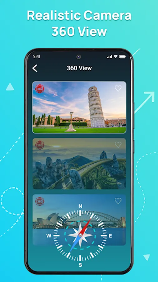
🌍 360 View: Experience the Earth in panoramic clarity with satellite map layers, immersive live earth view, and dynamic live satellite feeds.
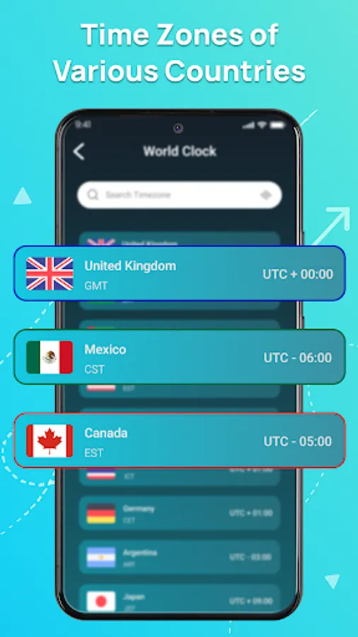
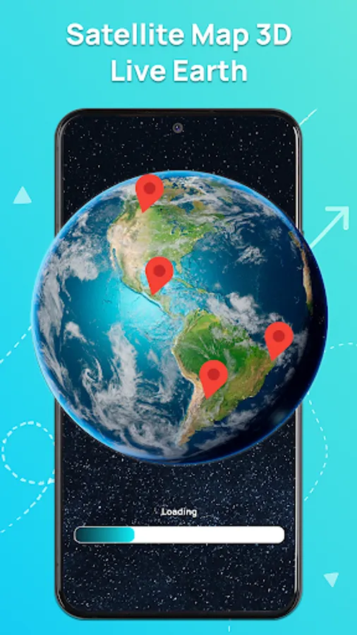
🗺️ 3D Earth Map: Dive into landscapes, explore landmarks, and navigate cities using interactive satellite map overlays combined with advanced live satellite technology and live earth view updates.
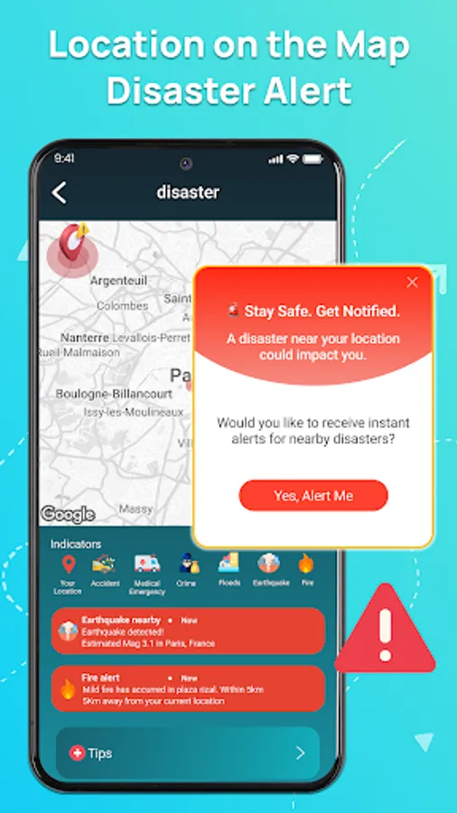
🚨 Disaster Alert: Get real-time warnings on storms, floods, or earthquakes directly on the satellite map. Integrated live earth view and live satellite coverage ensures safety at every step.
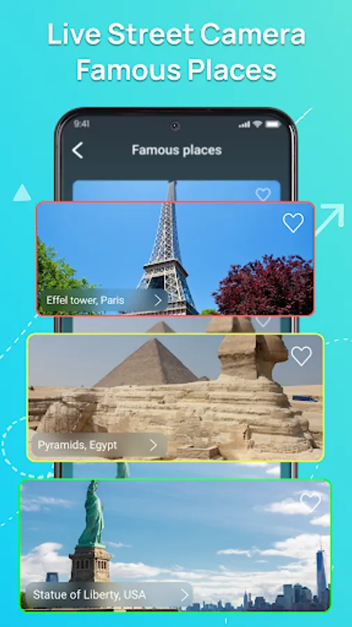
📸 HD Street View: Access realistic HD street view imagery to explore neighborhoods, roads, and landmarks as if you were there. Use HD street view alongside satellite map, live earth view, and live satellite feeds for the ultimate perspective.
📌 With Live Satellite Map & GPS Navigation, you can instantly explore any destination: switch smoothly between satellite map, live earth view, HD street view, and immersive 3D earth map—all enhanced by real-time live satellite imagery.
🔥 Don’t just navigate—experience Earth in HD clarity through satellite map, live earth view, and HD street view powered by live satellite updates.
⬇️ Download now and unlock your journey with satellite map, live earth view, HD street view, and live satellite—anytime, anywhere!
✨ Step into the future of exploration with Live Satellite Map & GPS Navigation, your all-in-one tool to explore the planet. From breathtaking live earth view and crystal-clear HD street view, to immersive 3D earth map, full 360 view, and instant satellite map updates, this app transforms your phone into a real-time live satellite explorer.
🚀 Travel anywhere, anytime. With satellite map accuracy, stay safe through real-time disaster alerts, switch between live earth view, explore cities with HD street view, and unlock stunning locations with immersive 3D earth map powered by live satellite data.
✅ Key Features:
🌍 360 View: Experience the Earth in panoramic clarity with satellite map layers, immersive live earth view, and dynamic live satellite feeds.
🗺️ 3D Earth Map: Dive into landscapes, explore landmarks, and navigate cities using interactive satellite map overlays combined with advanced live satellite technology and live earth view updates.
🚨 Disaster Alert: Get real-time warnings on storms, floods, or earthquakes directly on the satellite map. Integrated live earth view and live satellite coverage ensures safety at every step.
📸 HD Street View: Access realistic HD street view imagery to explore neighborhoods, roads, and landmarks as if you were there. Use HD street view alongside satellite map, live earth view, and live satellite feeds for the ultimate perspective.
📌 With Live Satellite Map & GPS Navigation, you can instantly explore any destination: switch smoothly between satellite map, live earth view, HD street view, and immersive 3D earth map—all enhanced by real-time live satellite imagery.
🔥 Don’t just navigate—experience Earth in HD clarity through satellite map, live earth view, and HD street view powered by live satellite updates.
⬇️ Download now and unlock your journey with satellite map, live earth view, HD street view, and live satellite—anytime, anywhere!
Live Satellite - 3D Earth Map Screenshots


Tap to Rate:
Reviews for Live Satellite - 3D Earth Map
Eli Cohen
12/19/2025
Terrible especially when paying for it.
Martin Davies
12/17/2025
There is no map, and full of adds everywhere