About 스마트GPS측량
Let's survey using GPS of smartphone!
GPS surveying application using the built-in GPS module smartphone.
Average accuracy of 2 to 3 meters compared to precision GPS instruments, and within 1 meter for obstacle-free areas.
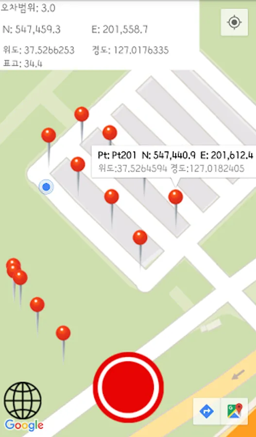
Real-time position coordinates can be measured and latitude and longitude / GRS80 geodetic coordinates are displayed simultaneously.
GRS80 coordinate system can select western origin, central origin, eastern origin, and Dokdo / Ulleungdo origin.
Approximate positional coordinates, stakeout and distance, and area calculations, except for precise surveys, are available.
Can be used by both expert and non-experts in GPS surveying.
Suitable for field practice and GPS survey training.
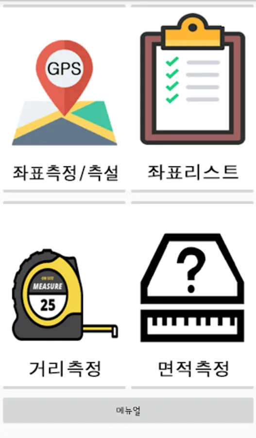
1. Coordinate Measurement
GRS80 (World Geodetic System) Coordinate System (West, Central, East, Dokdo / Ulleungdo Origin), Latitude
Coordinate display and measurement of real time position
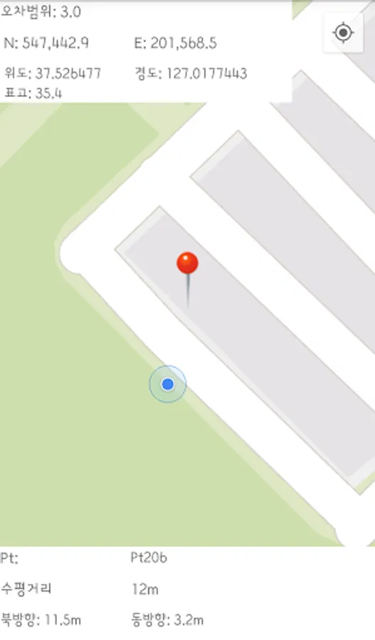
2. Stakeout of coordinates
Find locations by directly entering saved coordinates and coordinates
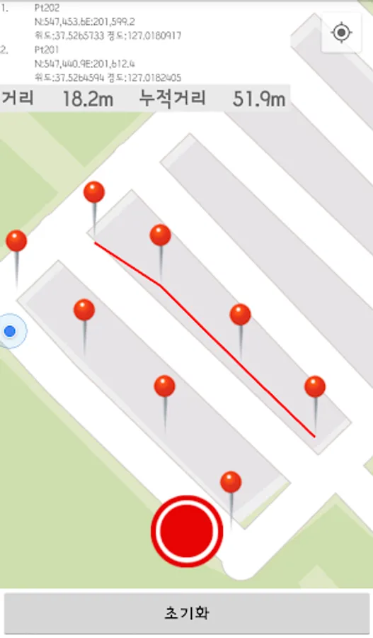
3. Distance measurement
Measure distance and cumulative distance between two points for stored coordinates or real-time position in meters
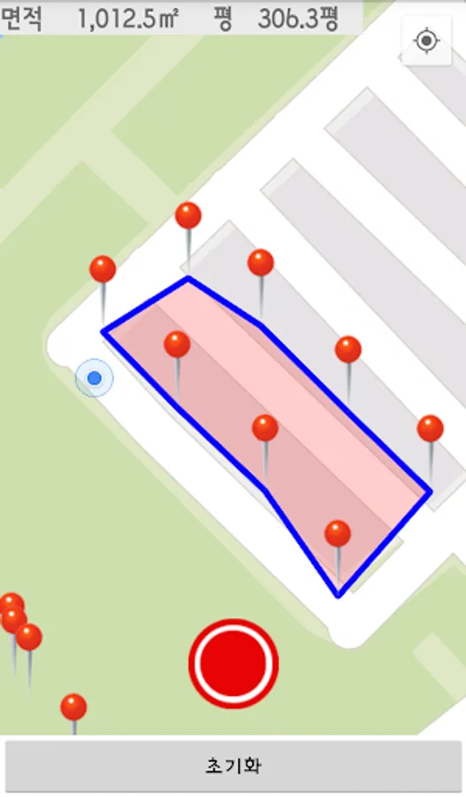
3. Area measurement
Area measurement of three or more points for storage coordinates or real-time position (units: square meters, square)
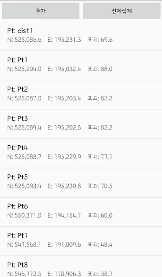
4. Coordinate List
Save data coordinate management
※ The projection origin of GRS80 coordinate system is x = 600,000 y = 200,000
※ GPS accuracy may vary depending on the measurement environment or smartphone model.
GPS surveying application using the built-in GPS module smartphone.
Average accuracy of 2 to 3 meters compared to precision GPS instruments, and within 1 meter for obstacle-free areas.
Real-time position coordinates can be measured and latitude and longitude / GRS80 geodetic coordinates are displayed simultaneously.
GRS80 coordinate system can select western origin, central origin, eastern origin, and Dokdo / Ulleungdo origin.
Approximate positional coordinates, stakeout and distance, and area calculations, except for precise surveys, are available.
Can be used by both expert and non-experts in GPS surveying.
Suitable for field practice and GPS survey training.
1. Coordinate Measurement
GRS80 (World Geodetic System) Coordinate System (West, Central, East, Dokdo / Ulleungdo Origin), Latitude
Coordinate display and measurement of real time position
2. Stakeout of coordinates
Find locations by directly entering saved coordinates and coordinates
3. Distance measurement
Measure distance and cumulative distance between two points for stored coordinates or real-time position in meters
3. Area measurement
Area measurement of three or more points for storage coordinates or real-time position (units: square meters, square)
4. Coordinate List
Save data coordinate management
※ The projection origin of GRS80 coordinate system is x = 600,000 y = 200,000
※ GPS accuracy may vary depending on the measurement environment or smartphone model.