Sedona Hiking
Wasatch Technology, Inc.
3.8 ★
store rating
1,000+
downloads
$4.99
In this hiking app, you can view detailed trail descriptions, access GPS-guided navigation, and explore points of interest. Includes offline maps, trail highlights, and difficulty ratings.
AppRecs review analysis
AppRecs rating 3.8. Trustworthiness 0 out of 100. Review manipulation risk 0 out of 100. Based on a review sample analyzed.
★★★☆☆
3.8
AppRecs Rating
Ratings breakdown
5 star
56%
4 star
19%
3 star
0%
2 star
3%
1 star
22%
What to know
✓
Good user ratings
75% positive sampled reviews
About Sedona Hiking
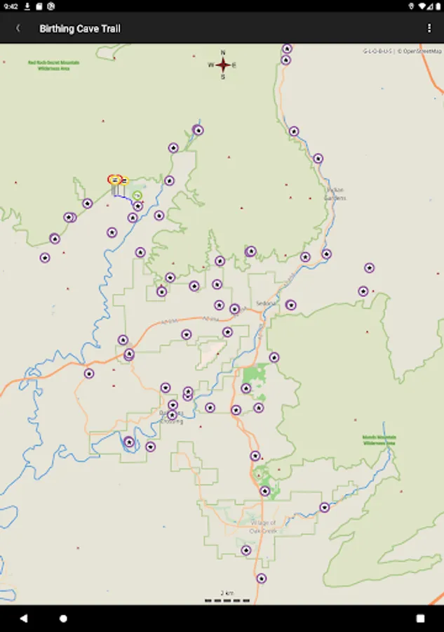
You really can take it with you. Sedona Arizona has 100+ trails. They cover forests, streams and red rock grandeur so you’ll need a guide. Sedona Hiking can be that guide. We supply trail descriptions, directions to the trail head, points of interest and the ability to follow your progress in real time with your GPS. Following the trails has never been easier. Now you can concentrate on enjoying the beauty of Sedona and not map reading or deciphering stacks of rocks. Load the Trail information into your Android device and “Take a Hike”! The trail maps and points of interest are preloaded so you don’t need cell service. Visit and explore www.SedonaHikingApp.com for trail listings and hike highlights with pictures from the trails.
Here’s how it works: After you decide on the trails you’d like to experience you download the trails onto your device (with a network connection) and select them as you do the hike. Everything you need is in each hike package.
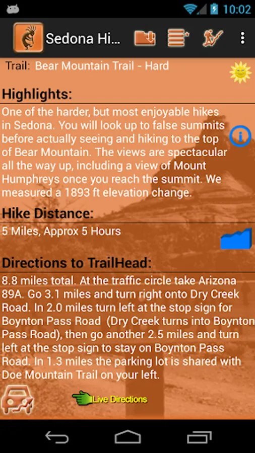
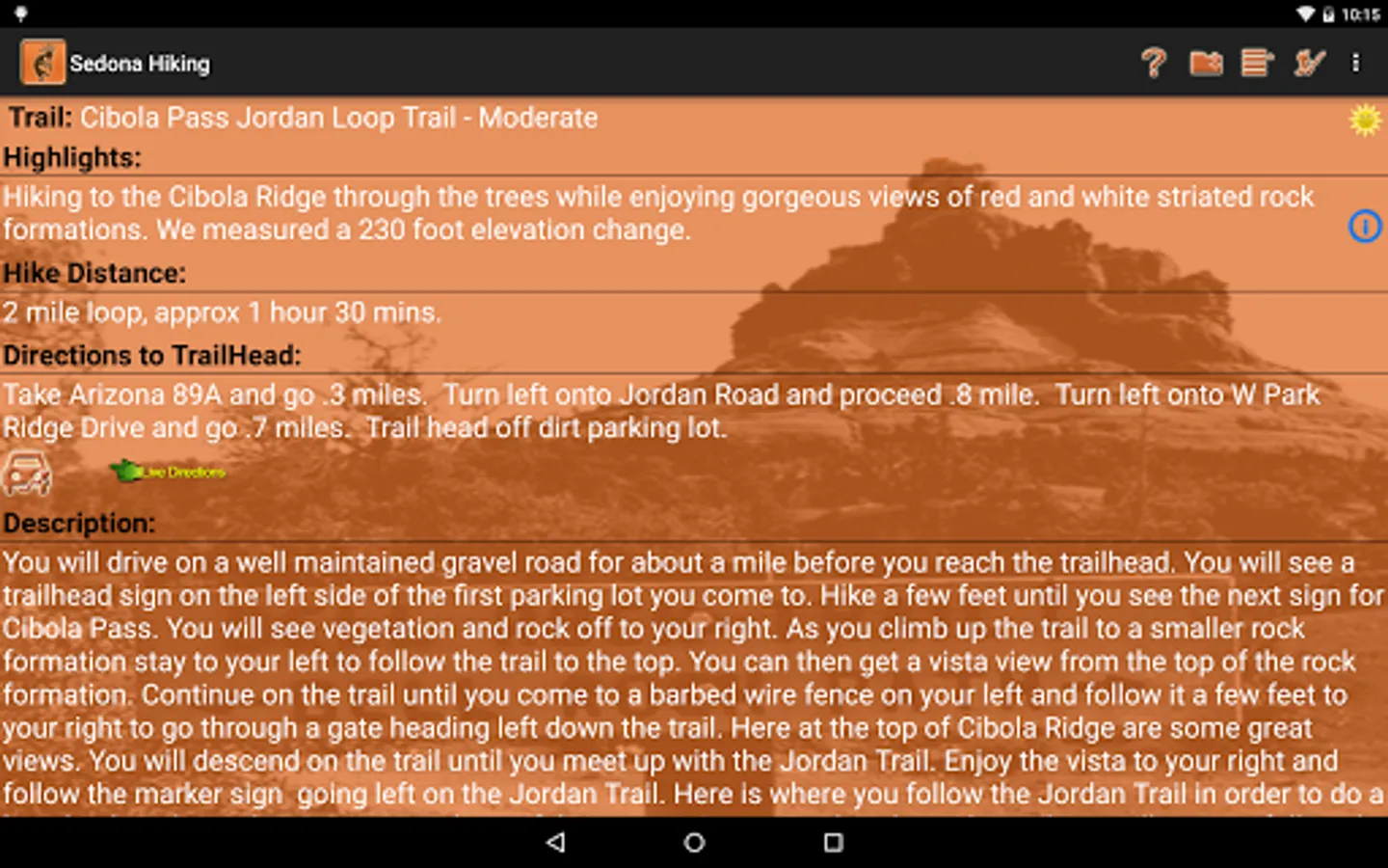
1. Highlights and features of the selected hiking trail.
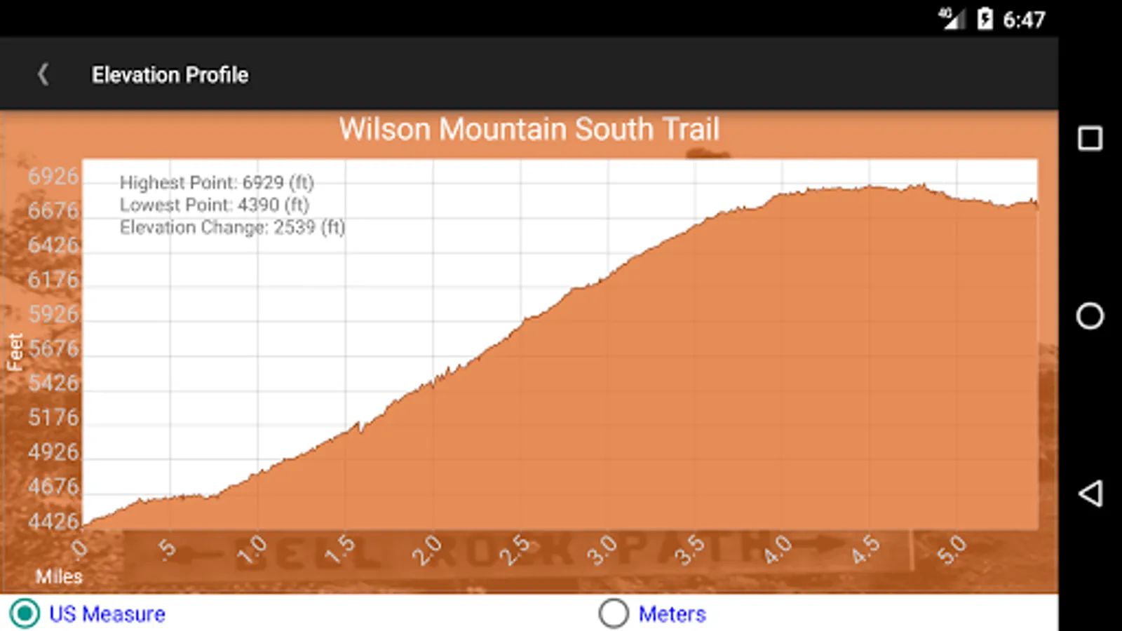
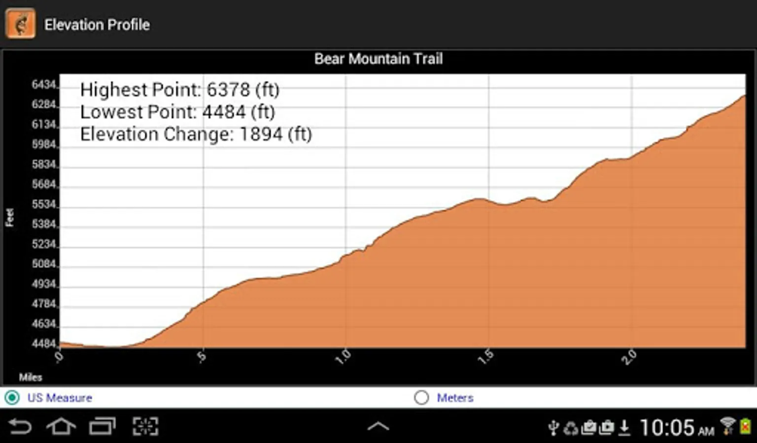
2. Length and difficulty rating of the trail.
3. A detailed description of the trail and what you’ll encounter and experience on the hike.
4. Directions to the trail head or Google directions and map if you so desire and have network connection.
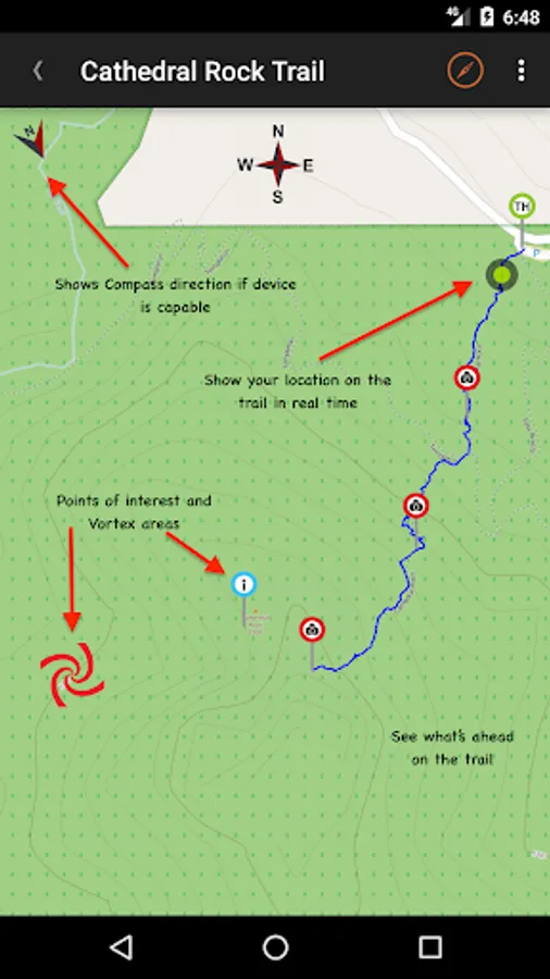
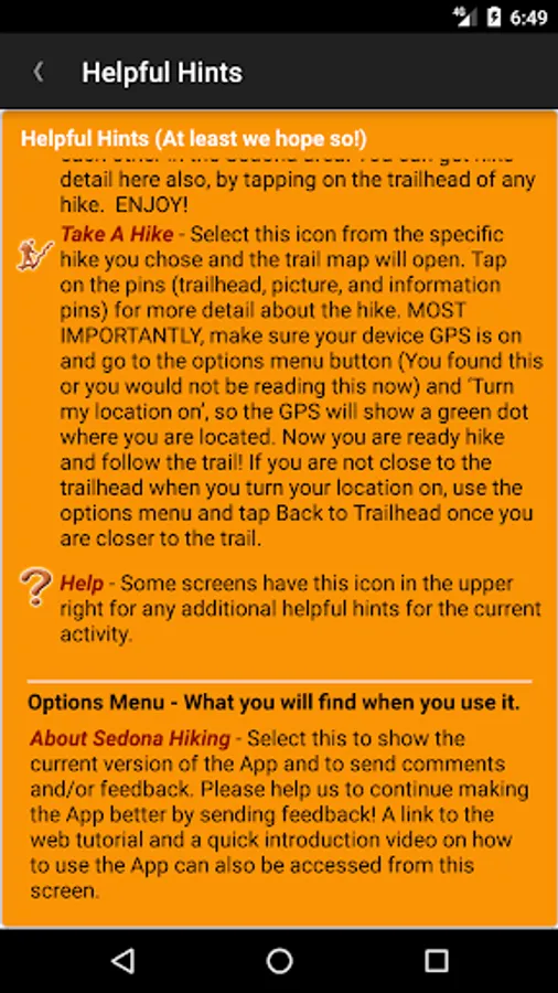
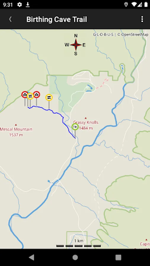
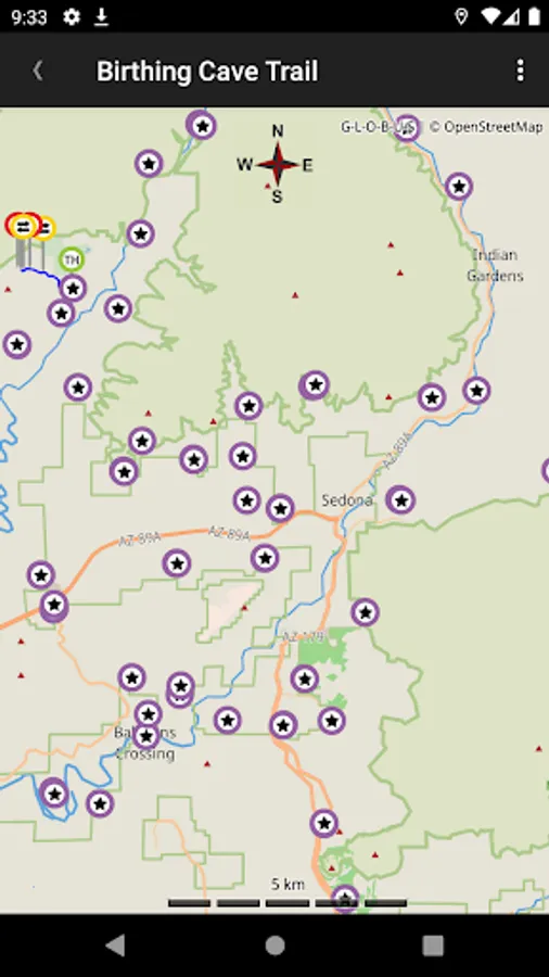
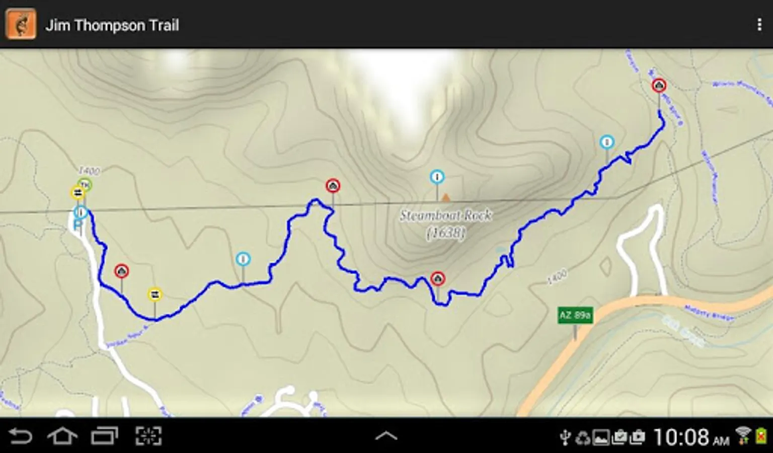
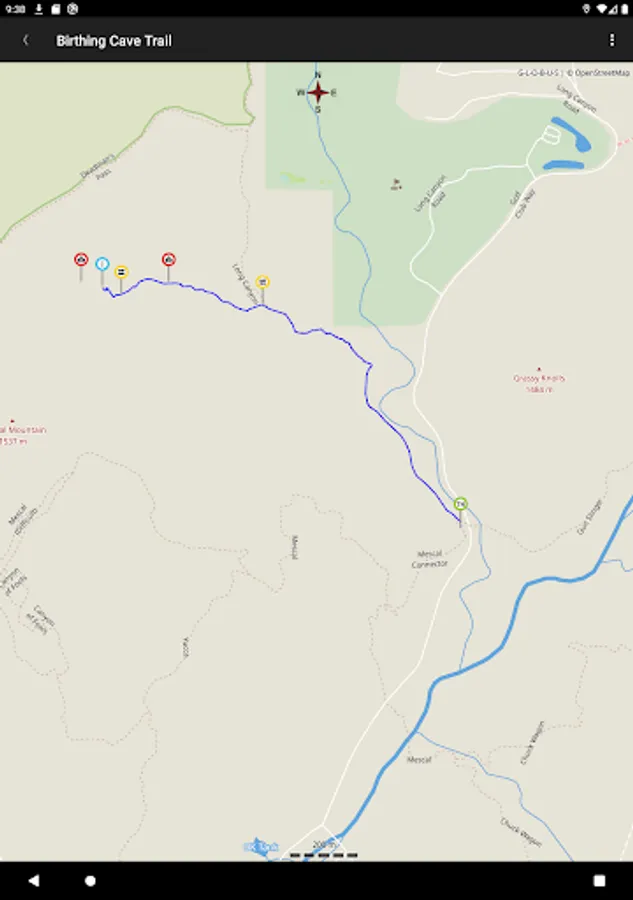
5. A trail map on screen that allows you to follow your progress and see your location in real time via GPS so you can be confident you’re on the trail.
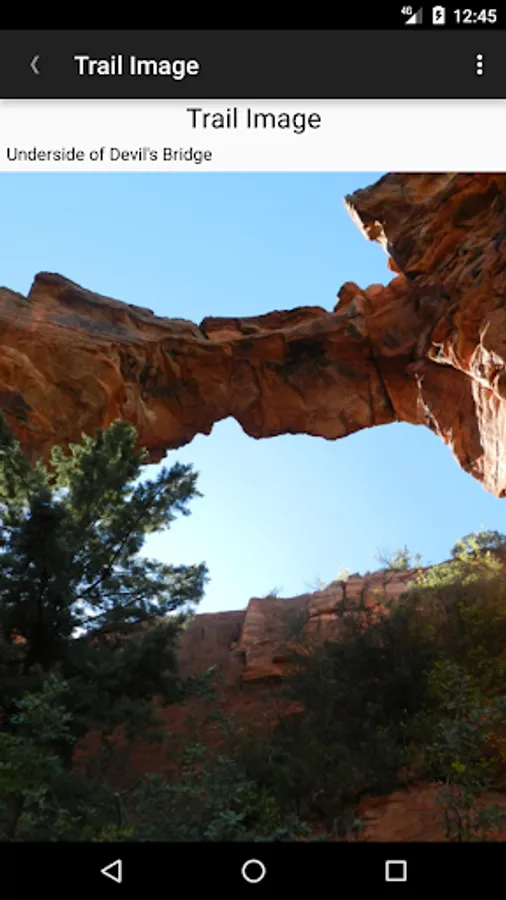
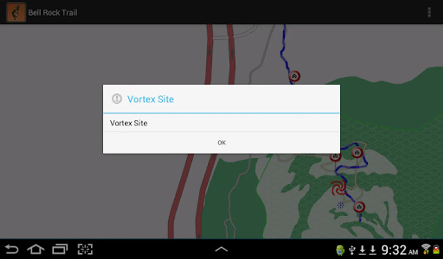
6. There are trail markers for intersections to watch for and pictures of what is ahead on the trail so you don’t miss out on sights that might be slightly off the trail.
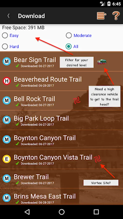
We have over 110 trails, that's 400+ miles of Sedona beauty!
We’ve hiked, recorded, and mapped all these trails ourselves. We gathered our trail data on the trail, not copied from various web pages like the Forest Service, or crowd sourced trail ratings found online. All our trails are hiked by us, tracks are recorded by us and verified by us, not downloaded from random hike web sites. So we think you will see the difference!
And we're the only Sedona Hiking App that shows your position on the trail in real time!
** Don't forget to enable GPS and select "Turn My Location ON" in the Hike Screen! (applies to versions lower than 2.9)
*** Beware some low power configurations can slow down or hinder GPS location updates. Won't show proper location on the trail.
Here’s how it works: After you decide on the trails you’d like to experience you download the trails onto your device (with a network connection) and select them as you do the hike. Everything you need is in each hike package.
1. Highlights and features of the selected hiking trail.
2. Length and difficulty rating of the trail.
3. A detailed description of the trail and what you’ll encounter and experience on the hike.
4. Directions to the trail head or Google directions and map if you so desire and have network connection.
5. A trail map on screen that allows you to follow your progress and see your location in real time via GPS so you can be confident you’re on the trail.
6. There are trail markers for intersections to watch for and pictures of what is ahead on the trail so you don’t miss out on sights that might be slightly off the trail.
We have over 110 trails, that's 400+ miles of Sedona beauty!
We’ve hiked, recorded, and mapped all these trails ourselves. We gathered our trail data on the trail, not copied from various web pages like the Forest Service, or crowd sourced trail ratings found online. All our trails are hiked by us, tracks are recorded by us and verified by us, not downloaded from random hike web sites. So we think you will see the difference!
And we're the only Sedona Hiking App that shows your position on the trail in real time!
** Don't forget to enable GPS and select "Turn My Location ON" in the Hike Screen! (applies to versions lower than 2.9)
*** Beware some low power configurations can slow down or hinder GPS location updates. Won't show proper location on the trail.