About Earth Map Zoom & 3D Satellite
Earth Map Zoom & 3D Satellite View – Explore the World in 3D from Your Mobile!
Discover the planet with high-quality satellite imagery, interactive maps, and immersive 3D views. Whether you’re zooming into cities, exploring famous landmarks, or checking traffic conditions, this smart earth map app helps you explore and interact with the world in a new way.
🌍 Key Features of this Earth Map & 3D Explorer app:
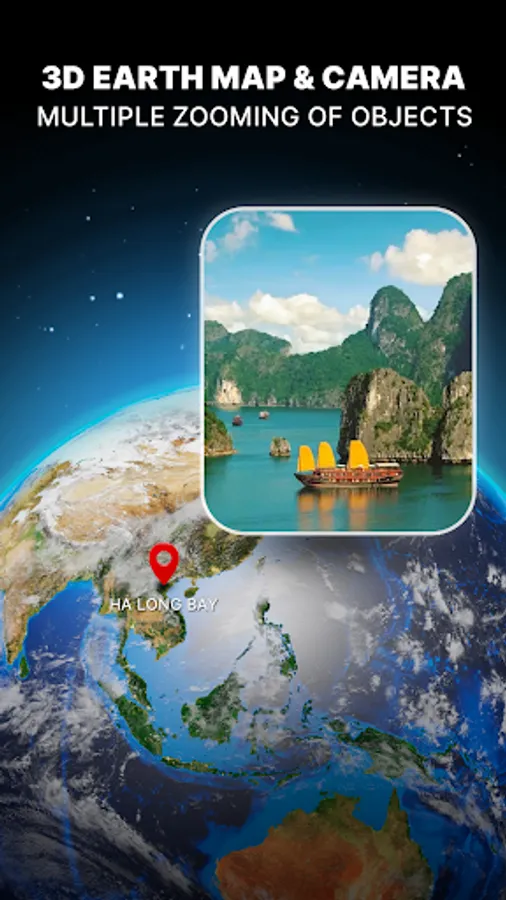
🔍 Zoom Earth Map with Satellite View
- Zoom in and out of any location with detailed map coverage
- Switch between map, terrain, and 3D satellite view
- Explore borders, landscapes, and natural features
- Enjoy realistic earth map visuals with smooth navigation
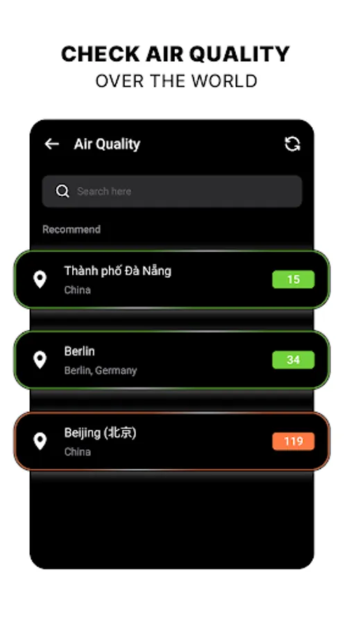
📸 Live Map & Street View Experience
- Access street-level imagery of selected cities and landmarks
- Explore weather layers, traffic updates, and map conditions
- View available webcams and public image feeds from different places
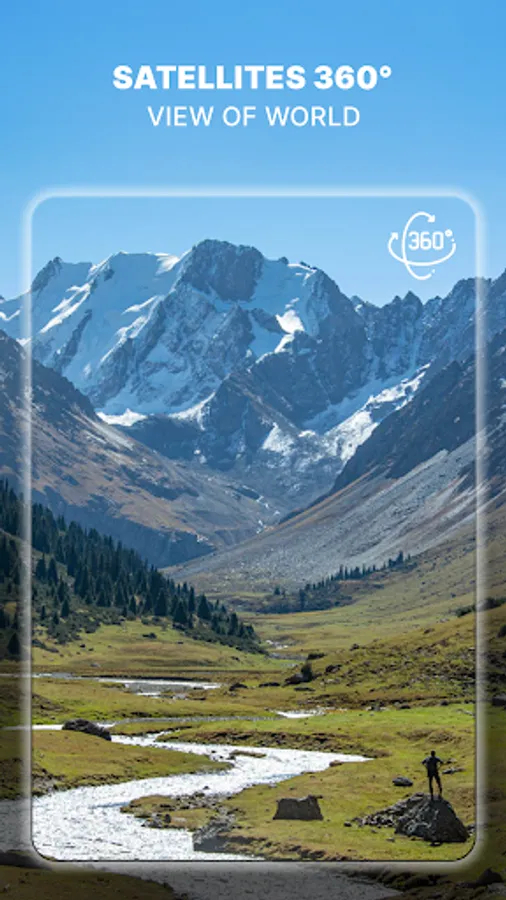
🔄 360° Explorer
- Interact with panoramic 360° map coverage
- Rotate, swipe, and zoom for a complete map experience
- Perfect for virtual exploration and learning
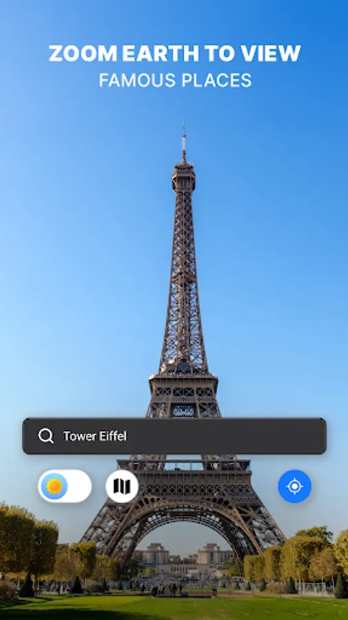
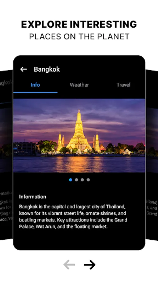
📍 Famous Places Information
- Discover world-famous destinations on the world map
- See details such as weather, travel info, and photos
- Great for trip planning or educational purposes
🚦 Traffic & Navigation Tools
- Stay updated with traffic conditions and congestion levels
- Check road quality and route information
- Navigate smarter with GPS-based live traffic maps
🧭 Daily Useful Tools
- Global time zones with a built-in world clock
- Digital compass to find directions easily
- Handy features for travelers and explorers
With Earth Map Zoom & 3D Satellite View, you can explore maps, landmarks, and traffic information — all from your mobile device. Whether you’re planning a journey, learning geography, or just exploring virtually, this app makes the world more accessible.
👉 Disclaimer: This app is not affiliated with Google Inc., Google Maps, or any other official mapping providers. It uses public and authorized data sources to deliver mapping features. Availability of features may vary based on data providers and user location.
Discover the planet with high-quality satellite imagery, interactive maps, and immersive 3D views. Whether you’re zooming into cities, exploring famous landmarks, or checking traffic conditions, this smart earth map app helps you explore and interact with the world in a new way.
🌍 Key Features of this Earth Map & 3D Explorer app:
🔍 Zoom Earth Map with Satellite View
- Zoom in and out of any location with detailed map coverage
- Switch between map, terrain, and 3D satellite view
- Explore borders, landscapes, and natural features
- Enjoy realistic earth map visuals with smooth navigation
📸 Live Map & Street View Experience
- Access street-level imagery of selected cities and landmarks
- Explore weather layers, traffic updates, and map conditions
- View available webcams and public image feeds from different places
🔄 360° Explorer
- Interact with panoramic 360° map coverage
- Rotate, swipe, and zoom for a complete map experience
- Perfect for virtual exploration and learning
📍 Famous Places Information
- Discover world-famous destinations on the world map
- See details such as weather, travel info, and photos
- Great for trip planning or educational purposes
🚦 Traffic & Navigation Tools
- Stay updated with traffic conditions and congestion levels
- Check road quality and route information
- Navigate smarter with GPS-based live traffic maps
🧭 Daily Useful Tools
- Global time zones with a built-in world clock
- Digital compass to find directions easily
- Handy features for travelers and explorers
With Earth Map Zoom & 3D Satellite View, you can explore maps, landmarks, and traffic information — all from your mobile device. Whether you’re planning a journey, learning geography, or just exploring virtually, this app makes the world more accessible.
👉 Disclaimer: This app is not affiliated with Google Inc., Google Maps, or any other official mapping providers. It uses public and authorized data sources to deliver mapping features. Availability of features may vary based on data providers and user location.