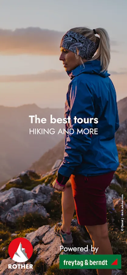
Rother: Hiking & Maps
Bergverlag Rother GmbH
4.3 ★
store rating
100,000+
downloads
Free
+ in-app
In this hiking app, you can plan routes, record tours, and access premium maps. Includes offline maps, customizable tour filters, and GPS navigation features.
AppRecs review analysis
AppRecs rating 4.1. Trustworthiness 84 out of 100. Review manipulation risk 22 out of 100. Based on a review sample analyzed.
★★★★☆
4.1
AppRecs Rating
Ratings breakdown
5 star
67%
4 star
22%
3 star
0%
2 star
0%
1 star
11%
What to know
✓
Low review manipulation risk
22% review manipulation risk
✓
Credible reviews
84% trustworthiness score from analyzed reviews
⚠
Pricing complaints
Many low ratings mention paywalls or pricing
About Rother: Hiking & Maps
Easy route planning and recording with premium maps and over 15,000 tested tours by professional hiking authors. All Rother tours are now fully available in English.
Here comes your reliable companion for the next hike!
With us there is no mess of useless tours, but only tour suggestions from professional authors - tested and regularly updated. With our maps from qualified cartographers, orientation is easy. For beautiful and safe outdoor experiences.
The Rother App is developed and published by Rother Bergverlag, known for reliable hiking guides.
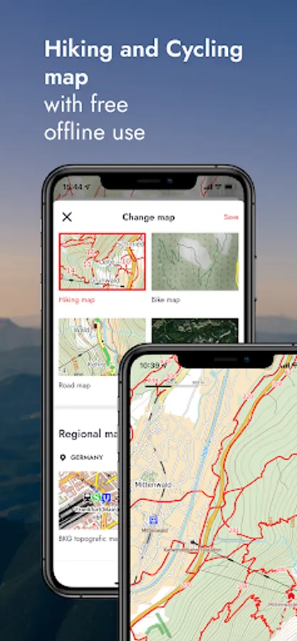
FREE OFFLINE MAPS
You can download our hiking and biking maps for free and use them offline. You can also plan your own routes and record your adventures.
GET ALL TOURS AND MAPS
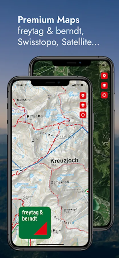
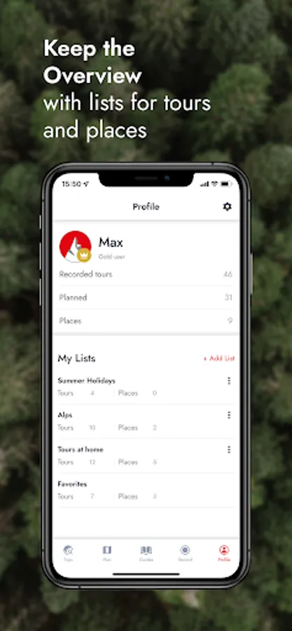
You have the choice: Unlock individual guides or get them all in the low-priced Gold subscription. This gives you access to all tours from Rother, all premium maps from freytag & berndt, Swisstopo and the satellite map. You can save tours and locations in your own lists, so you can keep track of everything.
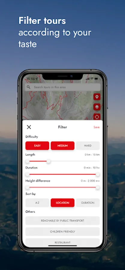
EASY TOUR SELECTION
Do you want a leisurely tour today or are you looking for a challenge? Are you looking for a child-friendly hike? No problem: easily filter tours according to your preferences, such as length and difficulty.
HIKING MAPS
Topographic maps in many zoom levels and satellite map. With our premium maps you get the finest cartography from freytag & berndt and others like Swisstopo, BKG, SHOCart, CNIG or Kartverket.
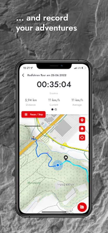
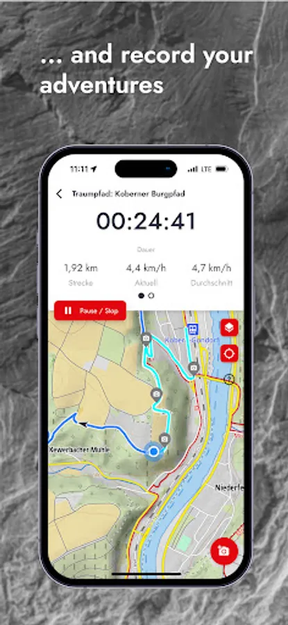
GPS NAVIGATION
While hiking you can always see your location and the track of the tour.
OFFLINE USE
Simply download the map for the desired area and go hiking without an internet connection.
ROUTE DESCRIPTIONS
Reliable tour descriptions and all information about requirements, refreshments, etc.
In a slideshow with photos of the tour you can see what to expect.
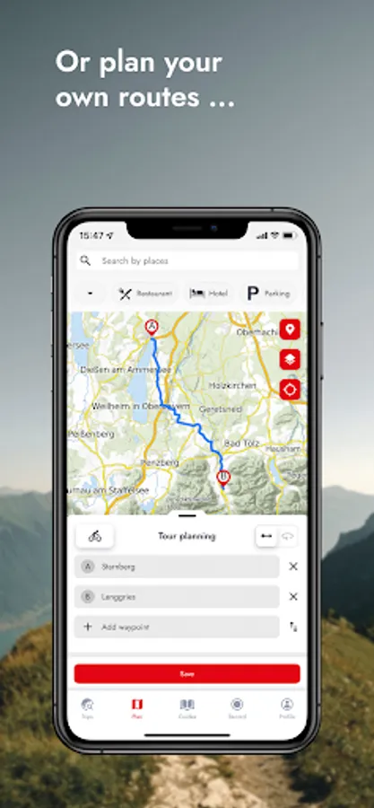
PLAN YOUR OWN ROUTE
Route planning with Rother is very easy and understandable: enter your start and destination and we will show you the way - on foot or by bike.
ROTHER GUIDES
You can also get our popular Rother hiking guides. Each guide contains around 50 tested tours by proven area experts.
There are more than 200 guides available for the most beautiful hiking regions worldwide - also for the Way of St. James and long-distance hiking trails as well as for winter (ski tours, snowshoe tours).
If you already have a book from us, you can import the GPS data into the app for free, but not unlock the corresponding guide for free.
ABOUT ROTHER BERGVERLAG
Rother Bergverlag is Europe's most important publisher of hiking guides. The authors are proven area experts who stand for a considered tour selection and the highest quality. All tours are professionally checked in the editorial office.
Here comes your reliable companion for the next hike!
With us there is no mess of useless tours, but only tour suggestions from professional authors - tested and regularly updated. With our maps from qualified cartographers, orientation is easy. For beautiful and safe outdoor experiences.
The Rother App is developed and published by Rother Bergverlag, known for reliable hiking guides.
FREE OFFLINE MAPS
You can download our hiking and biking maps for free and use them offline. You can also plan your own routes and record your adventures.
GET ALL TOURS AND MAPS
You have the choice: Unlock individual guides or get them all in the low-priced Gold subscription. This gives you access to all tours from Rother, all premium maps from freytag & berndt, Swisstopo and the satellite map. You can save tours and locations in your own lists, so you can keep track of everything.
EASY TOUR SELECTION
Do you want a leisurely tour today or are you looking for a challenge? Are you looking for a child-friendly hike? No problem: easily filter tours according to your preferences, such as length and difficulty.
HIKING MAPS
Topographic maps in many zoom levels and satellite map. With our premium maps you get the finest cartography from freytag & berndt and others like Swisstopo, BKG, SHOCart, CNIG or Kartverket.
GPS NAVIGATION
While hiking you can always see your location and the track of the tour.
OFFLINE USE
Simply download the map for the desired area and go hiking without an internet connection.
ROUTE DESCRIPTIONS
Reliable tour descriptions and all information about requirements, refreshments, etc.
In a slideshow with photos of the tour you can see what to expect.
PLAN YOUR OWN ROUTE
Route planning with Rother is very easy and understandable: enter your start and destination and we will show you the way - on foot or by bike.
ROTHER GUIDES
You can also get our popular Rother hiking guides. Each guide contains around 50 tested tours by proven area experts.
There are more than 200 guides available for the most beautiful hiking regions worldwide - also for the Way of St. James and long-distance hiking trails as well as for winter (ski tours, snowshoe tours).
If you already have a book from us, you can import the GPS data into the app for free, but not unlock the corresponding guide for free.
ABOUT ROTHER BERGVERLAG
Rother Bergverlag is Europe's most important publisher of hiking guides. The authors are proven area experts who stand for a considered tour selection and the highest quality. All tours are professionally checked in the editorial office.