Bike Guide "Franconian Switzerland and Steigerwald"
The popular mountain bike guide for Franconian Switzerland and the Steigerwald as an app for iPhone and iPad. 88 MTB tours and driving fun on 54,000 meters of altitude over 2,400 km await bikers. Everything is offered for beginners to cracks. From fantastic single trails, lonely forest paths, past wild and romantic streams, castles, caves, mills and - not to forget - breweries that invite you to stop.
This rocky low mountain range lies between Nuremberg in the south-west and Bayreuth in the north-east, and is not only very popular with climbers and canoeists. Although the highest mountains barely exceed 600m, mountain bikers get their money's worth here. Here the driver will find narrow, sometimes rocky trails in shady forests that are simply fun! And as a biker you are still largely alone.
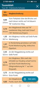
The app offers 73 tours in Franconian Switzerland and 15 tours in the Steigerwald with directions, elevation profiles and map data. The tours can be sorted and filtered according to starting point, level of difficulty or experience value. They are clearly shown, the difficulty of which is easy to recognize by the color.
Show More


