Take your heating pipes in your pocket
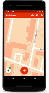
Use FieldGIS District Heating to get an overview of district heating lines in your catchment area. Location and all information about dimension, wiring material and other properties are gathered in one place and can be easily accessed in the field via your mobile or tablet. Pictures taken on site are saved easily and quickly, and can help in registering damage or retrieving the components in the future. FieldGIS District Heating gives you an overview and answers immediately.
With FieldGIS District Heating you can, among other things:
Locate wires where you stand
See properties for the individual components
Switch between different background cards
Take pictures to locate components / wires or faults / breaks
Show More