About RANDO(S) en HAUTE-LOIRE
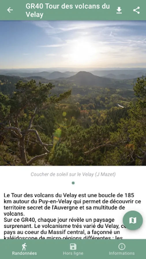
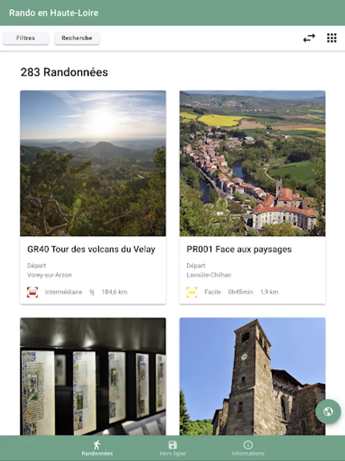
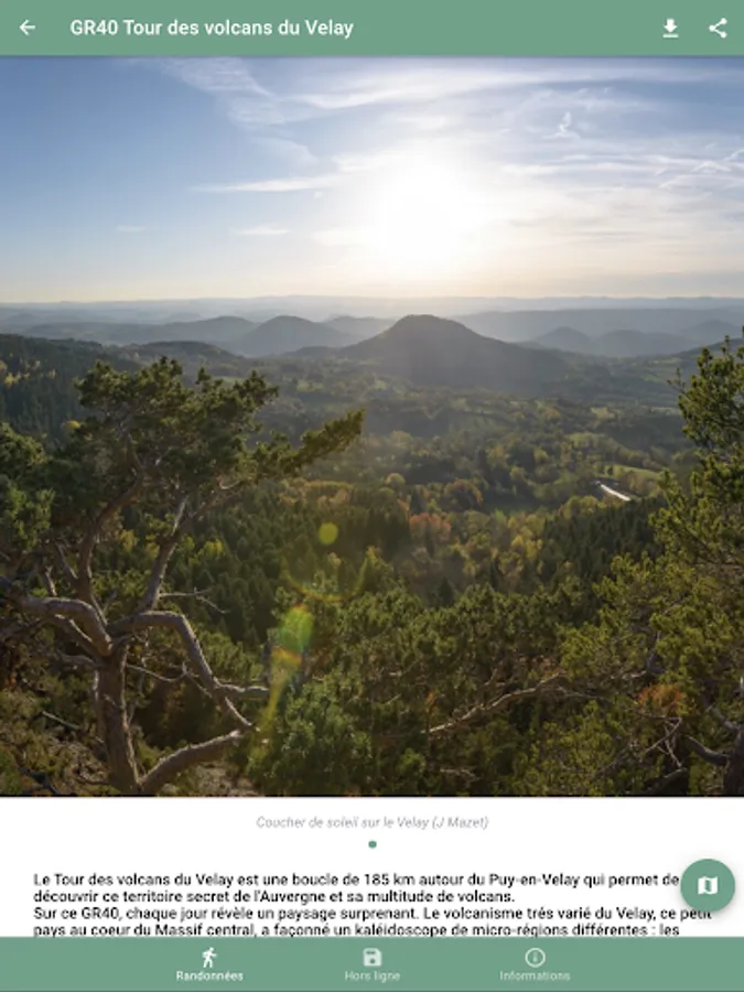
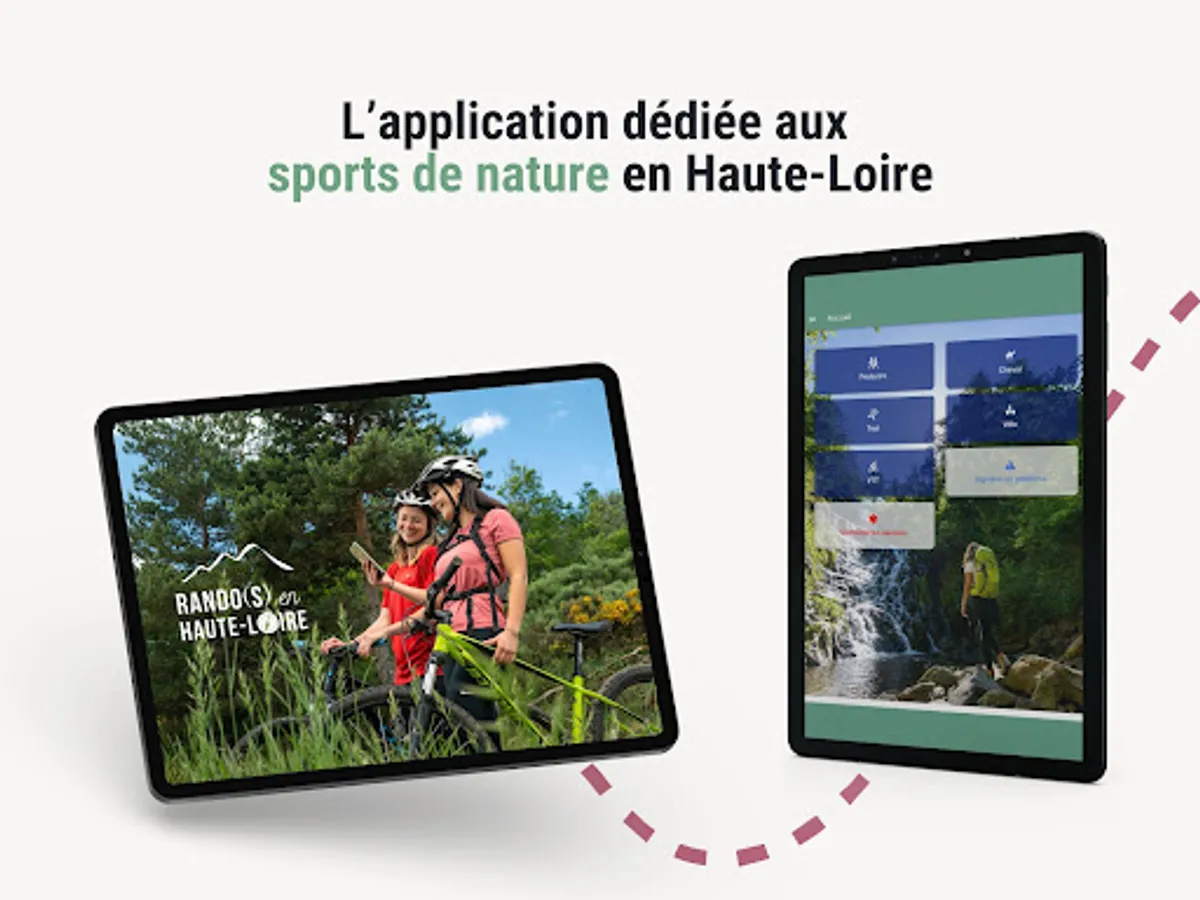
The “Rando(s) en Haute-Loire” mobile application opens the doors to a complete exploration of nature sports and the rich heritage of Haute-Loire. Discover detailed itineraries, complete with illustrations and regularly updated for an optimal experience.
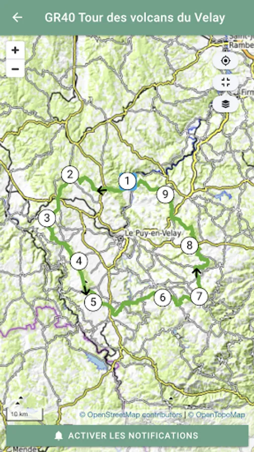
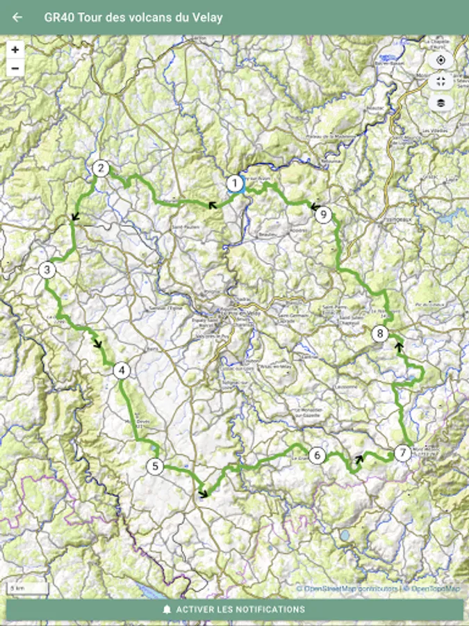
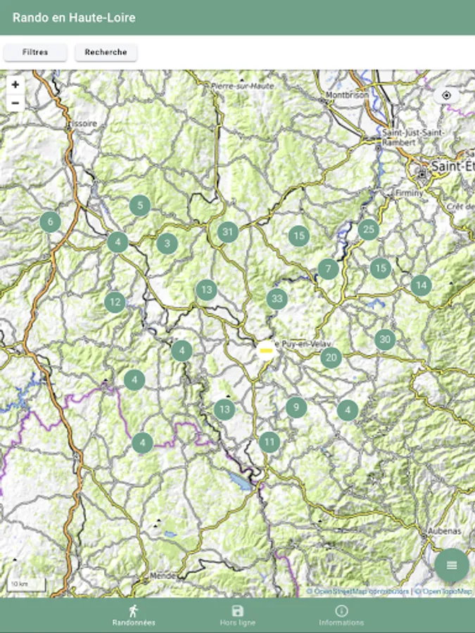
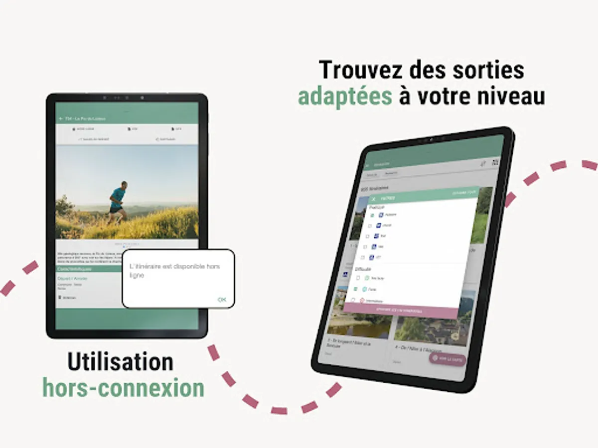
Immerse yourself in a host of available features, including 3D navigation, GPS tracking, print and download service, and an alert system to ensure your safety throughout your excursions.
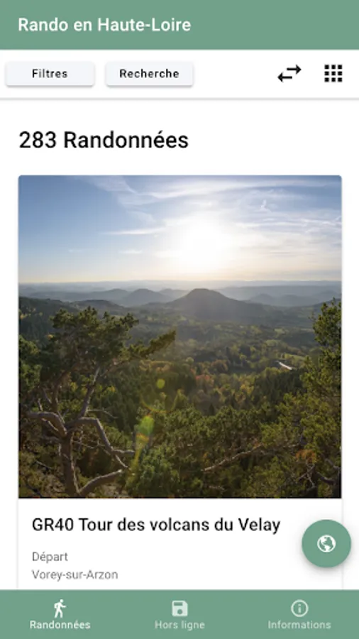
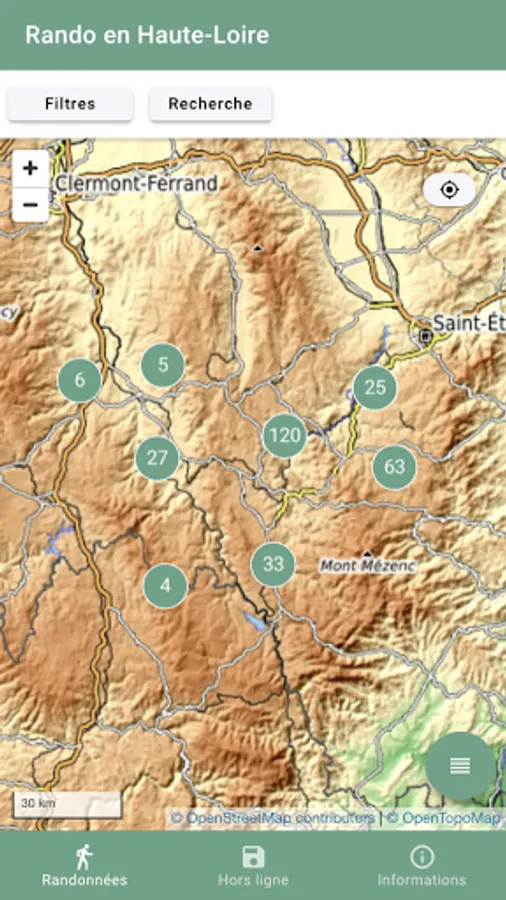
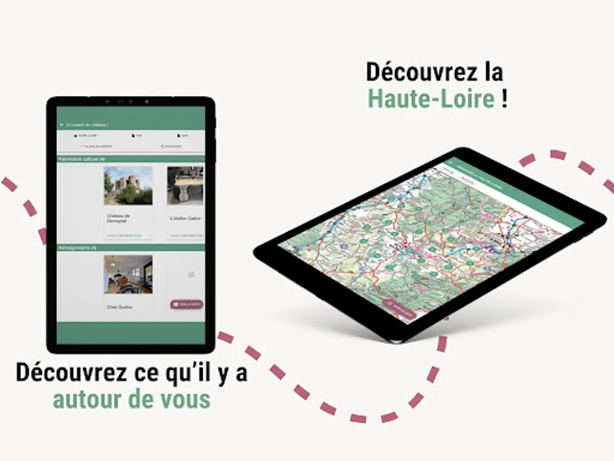
Designed for everyone, from families to athletes, the app lets you explore routes on foot, by bike, by mountain bike, and much more. It will become your mobile guide in the field, informing you about the specificities of your activity, and allowing you to explore the heritage and points of interest around your routes, such as accommodation, restaurants, producers and shops in the department. .
Its use is made easier thanks to the possibility of working offline. You can download the routes in advance to your smartphone or tablet for smooth and secure use even without a connection. Also benefit from real-time navigation thanks to geolocation, allowing you to explore the trails with complete peace of mind.
“Rando(s) en Haute-Loire” thus becomes your trusted companion, guiding you through exciting adventures, informing you about the rich local heritage, and offering you a complete and immersive hiking experience. Embark on a limitless exploration of the magnificent Haute-Loire trails with your guide in your pocket.
Immerse yourself in a host of available features, including 3D navigation, GPS tracking, print and download service, and an alert system to ensure your safety throughout your excursions.
Designed for everyone, from families to athletes, the app lets you explore routes on foot, by bike, by mountain bike, and much more. It will become your mobile guide in the field, informing you about the specificities of your activity, and allowing you to explore the heritage and points of interest around your routes, such as accommodation, restaurants, producers and shops in the department. .
Its use is made easier thanks to the possibility of working offline. You can download the routes in advance to your smartphone or tablet for smooth and secure use even without a connection. Also benefit from real-time navigation thanks to geolocation, allowing you to explore the trails with complete peace of mind.
“Rando(s) en Haute-Loire” thus becomes your trusted companion, guiding you through exciting adventures, informing you about the rich local heritage, and offering you a complete and immersive hiking experience. Embark on a limitless exploration of the magnificent Haute-Loire trails with your guide in your pocket.
RANDO(S) en HAUTE-LOIRE Screenshots


Tap to Rate: