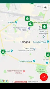
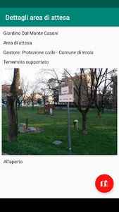
Unofficial map of waiting areas, where the population can get information and first aid after a civil protection event (earthquakes, floods, fires, ...).
Ability to view the details of each area and be guided to it.
Data from the OpenStreetMap geographic DB.
Source code: https://gitlab.com/Danysan1/AreeDiAttesa
Ability to view the details of each area and be guided to it.
Data from the OpenStreetMap geographic DB.
Source code: https://gitlab.com/Danysan1/AreeDiAttesa
Show More