About 날씨 위성 영상 라이브 - 실시간 날씨영상
☁️ App Name
Weather Satellite Image Live - Real-Time Weather Image
🌍 App Description
🌤️ Check National Weather Satellite Image in Real Time
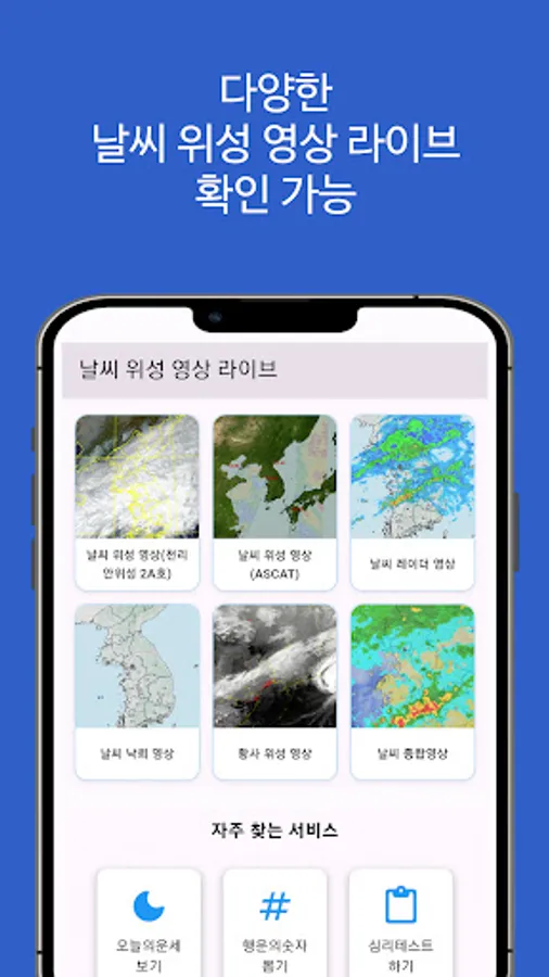
The Weather Satellite Image Live app is a professional weather app that allows you to view real-time weather images from various sources, including Cheollian Satellite 2A, ASCAT, and the Korea Meteorological Administration's radar, at a glance.
You can quickly and visually check changes in yellow dust, lightning, precipitation, clouds, and wind, providing more vivid real-time image-based weather information than the Korea Meteorological Administration's weather forecasts.
🔍 Key Features
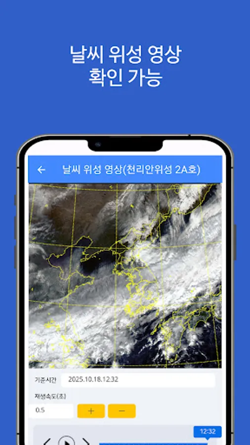
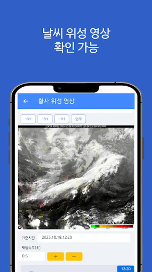
✅ Weather Satellite Image (Cheonlian Satellite 2A)
Real-time image from the Korea Meteorological Administration's Cheonlian Satellite 2A
Provides nationwide cloud, precipitation, water vapor, and infrared images
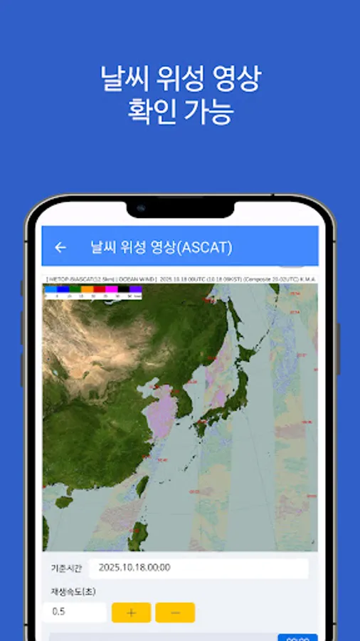
✅ Weather Satellite Image (ASCAT)
Real-time ASCAT satellite data, including sea wind speed and wind direction
Used to track typhoons and marine weather changes
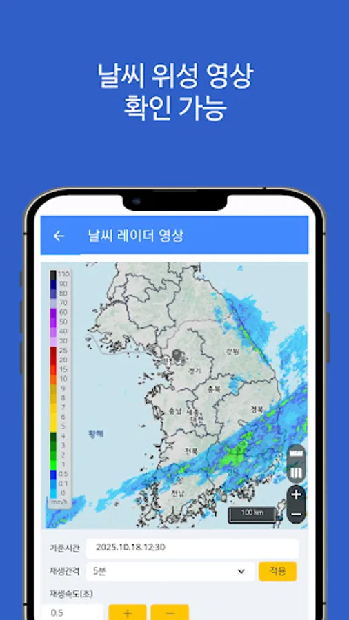
✅ Weather Radar Image
Real-time precipitation image from the Korea Meteorological Administration's radar
Check the movement path of precipitation clouds, snow clouds, and other precipitation sources
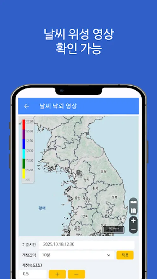
✅ Weather Lightning Image
Identify thunderstorm and lightning risk areas with real-time lightning observation images
Automatically mark areas with concentrated lightning strikes
✅ Yellow Dust Satellite Image
Real-time tracking of yellow dust movement
Visualize the spread of fine dust and yellow dust from China
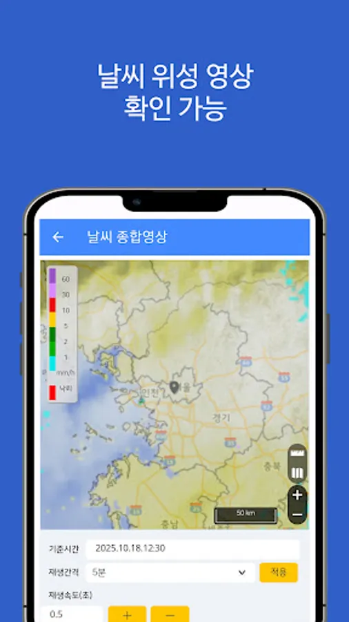
✅ Comprehensive Weather Image
Comprehensive weather monitoring function that provides a glance at all image data, including Cheonlian Satellite, radar, lightning, and yellow dust
🌦️ Recommended for:
Those who want to quickly check real-time satellite images from the Korea Meteorological Administration
Those who want accurate weather conditions before engaging in agriculture, fishing, outdoor activities, camping, golf, or drone flight
Those who want to view videos of unusual weather phenomena such as typhoons, yellow dust, and lightning directly
Those who want satellite-based weather information more accurate than real-time weather forecast apps
☀️ Summary of provided information
Weather satellite images (Cheonlian Satellite 2A)
Weather satellite images (ASCAT)
Weather radar images
Weather and lightning images
Yellow dust satellite images
Comprehensive weather images
🌈 Real-time weather from the sky
With just one app, "Weather Satellite Image Live," you can easily check nationwide weather conditions with real-time satellite images,
without having to search for complex weather websites.
※ This app does not represent the government or any government agency.
※ This app was created to provide high-quality information and does not assume any liability.
※ Source: Korea Meteorological Administration Weather Nuri - https://www.weather.go.kr/w/image/synthesis.do
Weather Satellite Image Live - Real-Time Weather Image
🌍 App Description
🌤️ Check National Weather Satellite Image in Real Time
The Weather Satellite Image Live app is a professional weather app that allows you to view real-time weather images from various sources, including Cheollian Satellite 2A, ASCAT, and the Korea Meteorological Administration's radar, at a glance.
You can quickly and visually check changes in yellow dust, lightning, precipitation, clouds, and wind, providing more vivid real-time image-based weather information than the Korea Meteorological Administration's weather forecasts.
🔍 Key Features
✅ Weather Satellite Image (Cheonlian Satellite 2A)
Real-time image from the Korea Meteorological Administration's Cheonlian Satellite 2A
Provides nationwide cloud, precipitation, water vapor, and infrared images
✅ Weather Satellite Image (ASCAT)
Real-time ASCAT satellite data, including sea wind speed and wind direction
Used to track typhoons and marine weather changes
✅ Weather Radar Image
Real-time precipitation image from the Korea Meteorological Administration's radar
Check the movement path of precipitation clouds, snow clouds, and other precipitation sources
✅ Weather Lightning Image
Identify thunderstorm and lightning risk areas with real-time lightning observation images
Automatically mark areas with concentrated lightning strikes
✅ Yellow Dust Satellite Image
Real-time tracking of yellow dust movement
Visualize the spread of fine dust and yellow dust from China
✅ Comprehensive Weather Image
Comprehensive weather monitoring function that provides a glance at all image data, including Cheonlian Satellite, radar, lightning, and yellow dust
🌦️ Recommended for:
Those who want to quickly check real-time satellite images from the Korea Meteorological Administration
Those who want accurate weather conditions before engaging in agriculture, fishing, outdoor activities, camping, golf, or drone flight
Those who want to view videos of unusual weather phenomena such as typhoons, yellow dust, and lightning directly
Those who want satellite-based weather information more accurate than real-time weather forecast apps
☀️ Summary of provided information
Weather satellite images (Cheonlian Satellite 2A)
Weather satellite images (ASCAT)
Weather radar images
Weather and lightning images
Yellow dust satellite images
Comprehensive weather images
🌈 Real-time weather from the sky
With just one app, "Weather Satellite Image Live," you can easily check nationwide weather conditions with real-time satellite images,
without having to search for complex weather websites.
※ This app does not represent the government or any government agency.
※ This app was created to provide high-quality information and does not assume any liability.
※ Source: Korea Meteorological Administration Weather Nuri - https://www.weather.go.kr/w/image/synthesis.do
날씨 위성 영상 라이브 - 실시간 날씨영상 Screenshots


Tap to Rate: