All-In-One Offline Maps
Psyberia
4.3 ★
57K ratings
5,000,000+
downloads
Free
+ in-app
AppRecs review analysis
AppRecs rating 4.3. Trustworthiness 70 out of 100. Review manipulation risk 38 out of 100. Based on a review sample analyzed.
★★★★☆
4.3
AppRecs Rating
Ratings breakdown
5 star
72%
4 star
10%
3 star
5%
2 star
1%
1 star
11%
What to know
✓
High user satisfaction
82% of sampled ratings are 4+ stars (4.3★ average)
✓
Authentic reviews
Natural distribution, no red flags
About All-In-One Offline Maps
No advertisements ~ No data sharing & monetization ~ No analytics ~ No third party libraries
Bored to wait for maps to display? Use All-In-One OfflineMaps! Once displayed, maps are stored and remain available, quickly, even with no network access.
• Want more than just roads on your maps? You will find what you need here;
• Used to go to places with poor network coverage? Everything will stay available;
• Used to go abroad? You won’t be lost anymore;
• Have a data allowance limit? It will reduce your usage.
★★ Maps ★★
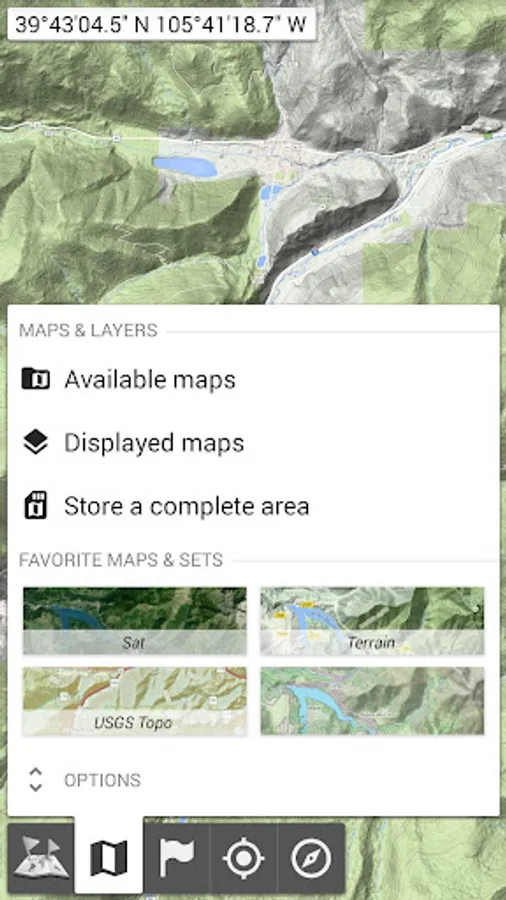
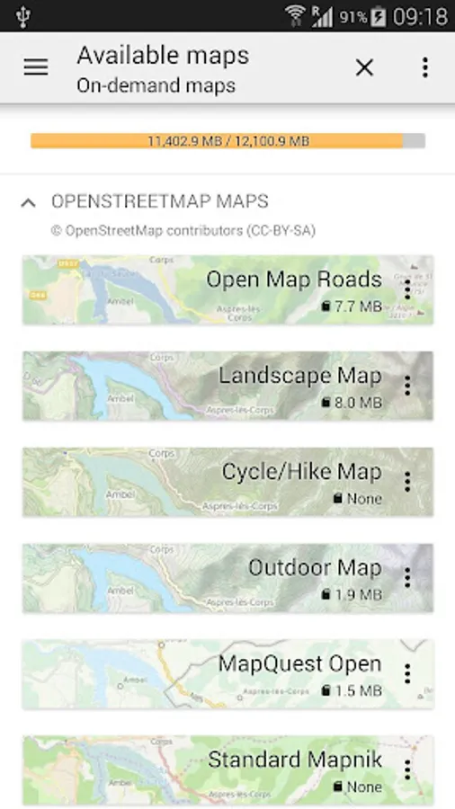
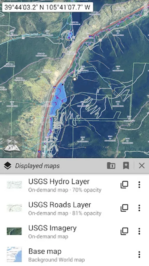
A lot of maps are available, including classical road maps, topographic maps, aerial (satellite) maps and various layers that can be added over any maps: OpenStreetMap (Roads, Topo), USGS National Map (Hi-res topo, Aerial imagery), Worldwide Military Soviet topo maps, etc.
• All maps can be stacked in layers, with precise opacity control;
• Select and store large areas in few clicks;
• Stored space is clear and can be easily deleted.
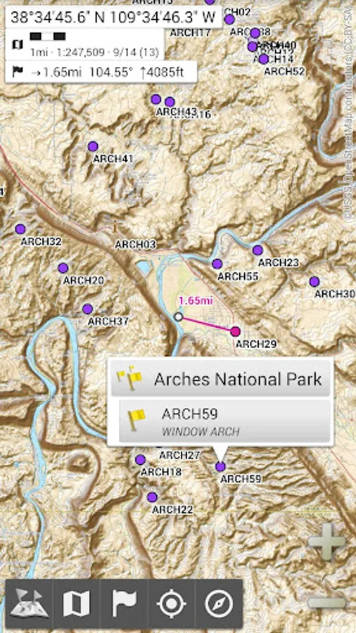
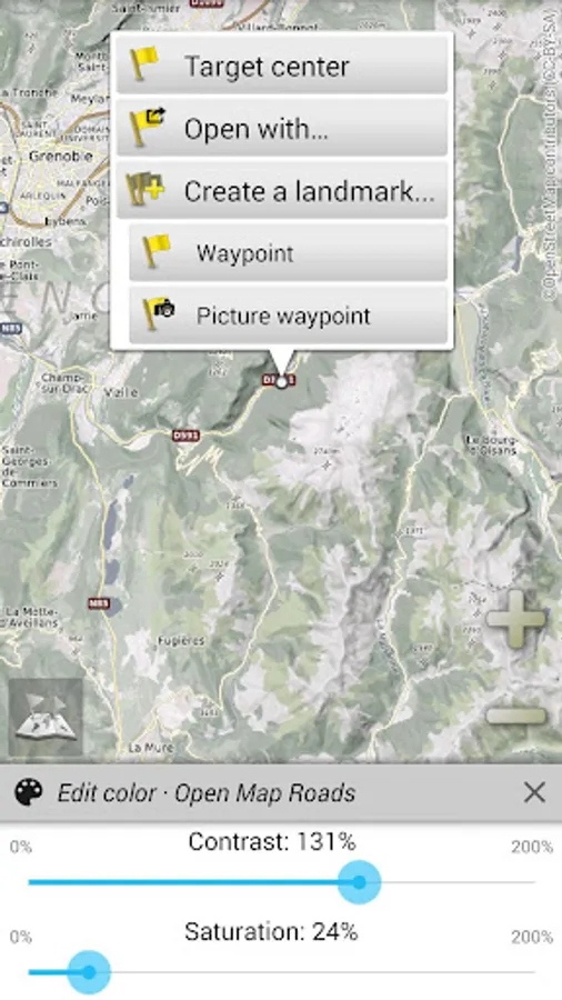
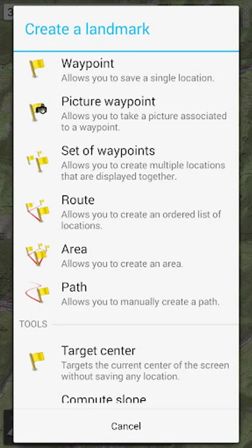
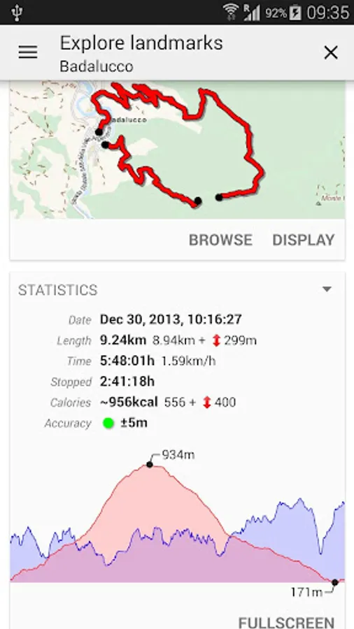
★★ Display, store and retrieve unlimited placemarks ★★
You can add various items on the map such as waypoints, icons, routes, areas and tracks.
You can easily manage them using the powerful SD-Card Placemarks Explorer.
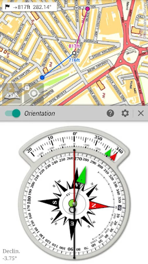
★★ On-map GPS Location & Orientation ★★
Your real location and direction are clearly displayed on the map, which can be rotated to match your real orientation (depends on device capabilities).
Easy turn on/off to save battery.
And also:
• Metric, imperial and hybrid distance units;
• GPS Latitude/Longitude and grid coordinate formats (UTM, MGRS, USNG, OSGB Grid, Irish Grid, Swiss Grid, Lambert Grids, DFCI Grid, QTH Maidenhead Locator System, …);
• Ability to import hundreds of coordinate formats from https://www.spatialreference.org;
• On-map grids display;
• Full screen map view;
• Multi-touch zoom;
• …
★★ Need more? ★★
If you are a real adventurer, try AlpineQuest Off-Road Explorer, the complete outdoor solution based on All-In-One OfflineMaps, loaded with a powerful GPS Track Recorder and more: https://www.alpinequest.net/google-play
Bored to wait for maps to display? Use All-In-One OfflineMaps! Once displayed, maps are stored and remain available, quickly, even with no network access.
• Want more than just roads on your maps? You will find what you need here;
• Used to go to places with poor network coverage? Everything will stay available;
• Used to go abroad? You won’t be lost anymore;
• Have a data allowance limit? It will reduce your usage.
★★ Maps ★★
A lot of maps are available, including classical road maps, topographic maps, aerial (satellite) maps and various layers that can be added over any maps: OpenStreetMap (Roads, Topo), USGS National Map (Hi-res topo, Aerial imagery), Worldwide Military Soviet topo maps, etc.
• All maps can be stacked in layers, with precise opacity control;
• Select and store large areas in few clicks;
• Stored space is clear and can be easily deleted.
★★ Display, store and retrieve unlimited placemarks ★★
You can add various items on the map such as waypoints, icons, routes, areas and tracks.
You can easily manage them using the powerful SD-Card Placemarks Explorer.
★★ On-map GPS Location & Orientation ★★
Your real location and direction are clearly displayed on the map, which can be rotated to match your real orientation (depends on device capabilities).
Easy turn on/off to save battery.
And also:
• Metric, imperial and hybrid distance units;
• GPS Latitude/Longitude and grid coordinate formats (UTM, MGRS, USNG, OSGB Grid, Irish Grid, Swiss Grid, Lambert Grids, DFCI Grid, QTH Maidenhead Locator System, …);
• Ability to import hundreds of coordinate formats from https://www.spatialreference.org;
• On-map grids display;
• Full screen map view;
• Multi-touch zoom;
• …
★★ Need more? ★★
If you are a real adventurer, try AlpineQuest Off-Road Explorer, the complete outdoor solution based on All-In-One OfflineMaps, loaded with a powerful GPS Track Recorder and more: https://www.alpinequest.net/google-play
All-In-One Offline Maps Screenshots
Tap to Rate:
Reviews for All-In-One Offline Maps
Ivan Basallote
12/29/2025
it's so nice to use this apps is nice
soeminthein spkt
12/28/2025
good app