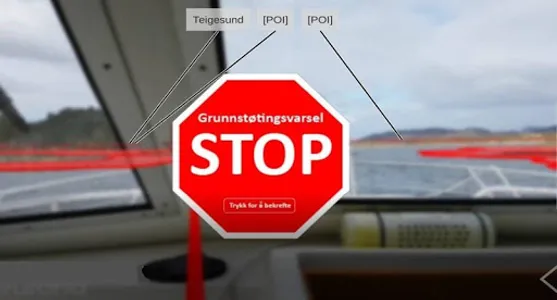
This app alerts you image and audio 30 seconds before you enter the 3-meter chart of the chart. It also works in a closed position in the pocket or in a strap on the arm. Now the app is on, the camera image is used to display areas in the 3-meter chart of the charts with transparent red polygons.
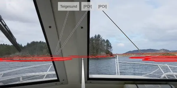
The 3-meter curve is provided by the Mapping division of the sea and refers to depths in relation to 0-level for depths in the seaplane. The app is intended to be used on Android phones and tablets with forward-looking chambers. Set in a punch on the window and directed forward, the app shows camera images with stored NoGo areas (areas deeper than 3 meters at low tide) in transparent red. A «course-speed vector» points in front of the boat in the direction of heading. The length of the vector is configurable; in default option it is set to 30 seconds.
The phone can also be held by hand to see No-Go areas surrounding the boat. The quality of the phone's compass then determines how accurate the display will be.
Show More