FWAC Wildfire Map
Fire, Weather & Avalanche Center
2.9 ★
80 ratings
10,000+
downloads
Free
AppRecs review analysis
AppRecs rating 2.9. Trustworthiness 0 out of 100. Review manipulation risk 0 out of 100. Based on a review sample analyzed.
★★☆☆☆
2.9
AppRecs Rating
Ratings breakdown
5 star
28%
4 star
16%
3 star
14%
2 star
5%
1 star
38%
What to know
✓
Authentic reviews
Natural distribution, no red flags
⚠
Mixed user feedback
Average 2.9★ rating suggests room for improvement
⚠
High negative review ratio
43% of sampled ratings are 1–2 stars
About FWAC Wildfire Map
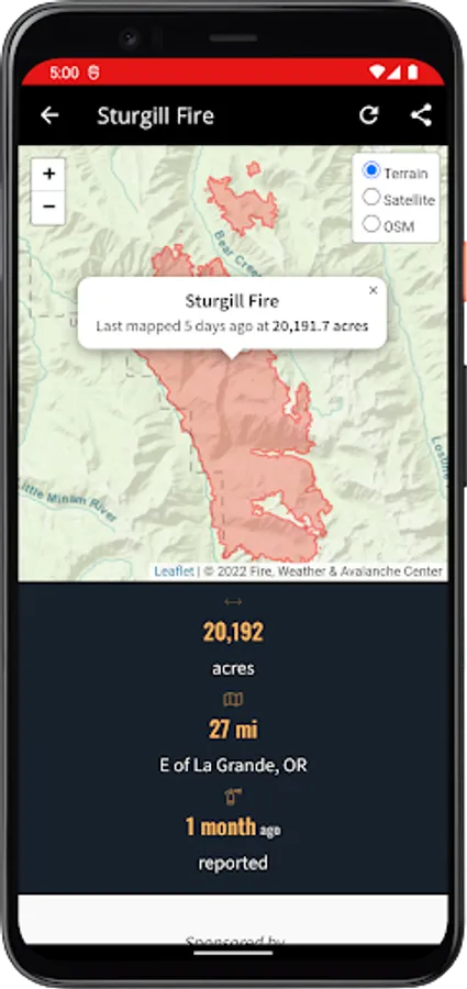
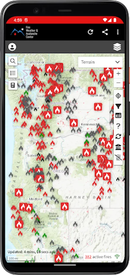
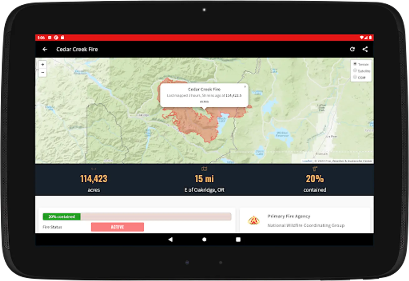
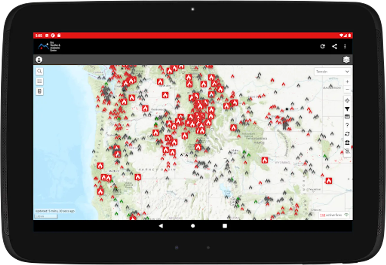
The Fire, Weather & Avalanche Center (FWAC) Wildfire Map app is a great tool for checking for wildfires--big or small--across the country. In addition to large wildfire incidents, our map also incorporates smoke checks, prescribed burns, and smaller wildfires that you usually don't hear about because they're only a couple acres in size.
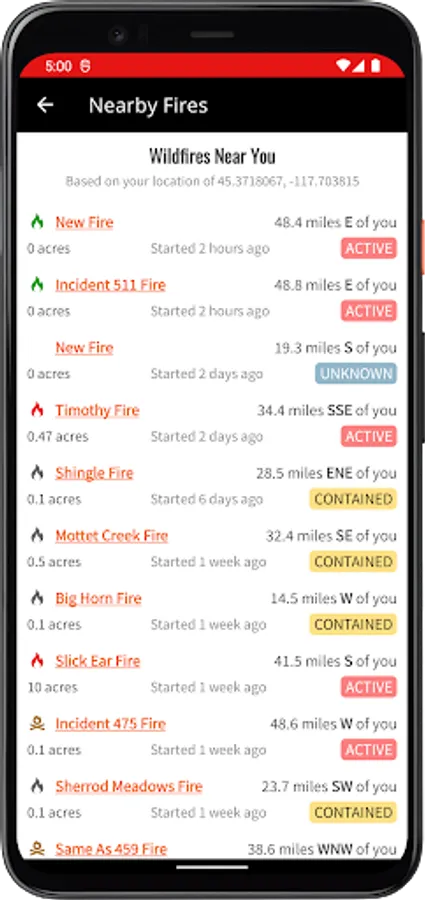
The same great wildfire map on our website is available for Android with another feature that uses your location to find wildfires that are closest to you!
The same great wildfire map on our website is available for Android with another feature that uses your location to find wildfires that are closest to you!
FWAC Wildfire Map Screenshots
Tap to Rate: