Drone Tracker - Drone Radar
SjajnoAplikeRazvoj
2.0 ★
store rating
10,000+
downloads
Free
In this drone detection app, you can scan for nearby drones using RemoteID signals and view their flight paths on a live map. Includes real-time drone detection, flight information, and multi-signal scanning support.
AppRecs review analysis
AppRecs rating 1.8. Trustworthiness 72 out of 100. Review manipulation risk 24 out of 100. Based on a review sample analyzed.
★☆☆☆☆
1.8
AppRecs Rating
Ratings breakdown
5 star
25%
4 star
0%
3 star
0%
2 star
0%
1 star
75%
What to know
✓
Low review manipulation risk
24% review manipulation risk
⚠
Mixed user feedback
Average 2.0★ rating suggests room for improvement
⚠
High negative review ratio
75% of sampled ratings are 1–2 stars
About Drone Tracker - Drone Radar
✨ Drone Tracker Drone Radar – Find Drones Near You in Real Time
Discover the skies around you with Drone Tracker Drone Radar — the ultimate app for drone detection, drone tracking, and live drone mapping.
Using advanced Bluetooth, Wi-Fi NAN, and Wi-Fi Beacon scanning, this app spots drones broadcasting RemoteID and shows them on a live drone radar map.
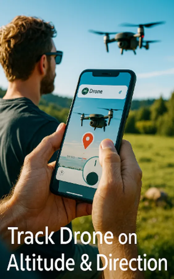
Whether you’re a drone pilot, hobbyist, or simply curious, you can now find drones near you, view their flight paths, and check their speed, altitude, and ID.
✈ Key Features
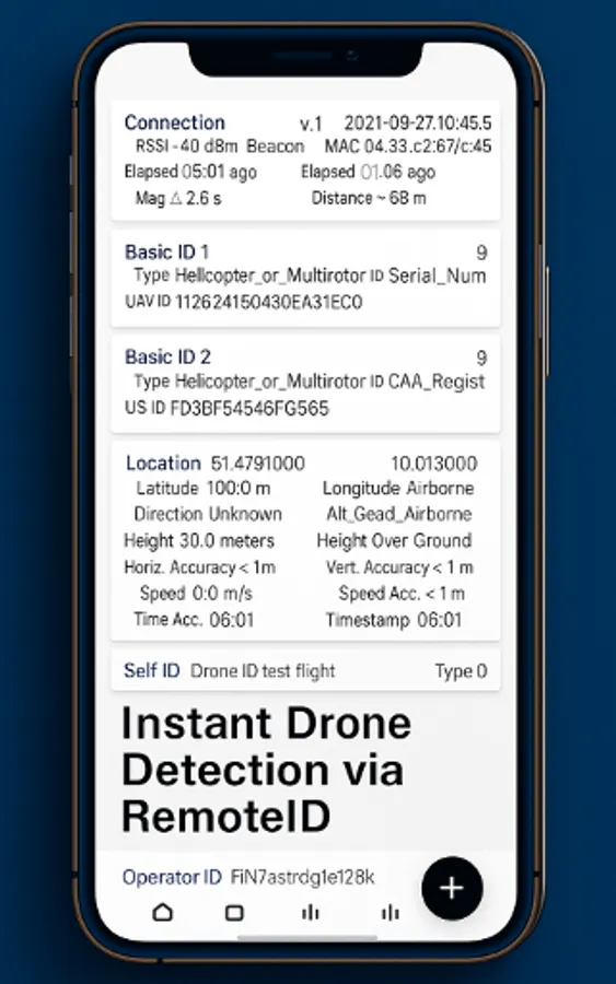
➡️ Drone Detection Near Me – Instantly find drones in your area using RemoteID.
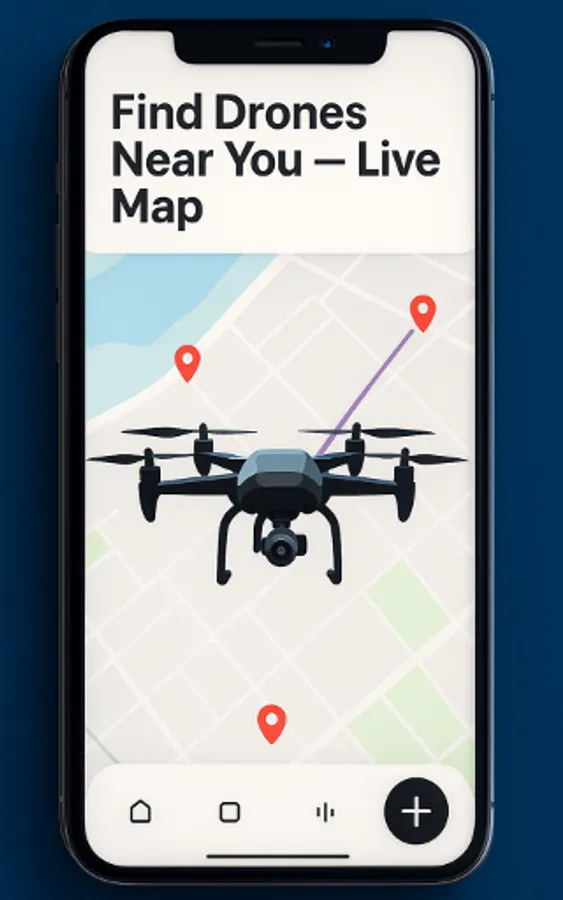
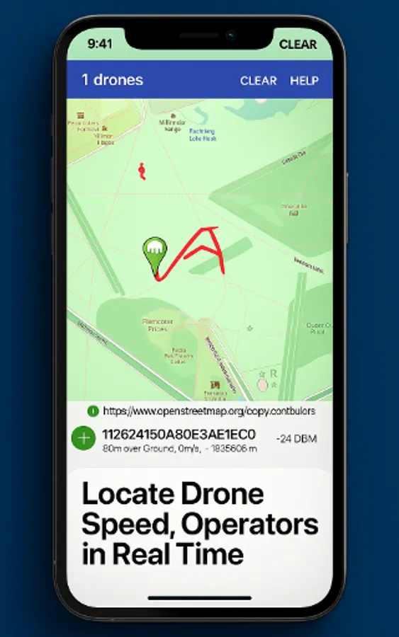
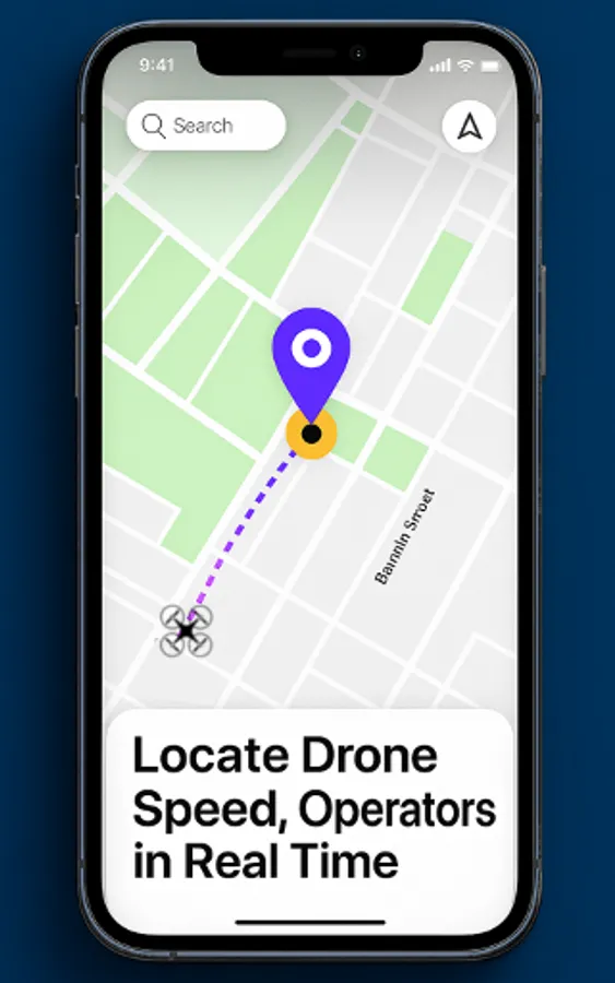
➡️ Live Drone Map & Radar – Track drone locations and flight paths in real time.
➡️ Multi-Signal Drone Scanner – Supports Bluetooth Legacy & Long Range, Wi-Fi NAN, Wi-Fi Beacon.
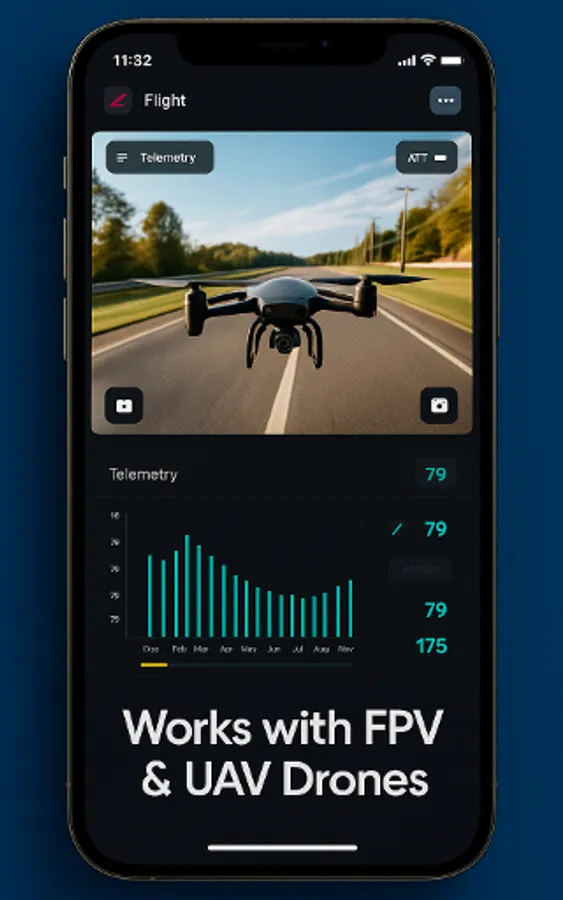
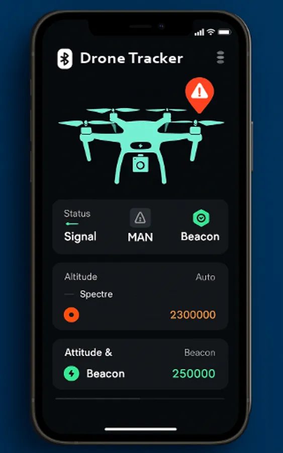
➡️ Detailed Drone Flight Info – Speed, altitude, direction, and operator details.
➡️ Standards-Compliant – Built on ASTM F3411 & ASD-STAN prEN 4709-002.
➡️ Open Source & Community Driven – Free to use and constantly improved.
🌍 Perfect For
Drone lovers spotting nearby flights for fun.
Pilots who want awareness of other drones in the air.
Tech fans exploring UAV & RemoteID technology.
Event organizers keeping skies safe.
🔍 How It Works
Open the app anywhere — at home, at the park, or during an event.
Tap Scan to detect active drones broadcasting RemoteID.
See each drone’s position on your live map and tap for full details.
✨ Why Drone Tracker Drone Radar?
Unlike generic radar apps, this is a purpose-built drone finder and tracker for real-time awareness and safety. Whether you want to spot drones near you or understand the UAV activity overhead, this is your go-to tool.
✨ Stay informed. Stay safe. See the skies like never before.
Discover the skies around you with Drone Tracker Drone Radar — the ultimate app for drone detection, drone tracking, and live drone mapping.
Using advanced Bluetooth, Wi-Fi NAN, and Wi-Fi Beacon scanning, this app spots drones broadcasting RemoteID and shows them on a live drone radar map.
Whether you’re a drone pilot, hobbyist, or simply curious, you can now find drones near you, view their flight paths, and check their speed, altitude, and ID.
✈ Key Features
➡️ Drone Detection Near Me – Instantly find drones in your area using RemoteID.
➡️ Live Drone Map & Radar – Track drone locations and flight paths in real time.
➡️ Multi-Signal Drone Scanner – Supports Bluetooth Legacy & Long Range, Wi-Fi NAN, Wi-Fi Beacon.
➡️ Detailed Drone Flight Info – Speed, altitude, direction, and operator details.
➡️ Standards-Compliant – Built on ASTM F3411 & ASD-STAN prEN 4709-002.
➡️ Open Source & Community Driven – Free to use and constantly improved.
🌍 Perfect For
Drone lovers spotting nearby flights for fun.
Pilots who want awareness of other drones in the air.
Tech fans exploring UAV & RemoteID technology.
Event organizers keeping skies safe.
🔍 How It Works
Open the app anywhere — at home, at the park, or during an event.
Tap Scan to detect active drones broadcasting RemoteID.
See each drone’s position on your live map and tap for full details.
✨ Why Drone Tracker Drone Radar?
Unlike generic radar apps, this is a purpose-built drone finder and tracker for real-time awareness and safety. Whether you want to spot drones near you or understand the UAV activity overhead, this is your go-to tool.
✨ Stay informed. Stay safe. See the skies like never before.