About Podpoľanie
The application is a useful tool every visitor Podpoľania.
The mobile application comfortably together all the necessary information for tourists and inhabitants of the southern part of Podpoľania. Cadastral covers cities: Detva and Hrinova and municipalities: Detvianska Huta, Fabrics, Krivan, Podkriváň, Korytárky, Klokoč, Vígľašská Huta Kalinka, Vígľaš, Stara Huta, Slatinské Lazy, Zvolen, Očová, Hrochoť, Buda, Dúbravy.
Wall contains information about events, events, events in the region (date, place and brief description of the event).
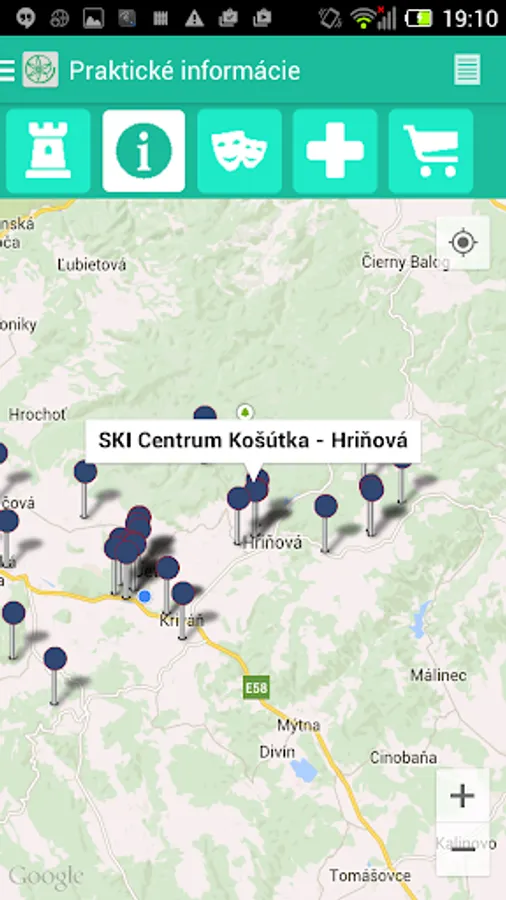
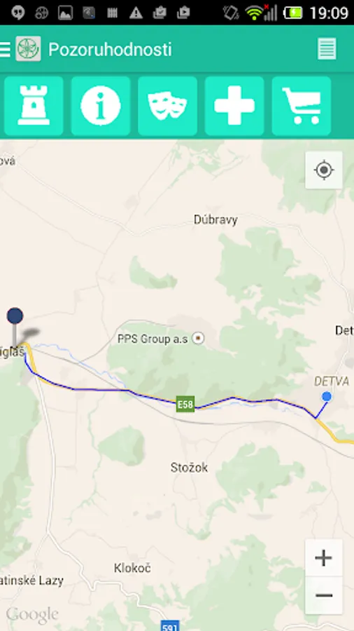
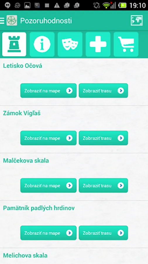
The section of the application site offers various categories of particular interest to tourists such as: eating, relax, accommodation, sport, attractions, sights. In case of approval of location, application map records the current location of the mobile phone. After opening as restaurants, are to provide basic information about the services and the possibility to see the routes from the point - localization of a mobile phone to target the restaurant. In the event that the operator of a website is also available on www.
Application allows user registration, if it is interested in engaging in discussion or posting comments tourism services that includes Applications.
The application is a useful tool for every visitor Podpoľania.
Comprehensive information on Podpoľaní can be found on the website portal www.podpolanie.sk
The mobile application comfortably together all the necessary information for tourists and inhabitants of the southern part of Podpoľania. Cadastral covers cities: Detva and Hrinova and municipalities: Detvianska Huta, Fabrics, Krivan, Podkriváň, Korytárky, Klokoč, Vígľašská Huta Kalinka, Vígľaš, Stara Huta, Slatinské Lazy, Zvolen, Očová, Hrochoť, Buda, Dúbravy.
Wall contains information about events, events, events in the region (date, place and brief description of the event).
The section of the application site offers various categories of particular interest to tourists such as: eating, relax, accommodation, sport, attractions, sights. In case of approval of location, application map records the current location of the mobile phone. After opening as restaurants, are to provide basic information about the services and the possibility to see the routes from the point - localization of a mobile phone to target the restaurant. In the event that the operator of a website is also available on www.
Application allows user registration, if it is interested in engaging in discussion or posting comments tourism services that includes Applications.
The application is a useful tool for every visitor Podpoľania.
Comprehensive information on Podpoľaní can be found on the website portal www.podpolanie.sk
Podpoľanie Screenshots
Tap to Rate: