About INGRADA mobile
With INGRADA mobile you can manage your geodata from anywhere and at any time on your smartphone and tablet. The intuitive user interface and simple application opens up the world of geoinformation systems for beginners.
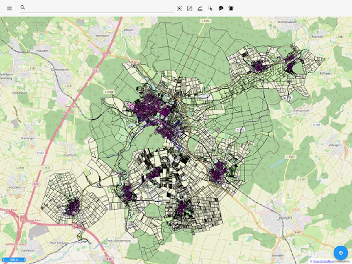
INGRADA mobile app enables simple and clear management and analysis of geographical data. Easily capture geodata on site with your smartphone or tablet - from green spaces and streets to traffic signs and furniture. Use powerful analytics tools to explore data and gain valuable insights. Visualize complex relationships in clear maps, diagrams and statistics to make informed decisions.
Features and highlights
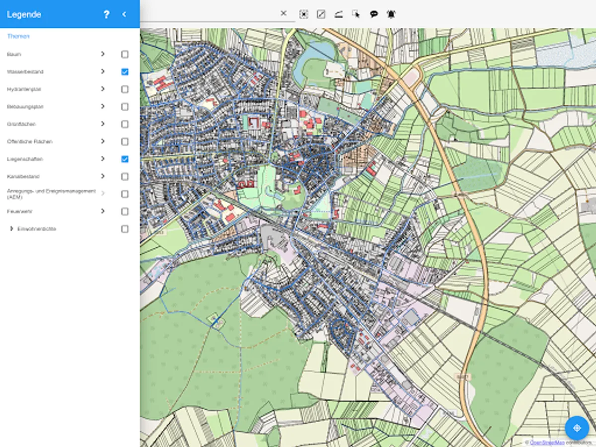
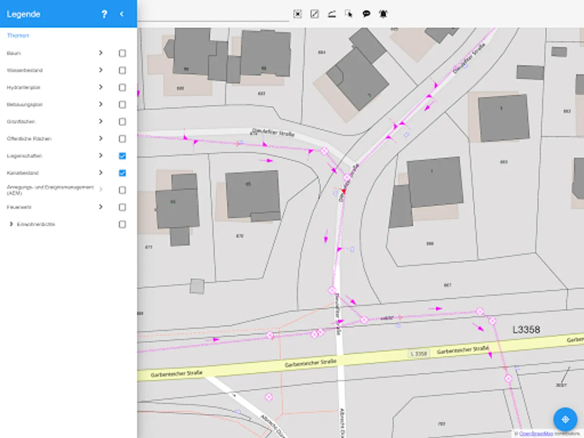
Simple and individual layer control
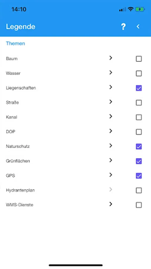
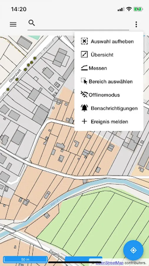
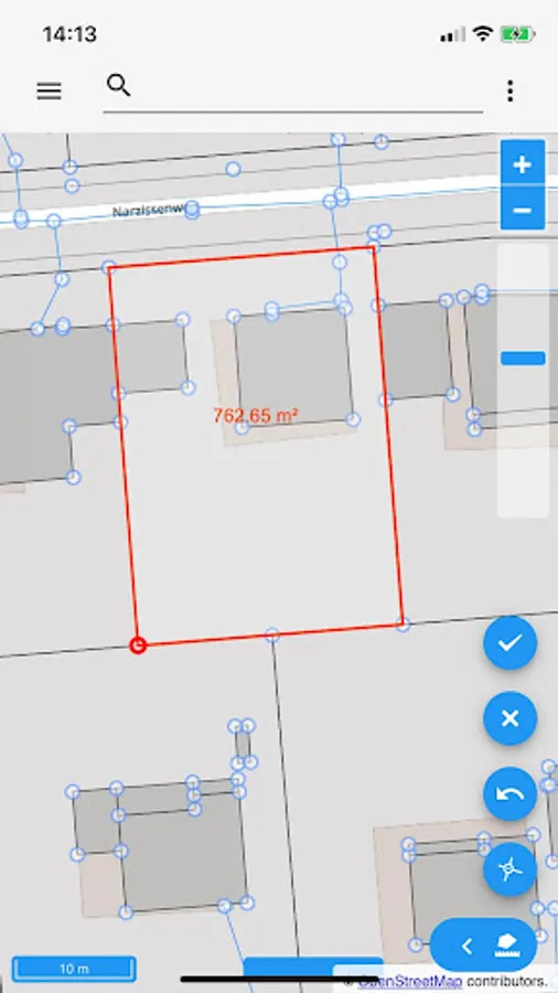
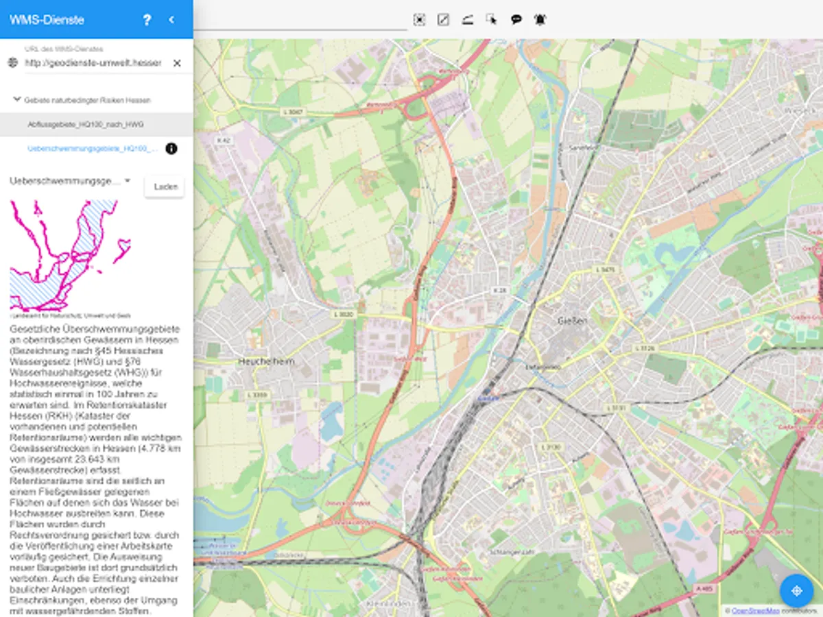
Control map content via the legend. Overlay your map with thematic content from WMS services. Measure distances and areas or stake out radii.
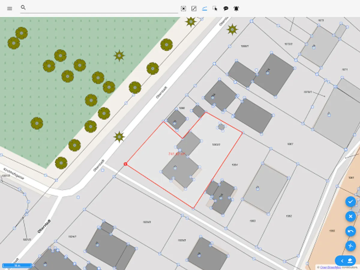
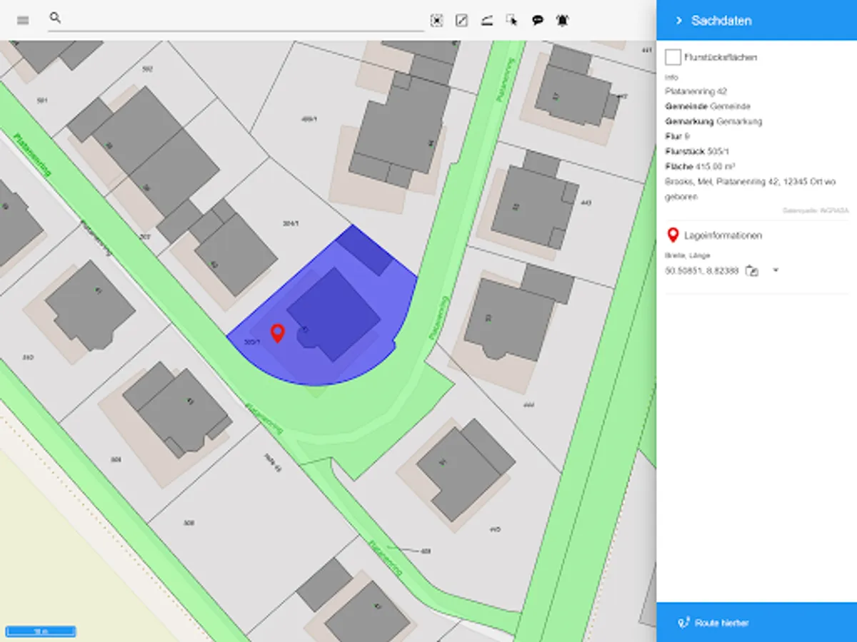
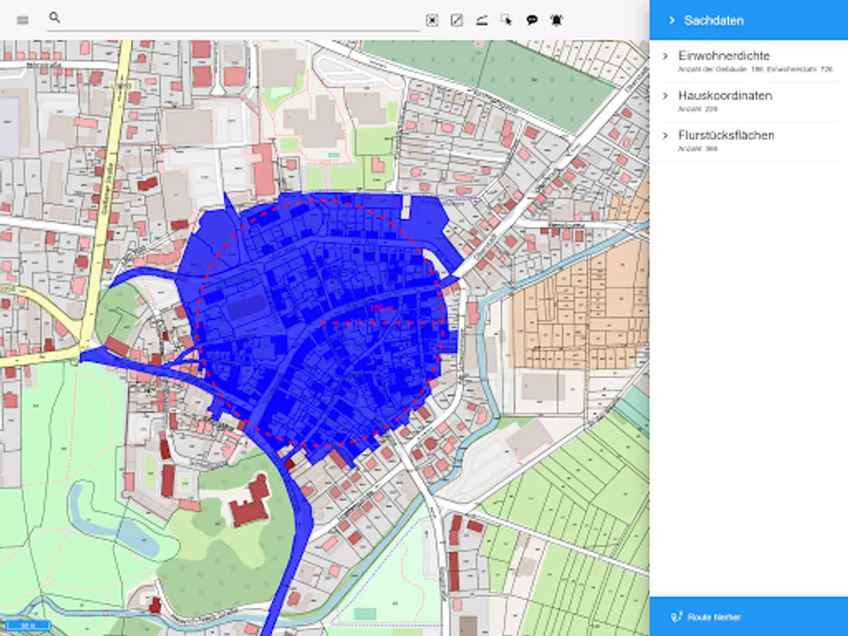
Precise geospatial data processing
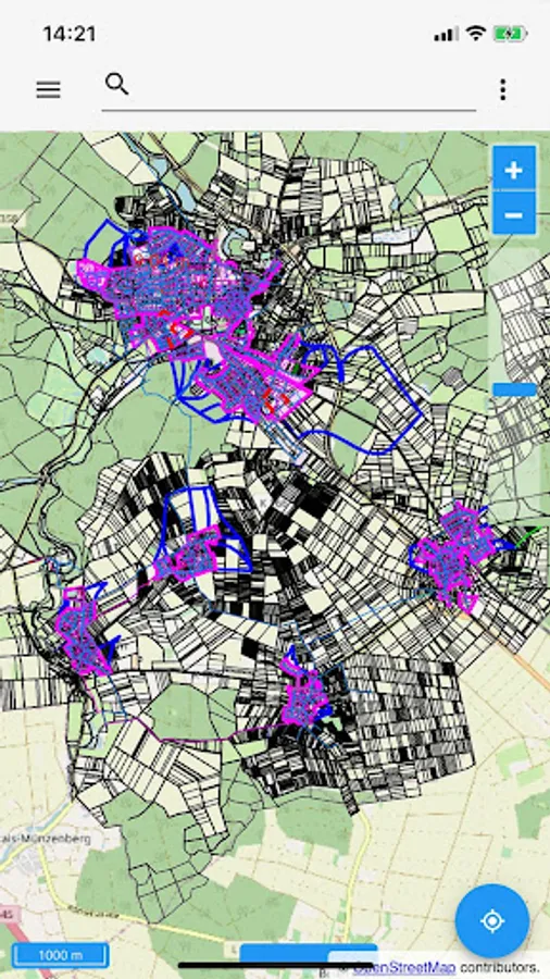
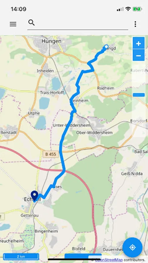
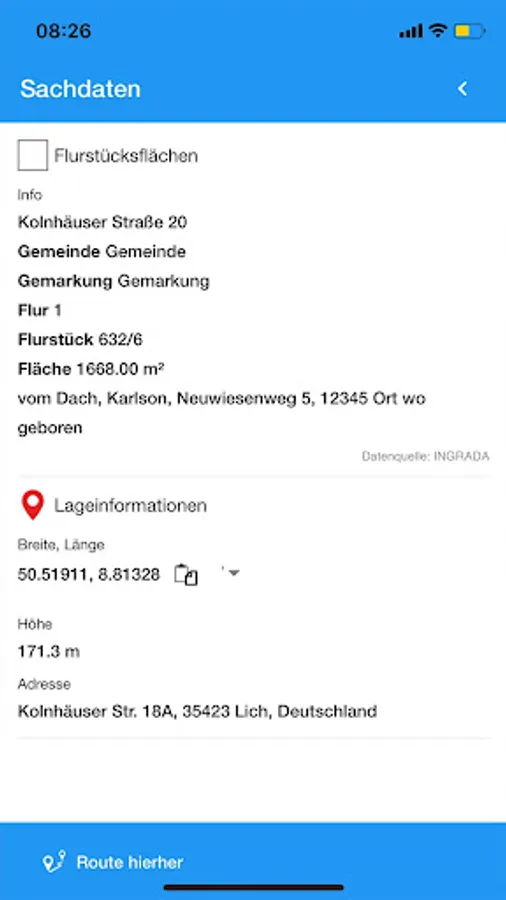
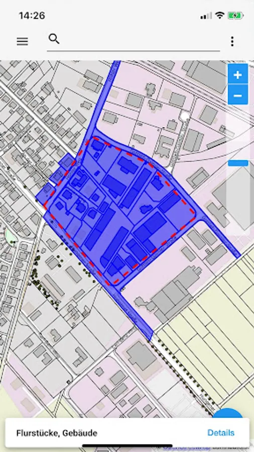
Determine your position and retrieve information about surrounding objects, such as the location and details of fire hydrants, structures, land, sports and green spaces, cycling and hiking trails, parking lots, bus stops and much more. With INGRADA mobile you have access to your GIS data anytime, anywhere.
Online and offline operation
If desired, INGRADA mobile saves the required data locally on your device so that you have access to your geoinformation at any time, even without an internet connection.
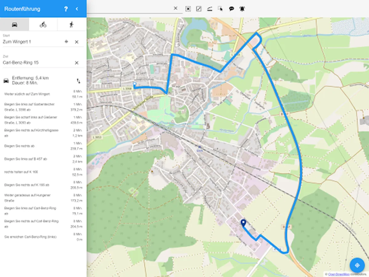
Applications for service providers, companies and administrations
Make your geoinformation system mobile. Whether administrative employees, service providers or members of municipal committees: Use INGRADA mobile wherever and whenever you need your geoinformation. Retrieve information on building plots, neighboring parcels or the route of supply and disposal lines - in meetings and meetings or directly on site.
Download the INGRADA mobile app now and get started:
Once you download INGRADA mobile, a world of possibilities is open to you. With just a few clicks you can try out the topic cards in a secure test environment. If you want to use your own geoinformation, you need a valid customer license. For further information, simply contact us: by phone at (0641) 98 246-0 or by email at info@softplan-informatik.de
INGRADA mobile app enables simple and clear management and analysis of geographical data. Easily capture geodata on site with your smartphone or tablet - from green spaces and streets to traffic signs and furniture. Use powerful analytics tools to explore data and gain valuable insights. Visualize complex relationships in clear maps, diagrams and statistics to make informed decisions.
Features and highlights
Simple and individual layer control
Control map content via the legend. Overlay your map with thematic content from WMS services. Measure distances and areas or stake out radii.
Precise geospatial data processing
Determine your position and retrieve information about surrounding objects, such as the location and details of fire hydrants, structures, land, sports and green spaces, cycling and hiking trails, parking lots, bus stops and much more. With INGRADA mobile you have access to your GIS data anytime, anywhere.
Online and offline operation
If desired, INGRADA mobile saves the required data locally on your device so that you have access to your geoinformation at any time, even without an internet connection.
Applications for service providers, companies and administrations
Make your geoinformation system mobile. Whether administrative employees, service providers or members of municipal committees: Use INGRADA mobile wherever and whenever you need your geoinformation. Retrieve information on building plots, neighboring parcels or the route of supply and disposal lines - in meetings and meetings or directly on site.
Download the INGRADA mobile app now and get started:
Once you download INGRADA mobile, a world of possibilities is open to you. With just a few clicks you can try out the topic cards in a secure test environment. If you want to use your own geoinformation, you need a valid customer license. For further information, simply contact us: by phone at (0641) 98 246-0 or by email at info@softplan-informatik.de