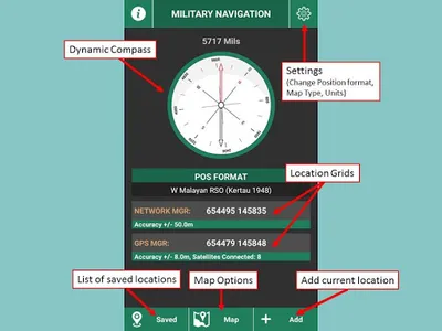
• Position Formats include Latitude/Longitude, UTM (WGS84), UPS, Malayan RSO and many more.
• Compass Function (Available in Degrees or Mils).
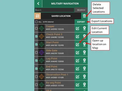
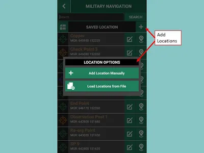
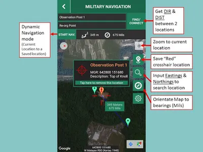
• Save Current Location/ View location on Map
• Color coded location markers for easier identification
• Make changes to saved locations
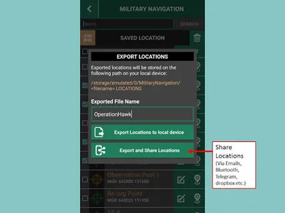
• Location sharing options (Export selected Locations, Share exported locations via Email, Bluetooth, Telegram etc., Import exported locations)
• Grid Conversion (E.g. Lat/Long to UTM)
• “Search Grid” option
• Dynamic map to bearing orientation
• Display Direction and Distance between 2 locations
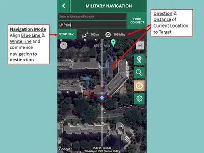
• Navigation function (Current location to destination)
• ***IT’S 100% FREE, NO ADS***
• Compass Function (Available in Degrees or Mils).
• Save Current Location/ View location on Map
• Color coded location markers for easier identification
• Make changes to saved locations
• Location sharing options (Export selected Locations, Share exported locations via Email, Bluetooth, Telegram etc., Import exported locations)
• Grid Conversion (E.g. Lat/Long to UTM)
• “Search Grid” option
• Dynamic map to bearing orientation
• Display Direction and Distance between 2 locations
• Navigation function (Current location to destination)
• ***IT’S 100% FREE, NO ADS***
Show More