AppRecs review analysis
AppRecs rating 2.3. Trustworthiness 82 out of 100. Review manipulation risk 27 out of 100. Based on a review sample analyzed.
★★☆☆☆
2.3
AppRecs Rating
Ratings breakdown
5 star
33%
4 star
0%
3 star
0%
2 star
0%
1 star
67%
What to know
✓
Low review manipulation risk
27% review manipulation risk
✓
Credible reviews
82% trustworthiness score from analyzed reviews
⚠
Mixed user feedback
Average 2.3★ rating suggests room for improvement
About Best Area
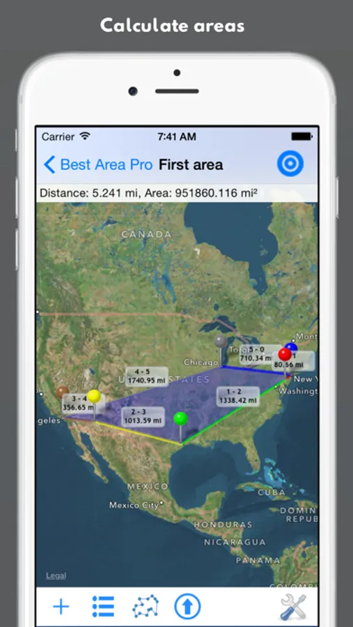
Our app facilitates field survey and enables you to determine distances and areas on a map.
Fields of application are measuring of floor space, lawn, fencing, asphalt coatings, forest areas, squares, buildings, landscape, flat roofs, etc. At the same time, measuring distances is possible for walking distances or routes covered by bicycle or car.
‚Best Area‘ offers the same functionality as ‚Best Area Pro‘. However, advertising will be displayed and the number of places is limited to nine.
Our app offers the following features:
- Measuring distances and areas
- Several option for entering locations
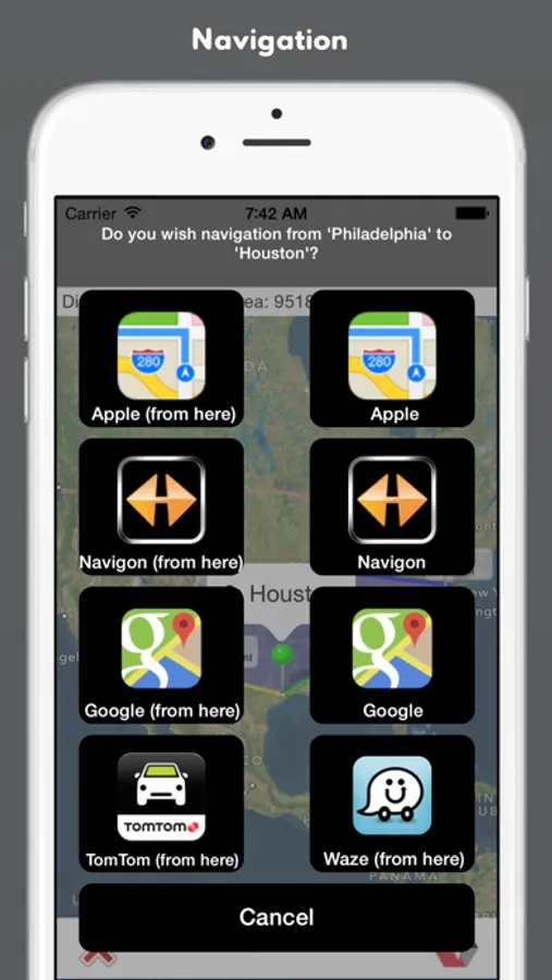
- Navigation function
- Automatic recognition of areas
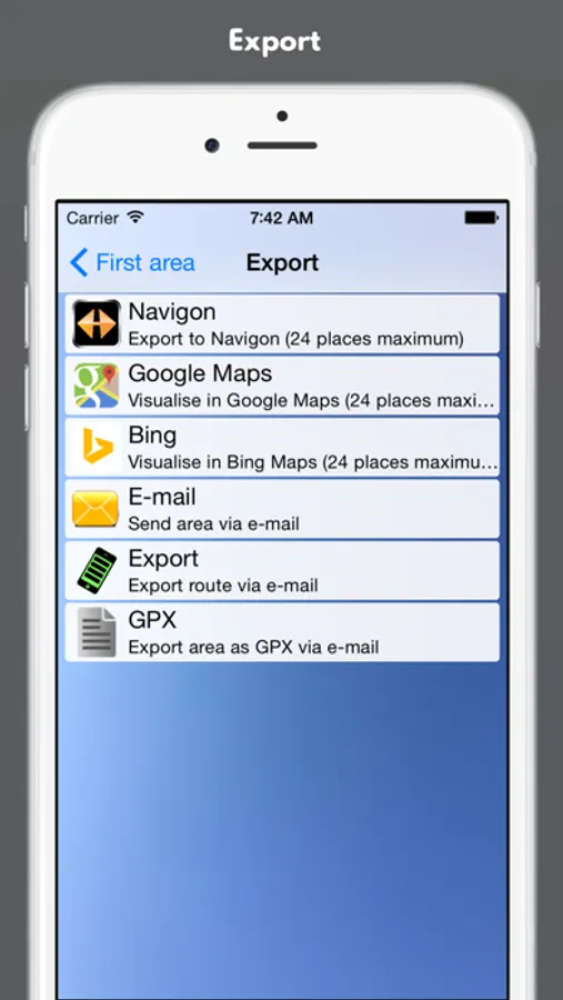
- GPX import/export
- Switching between metrical and imperial measuring system
- Support of diverse maps
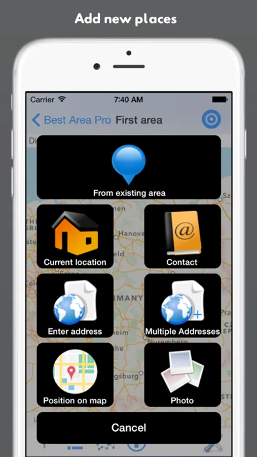
Entering locations:
- Directly from point in map
- Typing in address with automatic recognition
- Location of photo
- From existing area
Possible navigations:
- Apple Maps
- Google Maps
- Navigon
- Waze
- TomTom
Fields of application are measuring of floor space, lawn, fencing, asphalt coatings, forest areas, squares, buildings, landscape, flat roofs, etc. At the same time, measuring distances is possible for walking distances or routes covered by bicycle or car.
‚Best Area‘ offers the same functionality as ‚Best Area Pro‘. However, advertising will be displayed and the number of places is limited to nine.
Our app offers the following features:
- Measuring distances and areas
- Several option for entering locations
- Navigation function
- Automatic recognition of areas
- GPX import/export
- Switching between metrical and imperial measuring system
- Support of diverse maps
Entering locations:
- Directly from point in map
- Typing in address with automatic recognition
- Location of photo
- From existing area
Possible navigations:
- Apple Maps
- Google Maps
- Navigon
- Waze
- TomTom