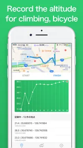
Elevation Logger record the elevation of the way you walk.
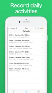
Why don’t you log the trajectory of mountain climbing, bicycle, daily running etc?
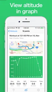
The recorded data can be checked by map and graph.
*** Recommended for people like this ***
· Those who like mountain climbing
· Those who like to ride a bicycle
· Those who want to check the inclination of the road you usually walk on
*** How to use ***
· Launch the application and press the "START" button
· Act (app works even in the background)
· press "FINISH" button to finish
· Check elevation data!
*** Main Feature ***
· "Maximum altitude" and "Minimum altitude" of the activity can be seen
· It is fun to see altitude transitions on a graph
· Activity can be recorded even offline (needs network to load elevation data)
*** Other ***
· Elevation data source is API of Google Maps (and Geographical Survey Institute in Japan)
· Depending on the location, altitude data may not be acquired
· Icons used in the app are using Icons 8's
(https://icons8.jp/)
Show More


