* What is Sea Drive?
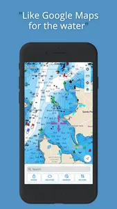
Sea Drive is a marine and boating application focused on charting, navigation, route building, track recording, tides, currents, and more! Our goal is to provide the best user experience for boaters on and off the water.
Sea Drive provides FREE US charts! We believe that everyone should have the tools on the water to feel safe and know how to find their way home (or pull up to a restaurant).
* Who is it for?
Sea Drive is for all of you who love the water! If you spend time on sailboats, fishing boats, bowriders, wakeboard boats, kayaks, or canoes this app will quickly become your go to co-captain
* What are the features?
**Offline Use
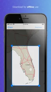
Sea Drive is meant to be used on the water and in the real world, that means cell service won't always be available. Charting, tides, currents, routing, tracks, GPS, compass, and more are all available without internet!
** Free Chart Data (US)
Currently only US charts are available (and will always remain free thanks to NOAA and your tax dollars). As Sea Drive improves we will be adding other chart regions for free or as low cost as possible.
** Tides and Currents
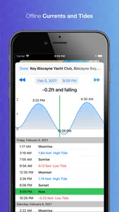
Tap a tides or currents icons on the chart to view offline predictions (for years into the future) at over 3000 locations.
** Build and Navigate Routes
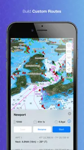
Build routes with easy to add waypoints, drag waypoints, delete waypoints, and give waypoints custom names. Export and share your routes with other boaters. Activate a route to see bearing (magnetic or true) to waypoints, estimated time to waypoints, and ETA at destination among other metrics.
** Record Tracks
Review and playback previously recorded tracks.
** Create and Share Markers
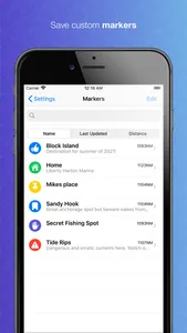
Add notes and measure distances to markers.
** Basic Features
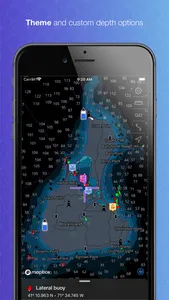
Location (GPS & Compass). Caliper tool. Display settings for custom chart options. Vessel details for hazard avoidance and route planning. Satellite and road map chart overlays.
** POI
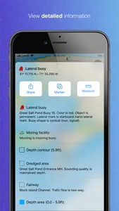
We've integrated with marinas.com so we can show points interest directly on the chart for features like marinas, boat ramps, anchorage areas, inlets, locks, harbors and more.
** Weather
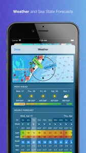
View weather forecasts for up to five days in the future including marine related weather like wind, gusts, swells, and wave information.
** Live Track Sharing
Create a live track share and send the link to friends. When imported, followers will see your current location and previous track directly on the Sea Drive app or website.
* We love feedback!
Sea Drive is built by boaters for boaters. This is just the start of our journey and we would like you all to be a part of it with us! Please provide any and all feedback!
Show More
