About Wanderfreund
Wanderfreund is your digital map and guide for long-distance hiking trails and tours in Germany. Wanderfreund offers you everything a "thru-hiker" needs for exploring the most beautiful German trails. Wanderfreund includes the following features:
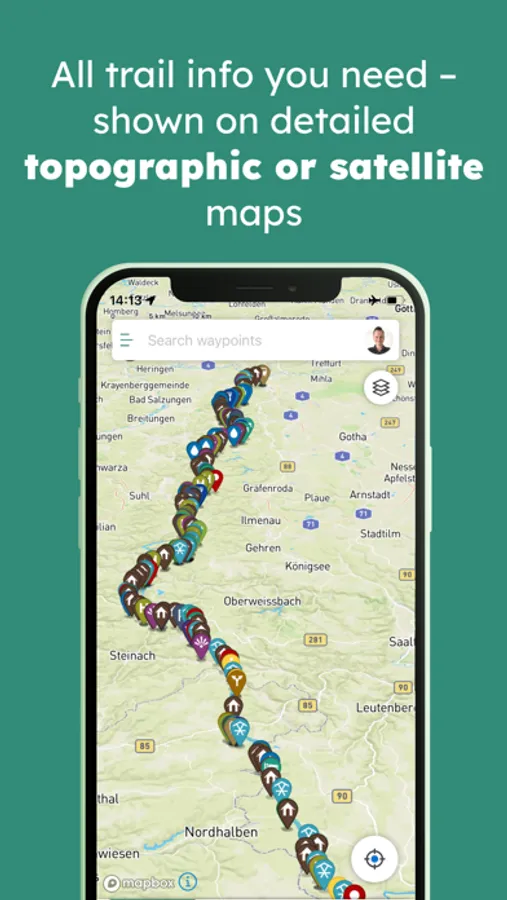
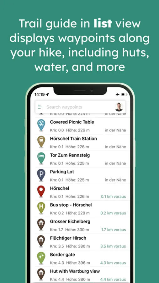
- Professionally curated and up-to-date trail information: Exact route, elevation profile, and thousands of waypoints.
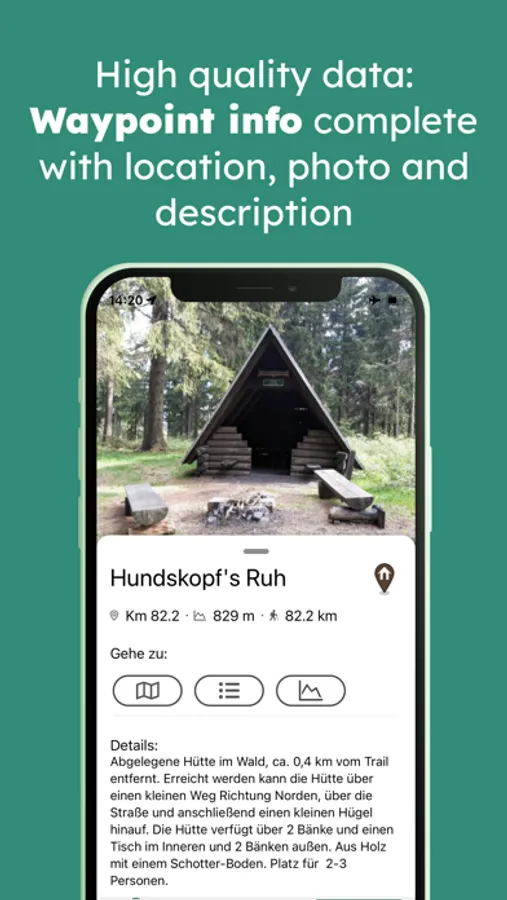
- Waypoints include detailed descriptions and photos for huts, water sources, towns, transportation and more.
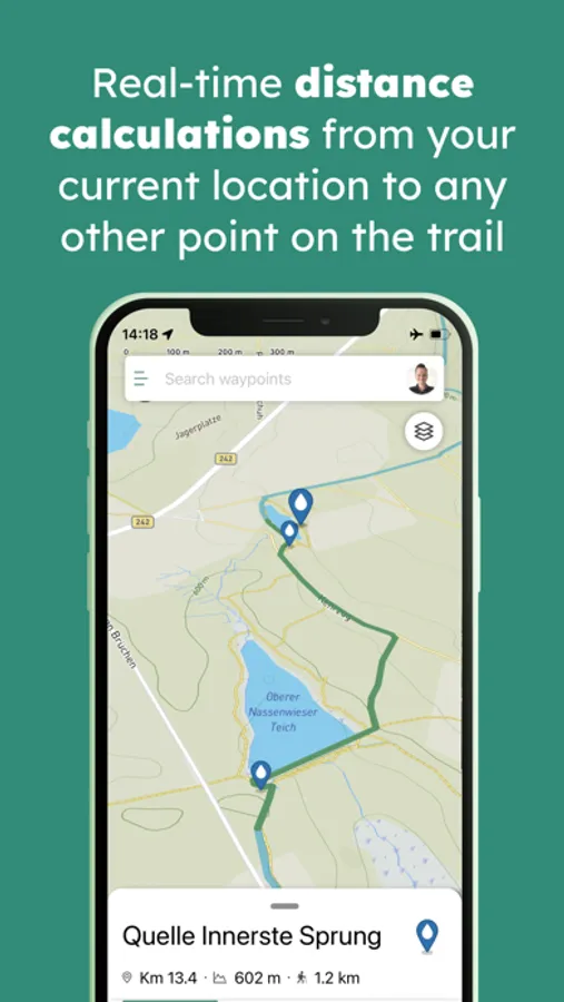
- Real-time calculations show the exact distance between your own location and any other place along the trail.
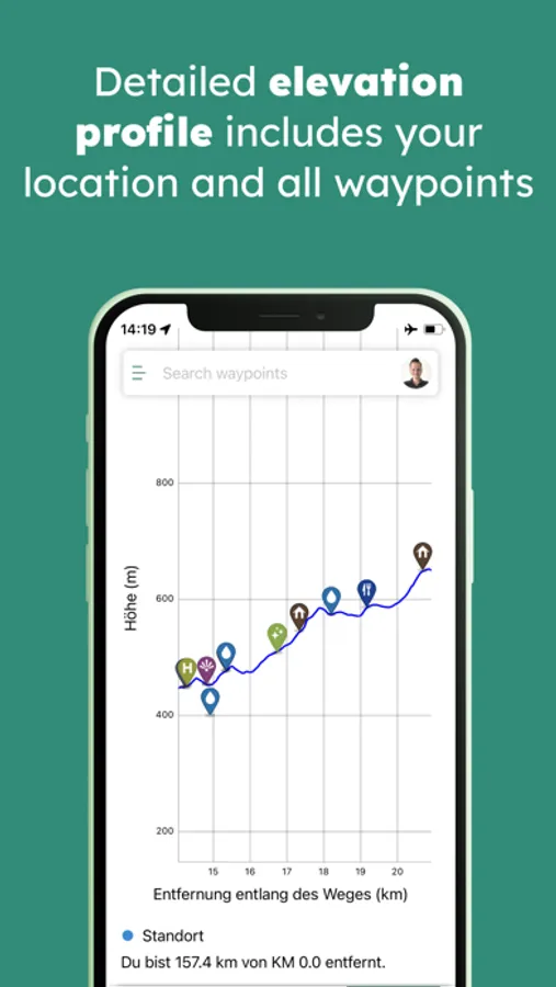
- Elevation profile shows your current location alongside all waypoints so you know how much climbing or descending is ahead.
- Detailed base-maps for your entire route.
- Fully functional offline: Simply download waypoint information, photos and maps, then navigate the trail even when you don't have cell service.
- Access to a dedicated long-distance hiking community: share live information and updates about the trail and waypoints with other users via the comment feature.
- Trails currently available in Wanderfreund: Rennsteig, Westweg, Hochrhöner, Weserberglandweg, Harzer Hexenstieg, Altmühltal Panoramaweg, Kammweg Erzgebirge-Vogtland. Many more are in the pipeline.
- Professionally curated and up-to-date trail information: Exact route, elevation profile, and thousands of waypoints.
- Waypoints include detailed descriptions and photos for huts, water sources, towns, transportation and more.
- Real-time calculations show the exact distance between your own location and any other place along the trail.
- Elevation profile shows your current location alongside all waypoints so you know how much climbing or descending is ahead.
- Detailed base-maps for your entire route.
- Fully functional offline: Simply download waypoint information, photos and maps, then navigate the trail even when you don't have cell service.
- Access to a dedicated long-distance hiking community: share live information and updates about the trail and waypoints with other users via the comment feature.
- Trails currently available in Wanderfreund: Rennsteig, Westweg, Hochrhöner, Weserberglandweg, Harzer Hexenstieg, Altmühltal Panoramaweg, Kammweg Erzgebirge-Vogtland. Many more are in the pipeline.
Wanderfreund Screenshots


Tap to Rate: