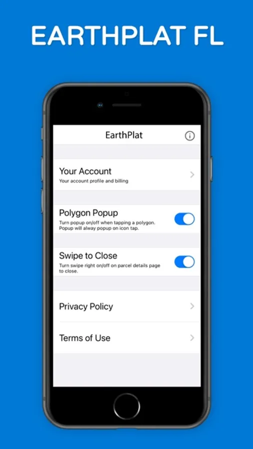
About EarthPlat
EarthPlat FL – Florida Property & Parcel Maps
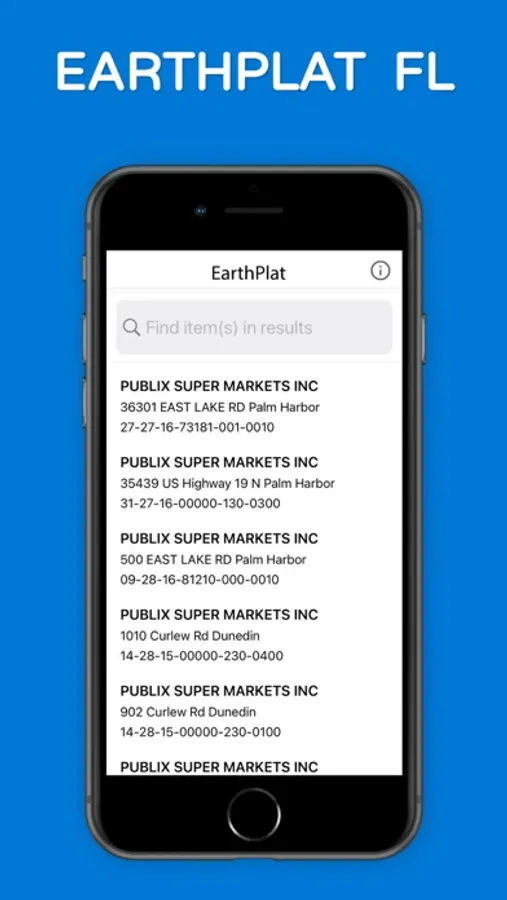
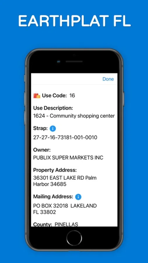
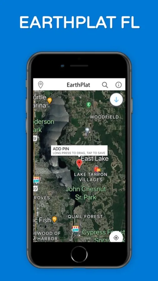
EarthPlat FL delivers real-time Florida property and parcel data using your iPhone or iPad’s GPS. Instantly search property boundaries, parcel maps, ownership details, and land information anywhere in Florida.
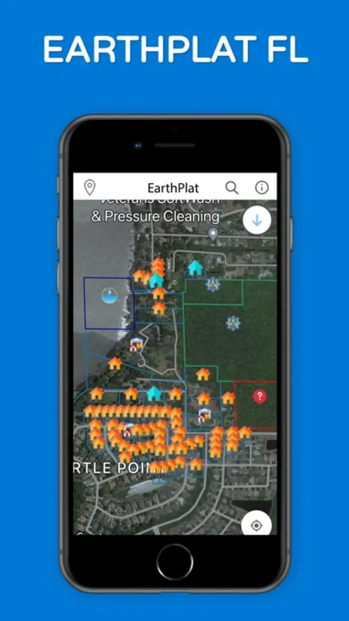
View over 10 million Florida parcels with accurate boundary lines and property data, updated and displayed directly on the map as you move. EarthPlat FL is built for real estate professionals, surveyors, contractors, land investors, and homeowners who need fast, reliable property information in the field.
Key Features
• Florida parcel maps with boundary lines
• GPS-based property search in real time
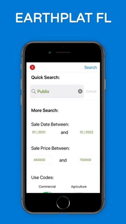
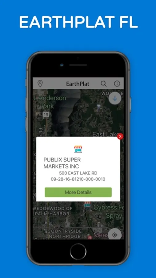
• Property ownership and parcel details
• Land and lot lookup across Florida
• Optimized for iPhone and iPad
EarthPlat FL provides statewide Florida property coverage, supporting all 67 Florida counties.
Florida County Coverage
Complete statewide coverage including Miami-Dade, Broward, Palm Beach, Orange, Hillsborough, Pinellas, Duval, Lee, Collier, Polk, Sarasota, Seminole, Volusia — and every Florida county.
Legal
Privacy Policy: https://earthplat.com/home/privacy
Terms of Use: https://earthplat.com/home/terms
EarthPlat FL delivers real-time Florida property and parcel data using your iPhone or iPad’s GPS. Instantly search property boundaries, parcel maps, ownership details, and land information anywhere in Florida.
View over 10 million Florida parcels with accurate boundary lines and property data, updated and displayed directly on the map as you move. EarthPlat FL is built for real estate professionals, surveyors, contractors, land investors, and homeowners who need fast, reliable property information in the field.
Key Features
• Florida parcel maps with boundary lines
• GPS-based property search in real time
• Property ownership and parcel details
• Land and lot lookup across Florida
• Optimized for iPhone and iPad
EarthPlat FL provides statewide Florida property coverage, supporting all 67 Florida counties.
Florida County Coverage
Complete statewide coverage including Miami-Dade, Broward, Palm Beach, Orange, Hillsborough, Pinellas, Duval, Lee, Collier, Polk, Sarasota, Seminole, Volusia — and every Florida county.
Legal
Privacy Policy: https://earthplat.com/home/privacy
Terms of Use: https://earthplat.com/home/terms
EarthPlat Screenshots
Tap to Rate: