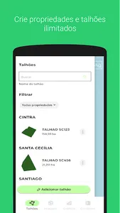
SCCON Ag Platform: View the daily changes taking place in your farm right from your mobile device!
The SCCON Ag app provides solutions based on continuous monitoring with daily high spatial resolution PlanetScope satellite images to better explain and respond to changes throughout the crop lifecycle.
The ability to overlay the entire area of interest several times throughout the week with the same type of sensor allows for detailed monitoring of the dynamics related to the harvesting process over weekly intervals. This capability also ensures complete imaging with the lowest cloud cover rates when compared to any other high resolution imaging solution available.
From automated analysis and the use of analytics and algorithms configured by project, SCCON delivers to its customers change detection alerts and analytical reports based on daily monitoring with PlanetScope images.
Daily images available: RGB and NDVI
Show More


