About Basel AR
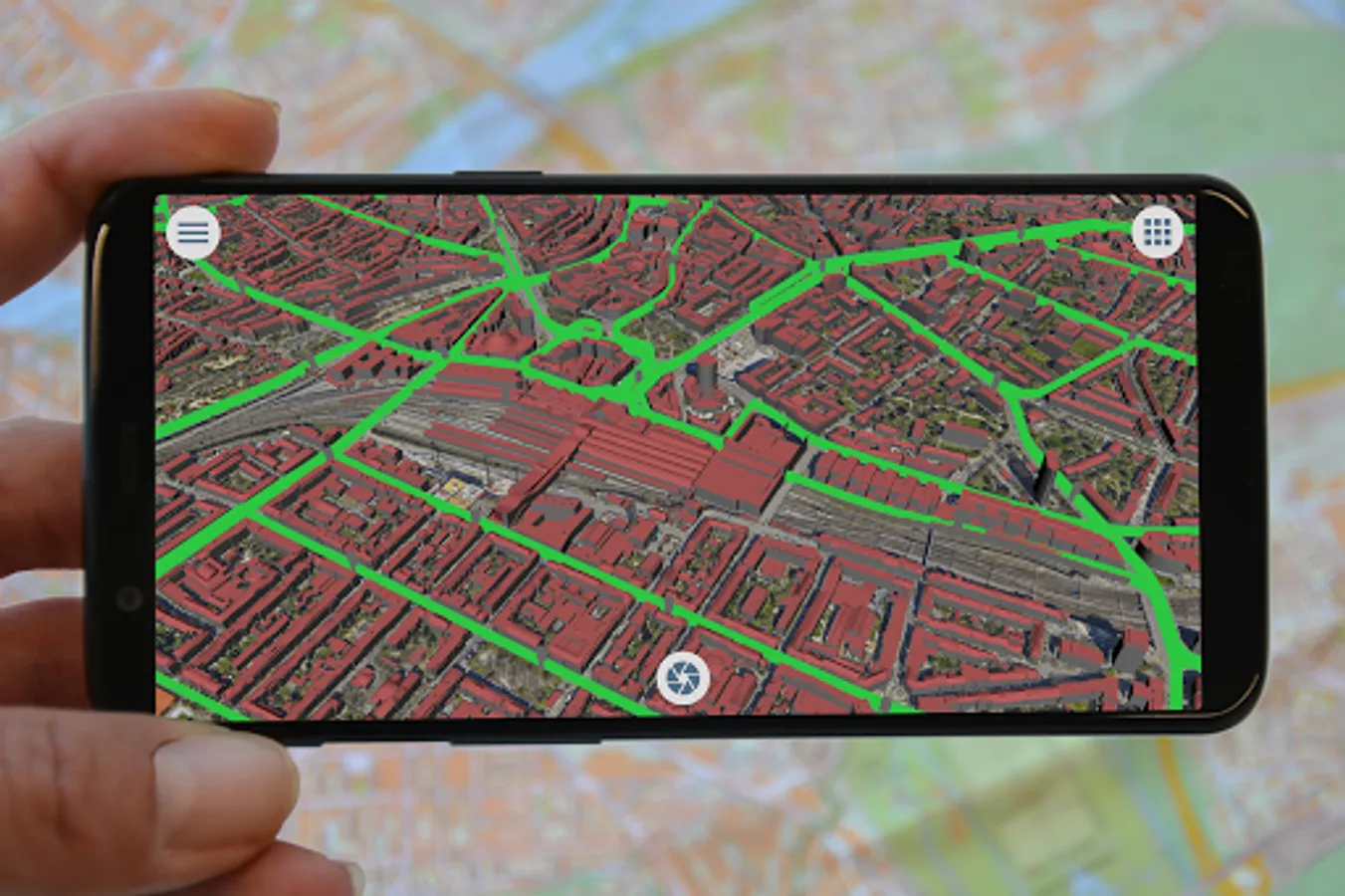
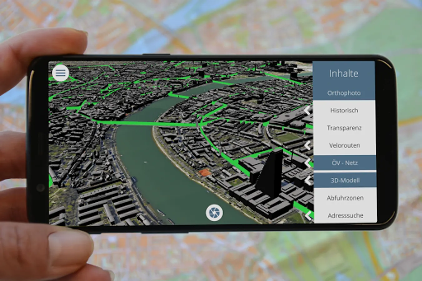
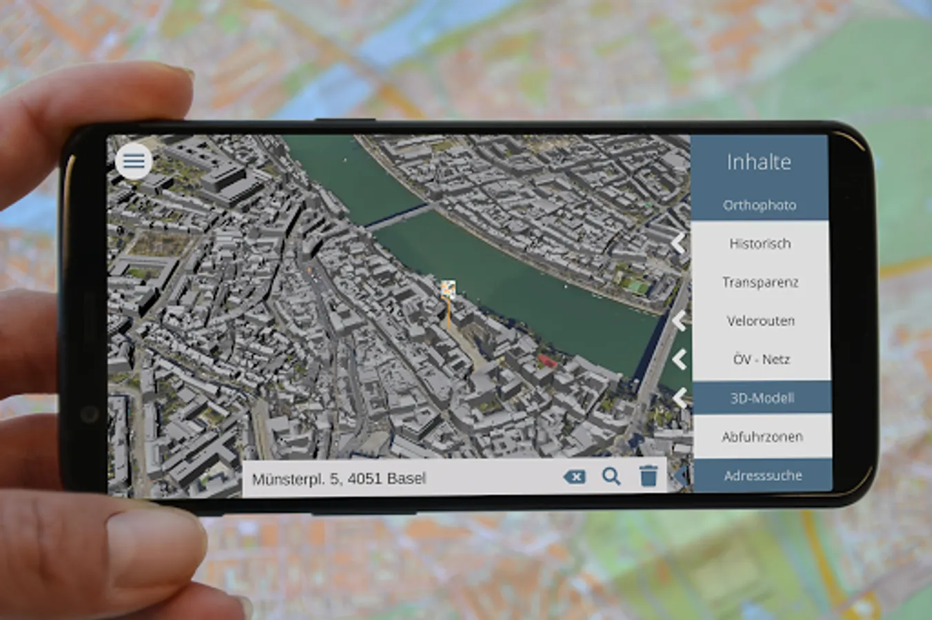
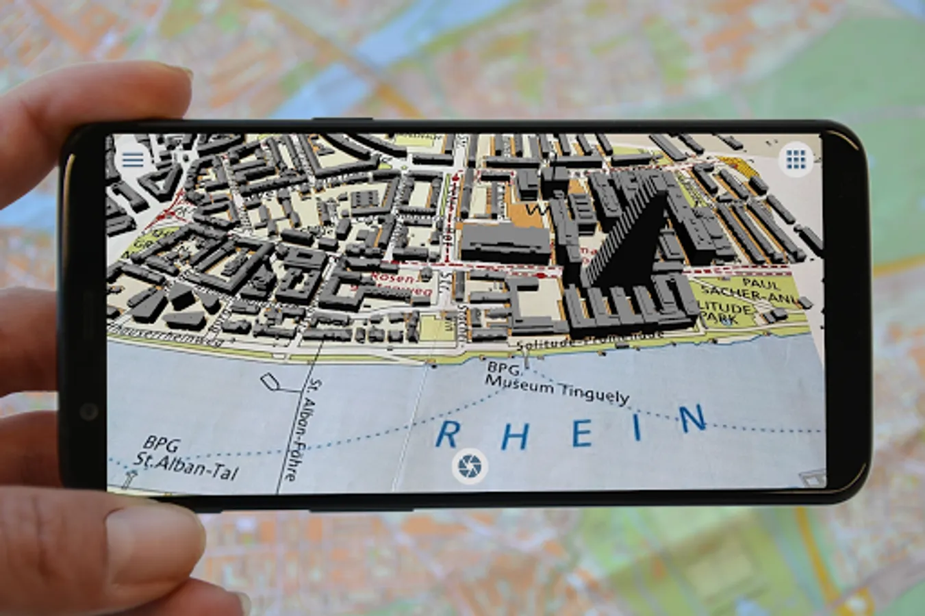
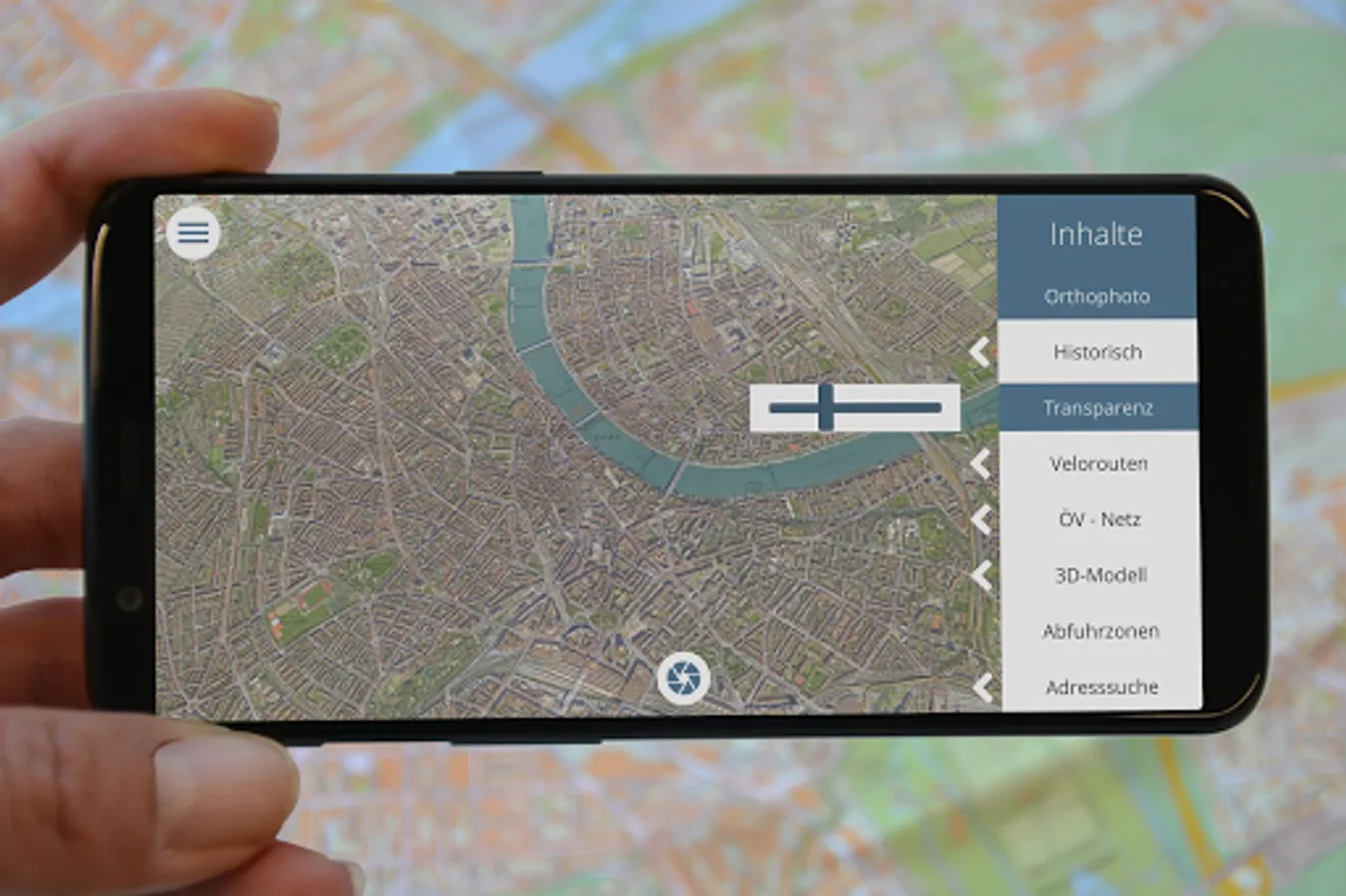
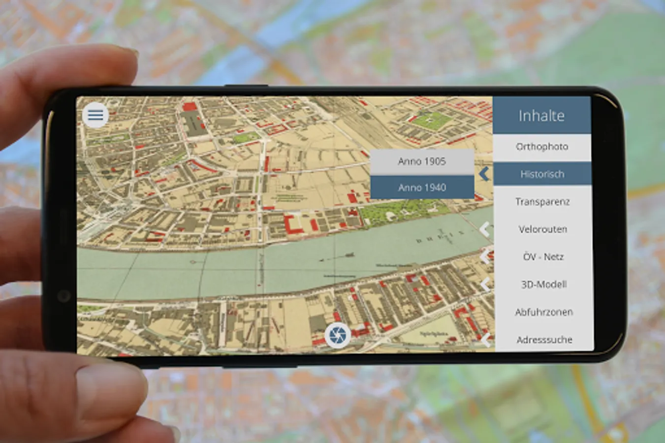
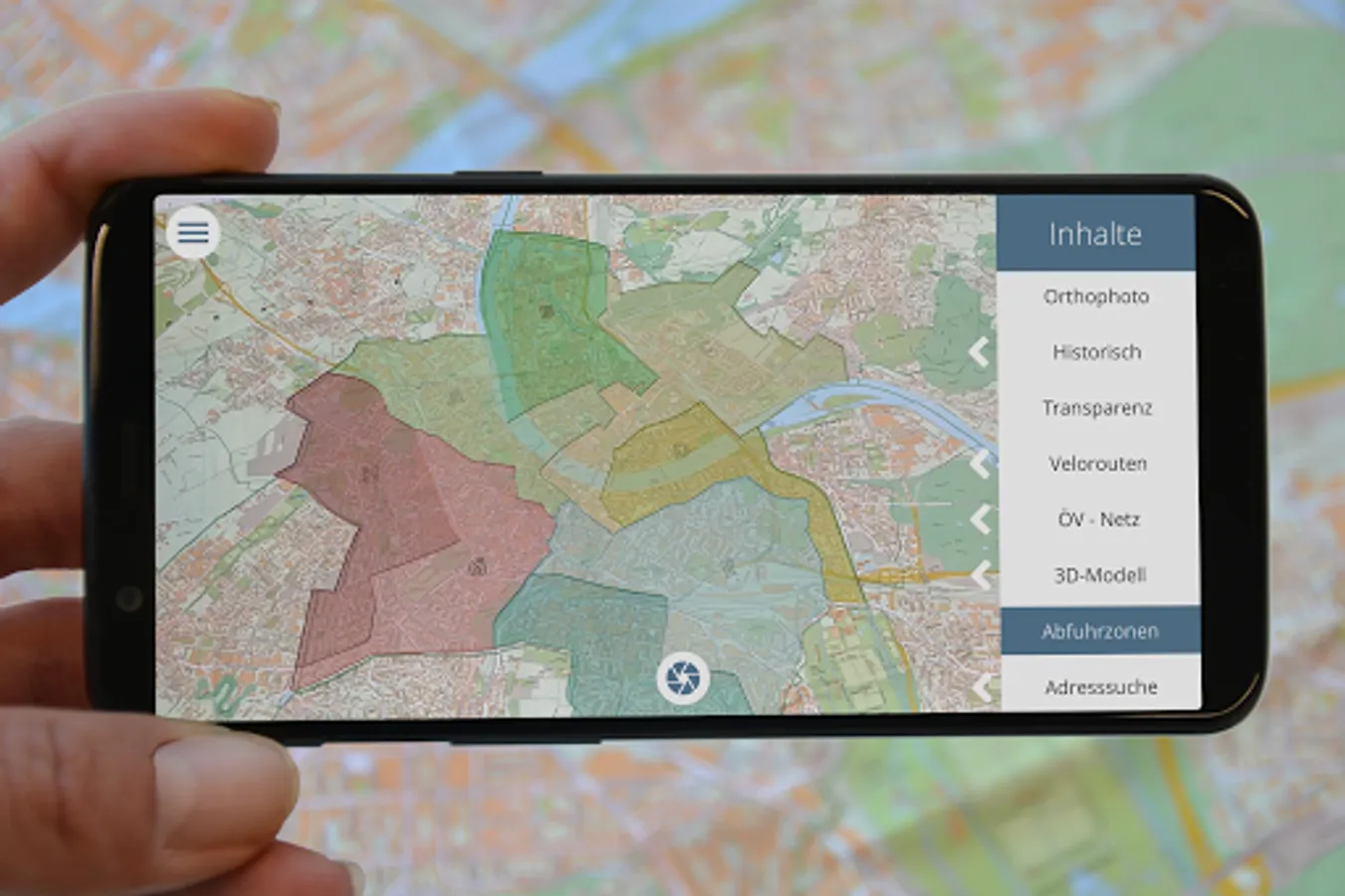
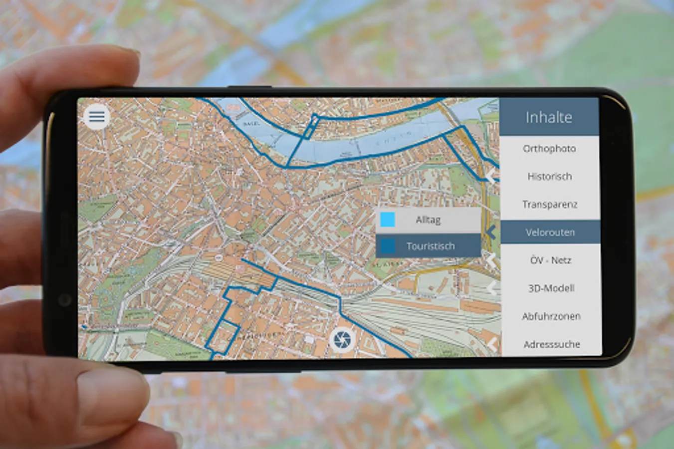
With Basel AR you can extend the official city map of Basel with various geodata. Rediscover the city map and superimpose it with orthophotos, historical maps, cycle routes, the public transport network or the 3D city model. An address search also allows you to find and display places on the printed city map.
Basel AR works with the official city map of Basel. Visit MapBS and print out your desired section of the city as an ImageTarget. Please note that only the representation of the city map in scales from 1:3'500 to 1:10'000 will work.
This application was developed in cooperation between the Grundbuch- and Vermessungsamt of the Canton of Basel-Stadt and the Institute of Geomatics of the University of Applied Sciences Northwestern Switzerland.
Basel AR is optimized for use with smartphones with screen aspect ratios of 16:9 and larger.
Kanton Basel-Stadt
Bau- und Verkehrsdepartement
Grundbuch- und Vermessungsamt
Dufourstrasse 40
CH-4001 Basel
http://www.gva.bs.ch
https://map.geo.bs.ch
Phone: +41 61 267 92 85
Mail: gva@bs.ch
Fachhochschule Nordwestschweiz
Hochschule für Bau, Architektur und Geomatik
Institut Geomatik IGEO
Hofackerstrasse 30
CH-4132 Muttenz
http://www.fhnw.ch/igeo
Phone: +41 61 228 55 55
Mail: geomatik.habg@fhnw.ch
Basel AR works with the official city map of Basel. Visit MapBS and print out your desired section of the city as an ImageTarget. Please note that only the representation of the city map in scales from 1:3'500 to 1:10'000 will work.
This application was developed in cooperation between the Grundbuch- and Vermessungsamt of the Canton of Basel-Stadt and the Institute of Geomatics of the University of Applied Sciences Northwestern Switzerland.
Basel AR is optimized for use with smartphones with screen aspect ratios of 16:9 and larger.
Publisher
Kanton Basel-Stadt
Bau- und Verkehrsdepartement
Grundbuch- und Vermessungsamt
Dufourstrasse 40
CH-4001 Basel
http://www.gva.bs.ch
https://map.geo.bs.ch
Phone: +41 61 267 92 85
Mail: gva@bs.ch
Development
Fachhochschule Nordwestschweiz
Hochschule für Bau, Architektur und Geomatik
Institut Geomatik IGEO
Hofackerstrasse 30
CH-4132 Muttenz
http://www.fhnw.ch/igeo
Phone: +41 61 228 55 55
Mail: geomatik.habg@fhnw.ch
Basel AR Screenshots
Tap to Rate: