swisstopo
Federal Office of Topography swisstopo
4.7 ★
3K ratings
1,000,000+
downloads
Free
AppRecs review analysis
AppRecs rating 4.6. Trustworthiness 83 out of 100. Review manipulation risk 19 out of 100. Based on a review sample analyzed.
★★★★☆
4.6
AppRecs Rating
Ratings breakdown
5 star
80%
4 star
15%
3 star
0%
2 star
0%
1 star
5%
What to know
✓
Low review manipulation risk
19% review manipulation risk
✓
Credible reviews
83% trustworthiness score from analyzed reviews
✓
High user satisfaction
80% of sampled ratings are 5 stars
About swisstopo
On the road with the best app of the year: the swisstopo app won the "Master of Swiss Apps 2021" award.
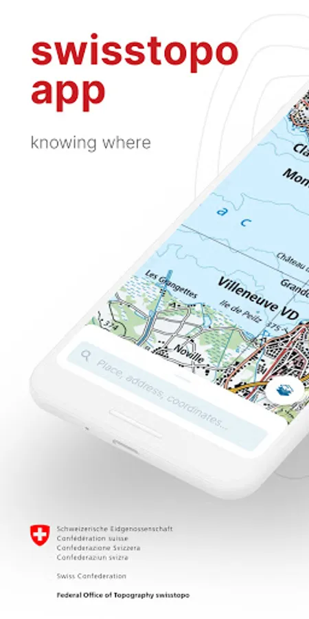
Use the famous national maps to discover even the most remote places in Switzerland and topics such as hiking, cycling, snow sports and aviation. All functions and data of the app as well as offline use are free of charge. The app is free of advertising and does not require a login.
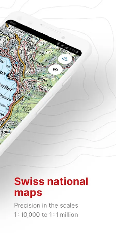
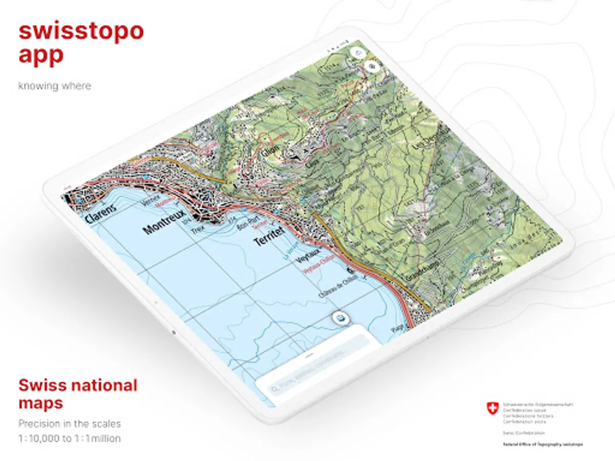
- all scales from 1:10 000 to 1:1 million
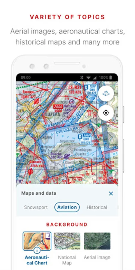
- current aerial image and historical maps
- official hiking, mountain hiking and alpine hiking trails
- closures of hiking trails
- snowshoe and ski routes
- SwitzerlandMobility routes
- public transport stops
ON THE ROAD
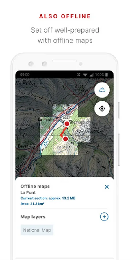
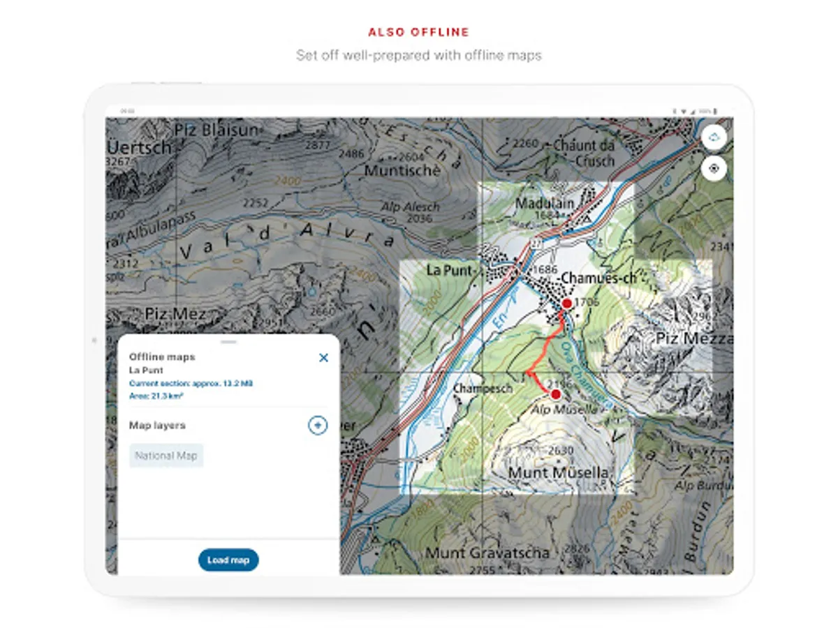
- free offline maps (1:25 000 to 1:1 million)
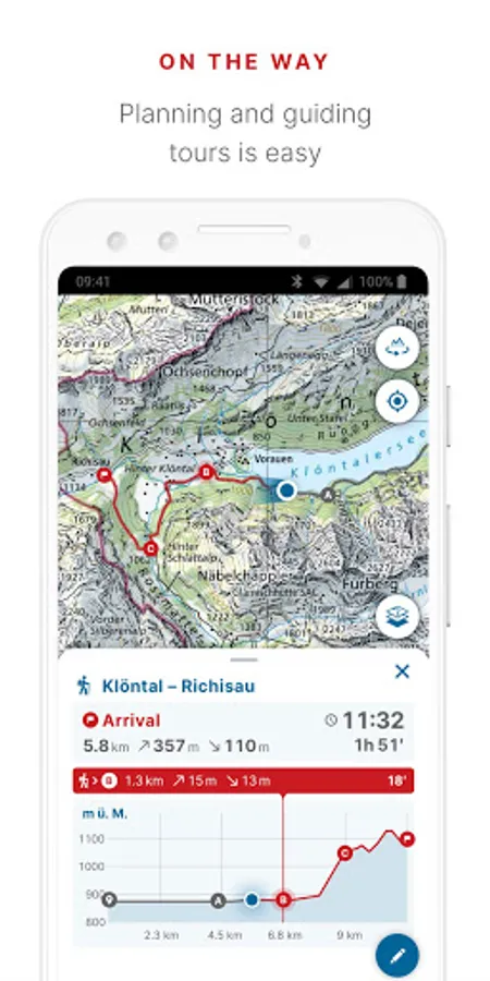
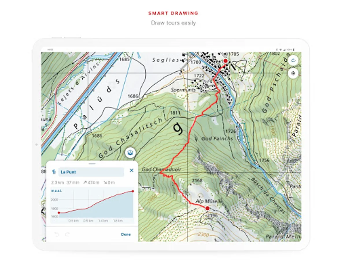
- draw, record, import and share your own tours
- set tour type (hiking, cycling, mountain biking) and personal pace
- tour guide (arrival time, remaining distance)
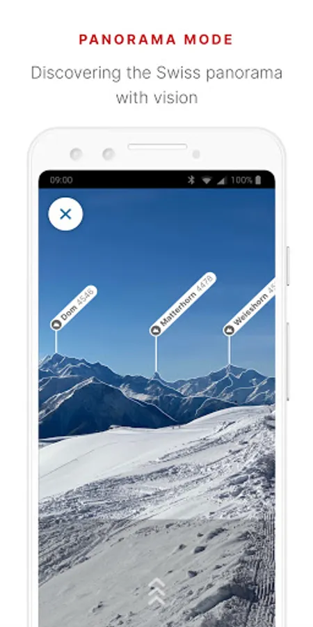
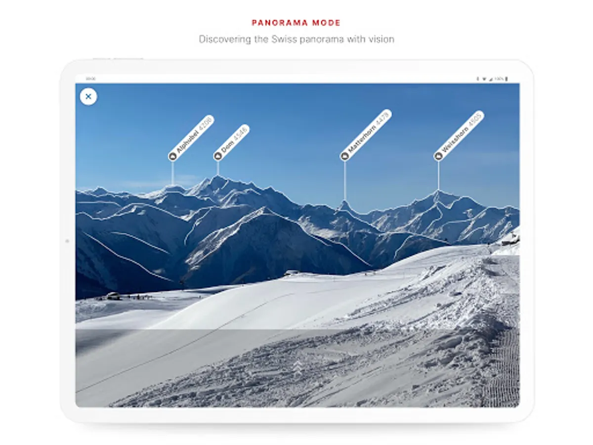
- panorama mode (labelled panorama, view tour in "3D")
- save markers, add notes, share
TOOLS such as measure, compare and search (for geographical names, addresses or coordinates)
Report changes to maps and geodata
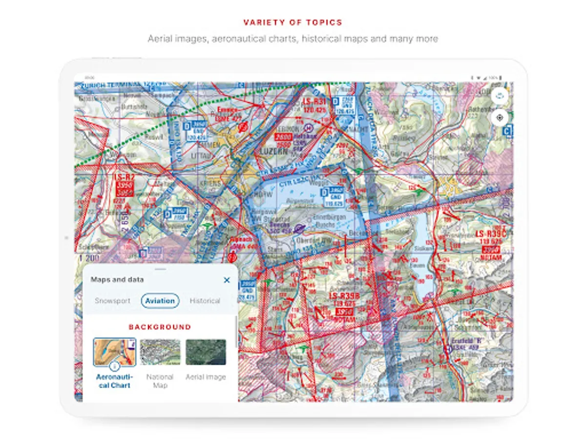
AVIATION
- aeronautical charts, obstacles, airspaces
- landing sites
- restrictions for drones and model aircrafts
Do you have a question? Then write to us:
support-cd@swisstopo.ch
Use the famous national maps to discover even the most remote places in Switzerland and topics such as hiking, cycling, snow sports and aviation. All functions and data of the app as well as offline use are free of charge. The app is free of advertising and does not require a login.
- all scales from 1:10 000 to 1:1 million
- current aerial image and historical maps
- official hiking, mountain hiking and alpine hiking trails
- closures of hiking trails
- snowshoe and ski routes
- SwitzerlandMobility routes
- public transport stops
ON THE ROAD
- free offline maps (1:25 000 to 1:1 million)
- draw, record, import and share your own tours
- set tour type (hiking, cycling, mountain biking) and personal pace
- tour guide (arrival time, remaining distance)
- panorama mode (labelled panorama, view tour in "3D")
- save markers, add notes, share
TOOLS such as measure, compare and search (for geographical names, addresses or coordinates)
Report changes to maps and geodata
AVIATION
- aeronautical charts, obstacles, airspaces
- landing sites
- restrictions for drones and model aircrafts
Do you have a question? Then write to us:
support-cd@swisstopo.ch
swisstopo Screenshots
Tap to Rate:
Reviews for swisstopo
Walter Suter
10/12/2025
exellent
Lipopark
10/9/2025
Prinzipiell sehr gute App,nur leider löschen sich meine Offline Maps regelmässig von alleine. Kann ich dem irgendwie vorbeugen?