PeakVisor - 3D Maps & Peaks ID
Routes Software SRL
3.8 ★
1K ratings
100,000+
downloads
Free
+ in-app
In this outdoor navigation app, you can identify peaks, explore 3D terrain maps, and plan routes for various mountain activities. Includes 3D maps, peak profiles, hiking routes, ski information, and mountain facility schedules.
AppRecs review analysis
AppRecs rating 3.5. Trustworthiness 89 out of 100. Review manipulation risk 15 out of 100. Based on a review sample analyzed.
★★★☆☆
3.5
AppRecs Rating
Ratings breakdown
5 star
58%
4 star
7%
3 star
8%
2 star
8%
1 star
18%
What to know
✓
Low review manipulation risk
15% review manipulation risk
✓
Credible reviews
89% trustworthiness score from analyzed reviews
⚠
Pricing complaints
Many low ratings mention paywalls or pricing
About PeakVisor - 3D Maps & Peaks ID
Here’s a brief orientation on the tools we offer to get oriented in the mountains:
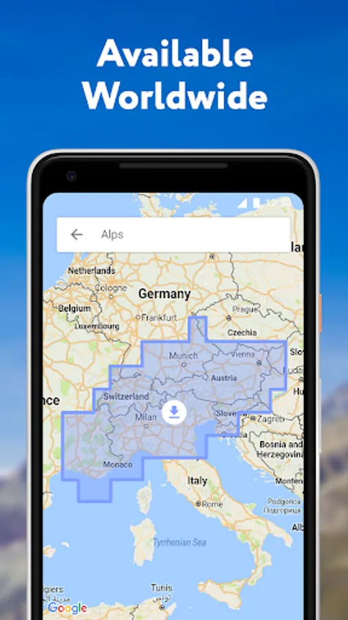
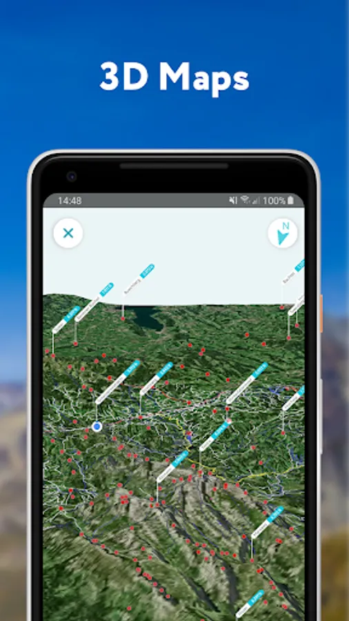
● 3D Maps
As human athletic achievement progresses in the mountains, so does the technology to assist your adventures. With PeakVisor, you unlock the topo maps of the future; our cutting-edge technology with high-precision terrain modeling offers deep insight into the mountain landscape of your choice. With one glance, you be blessed with years of knowledge about an area’s terrain.
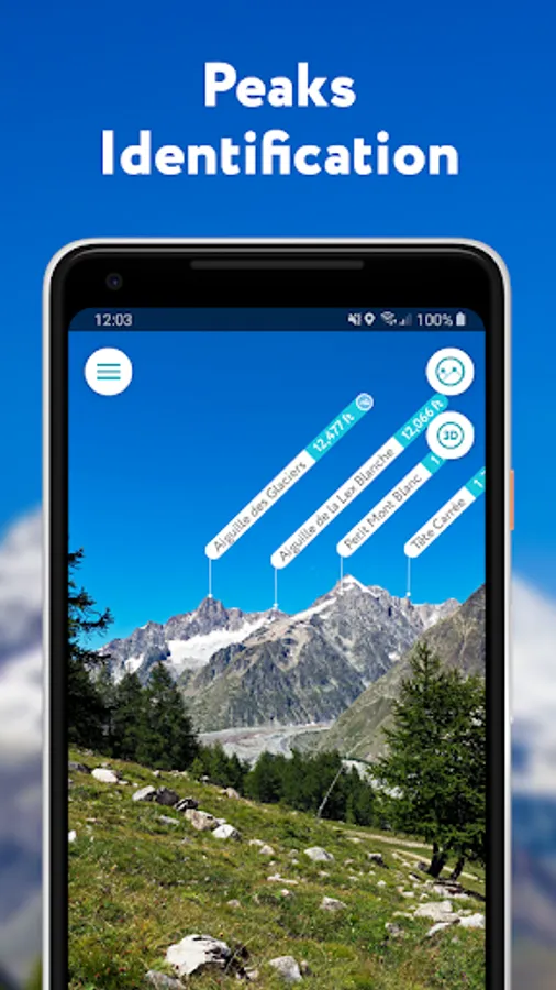
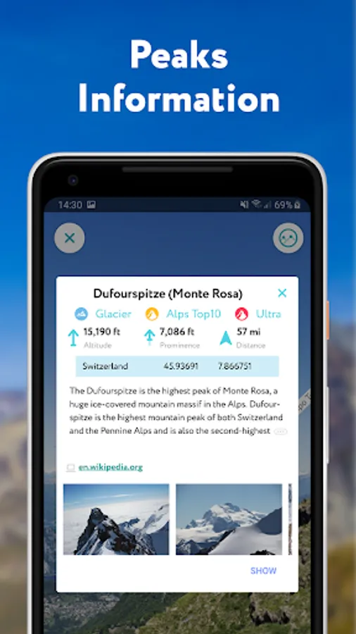
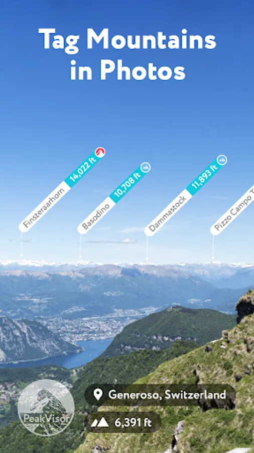
● Identify Peaks
Identify more than a million mountains, hills, buttes, spires, and more from all over the world, with a detailed profile for each of them! Our app shows you altitude, topographic prominence, mountain range, national parks or reserves, as well as photos and additional Wikipedia articles.
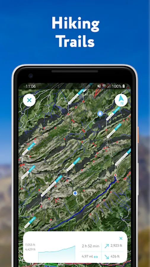
● Plan Hiking Routes
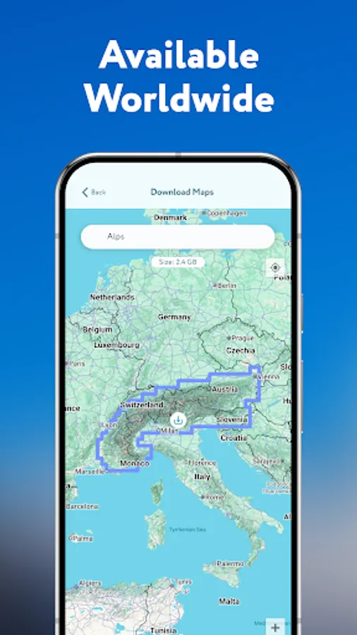
A vast network of worldwide hiking trails and walking pathways included in PeakVisor’s 3D Maps will help you compose a hiking route which includes evaluating the distance you can expect to hike as well as a route’s elevation profile and estimated time for completion.
● Skiing
In winter mountain sports, PeakVisor’s topographic 3D Maps allow a visual understanding of the terrain and provide detailed information about mountain lifts, ski resort trails, and backcountry ski touring routes. The app also offers features such as winter mode and a slope steepness overlay to identify avalanche terrain on your route.
● Cable Cars and Mountain Huts are inlaid onto our 3D Maps, complete with schedules. This is especially useful in Europe, where many objectives involve a cable car ride to gain some altitude, lest you want to do some genuinely punishing climbs. And you haven’t experienced the old-world mountain culture until you’ve had a memorable meal and night at a rustic mountain hut in the high country.
● Peak Bagging
The app offers monthly climbing challenges and Peak Bagging competitions to keep the motivation where it needs to be…UP.
● GPS Tracking
Track any outdoor adventures, whether hiking, skiing, mountain biking, etc. Post-adventure, you can visualize your route in the miniature 3D world, check out stats like distance and elevation gain, and export a GPX file of your new route.
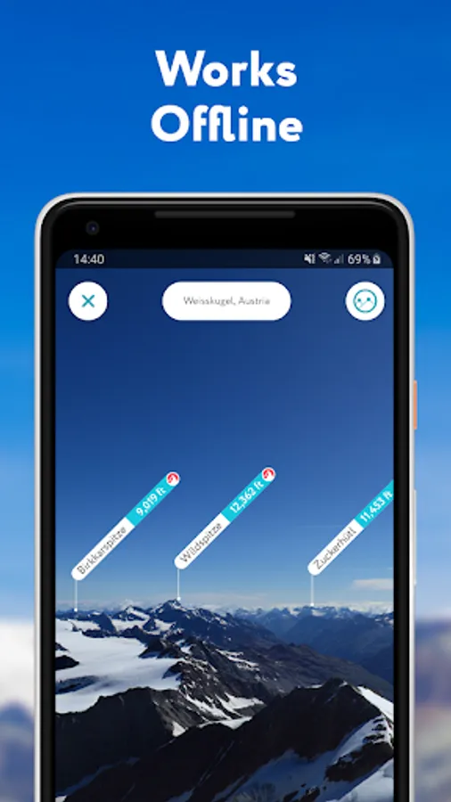
● All Features Work Offline
PeakVisor is the Swiss army knife for outdoor adventure, one that you will soon find indispensable while in the mountains. With so many features at your fingertips, you’ll find value from the app whenever you're on the trail.
PeakVisor - 3D Maps & Peaks ID Screenshots
Tap to Rate:
Reviews for PeakVisor - 3D Maps & Peaks ID
Marco Pozzan
2/22/2026
Il punteggio basso è dovuto solo alle piste da sci inaffidabili. Ad esempio la pista no. 9 Delle Rocce (Marilleva) è una pista blu e non rossa.
Peter Staples
1/9/2026
The maps are fast and accurate. But... Limited zoom out so hard to navigate across an area. No tilt ability, so no aerial or ground view, chosen fixed angle sucks. Once the zoom out limit is reached further zoom outs move the position (odd and annoying). The winter mode just changes the colour... It's just not enjoyable to use at all