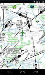
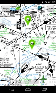
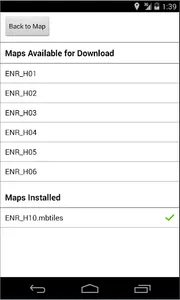
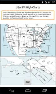
USAHighAltIFRCharts provides all offline moving High Altitude IFR Charts of entire United States. It include all 50 states including Hawaii and Alaska. This map comes preinstalled H10 Washington DC map. You can download more charts as you please free of charge. There over 12 charts that cover entire United States. You get unlimited charts database update with this app. All charts work self contained offline when you do not have any network connections (Wifi or 4G). Your current location is shown on a moving map with airplane icon centered around it.
*Location icon can be centered or track from your placement on screen.
*Made by and for pilots
*Easy to use and learn
*Quick and responsive
*All 12 High Altitude Instrument charts provided free with no in-app purchases
*Runs on most Android devices
*No ads or invasive permission
*Terrain maps covers entire USA
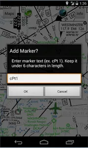
*Add custom markers and way-points for route planning
*Real-time GPS navigation and tracking
http://airplanegroundschools.com/android/usa-high-altitude-ifr-charts.php
*Location icon can be centered or track from your placement on screen.
*Made by and for pilots
*Easy to use and learn
*Quick and responsive
*All 12 High Altitude Instrument charts provided free with no in-app purchases
*Runs on most Android devices
*No ads or invasive permission
*Terrain maps covers entire USA
*Add custom markers and way-points for route planning
*Real-time GPS navigation and tracking
http://airplanegroundschools.com/android/usa-high-altitude-ifr-charts.php
Show More